Kananaskis, AB, Canada
4 September 2021
With Wen
Easy off-the-beaten-track objective in K-Country
Mount Nomad was a nice little treat! It’s close enough to be reached easily from Calgary, without too long of a drive (ca. 1.5 to 2 h), but remote enough to be devoid of the crowds you encounter on other Kananaskis objectives.
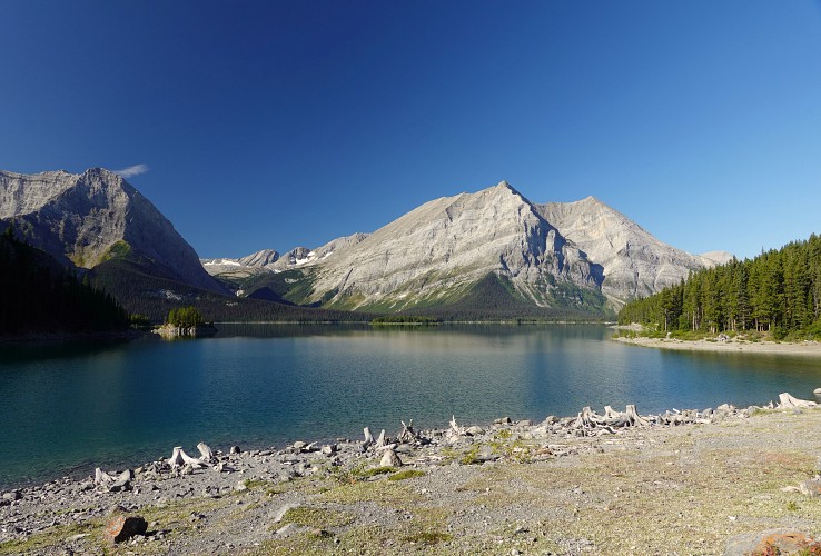
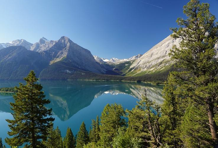
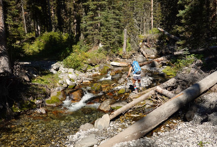
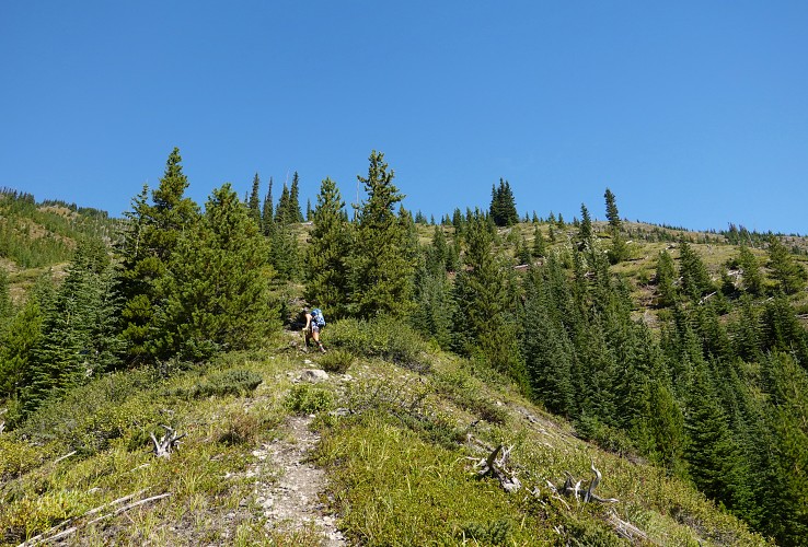
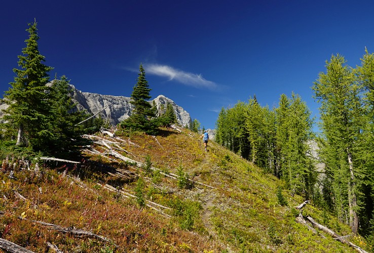
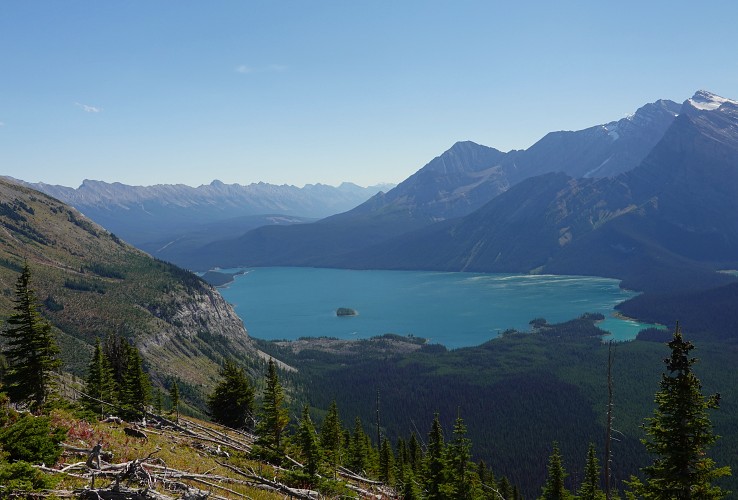
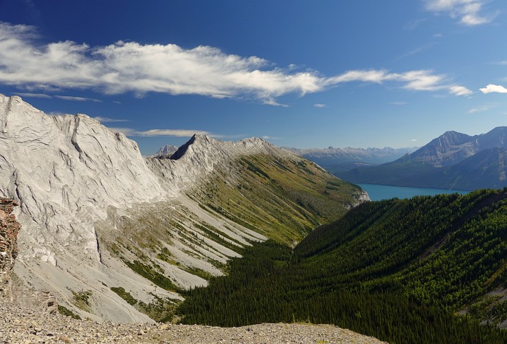
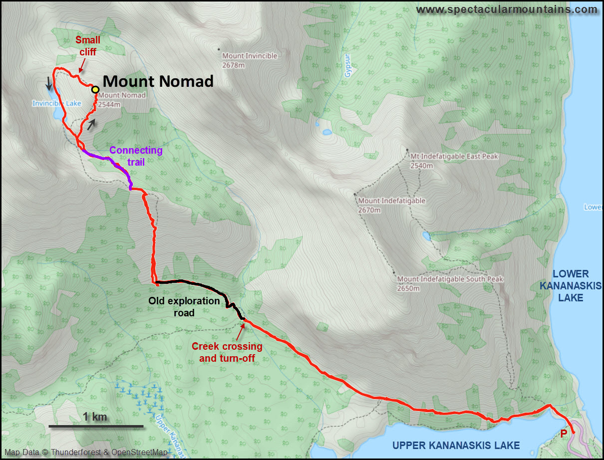
Starting at the North Interlakes parking lot by Upper Kananaskis Lake, the initial approach along the lake is super scenic and a great way to warm up for the day. You could also very well bike this first 4 km section. We then turned off to a smaller, less travelled trail that branches off to the right near a creek (can be rock-hopped) and continued up this partially overgrown trail, which is actually an old exploration road, for another 1.2 km.
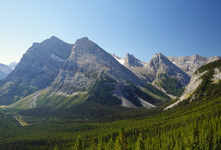
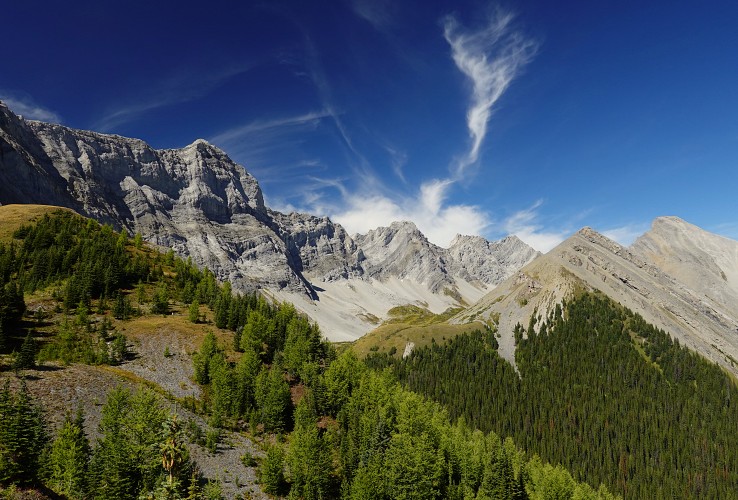
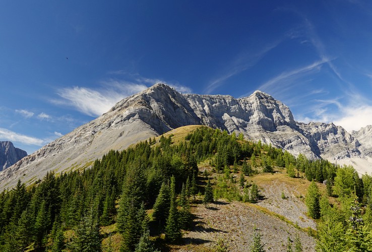
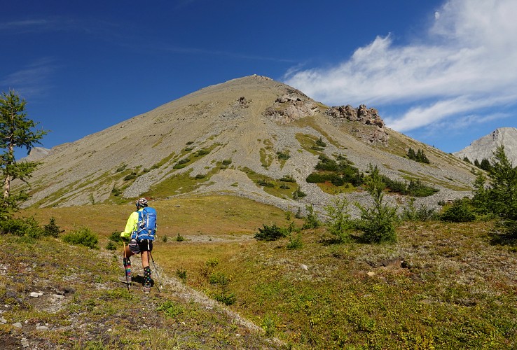
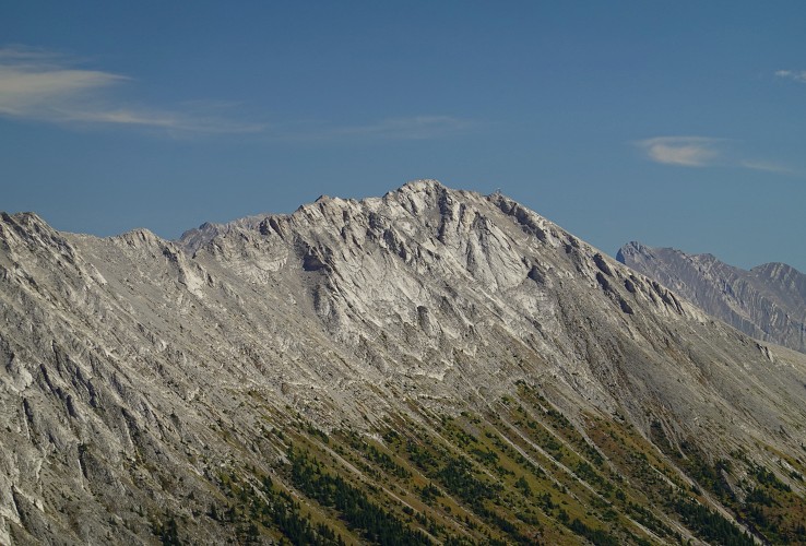
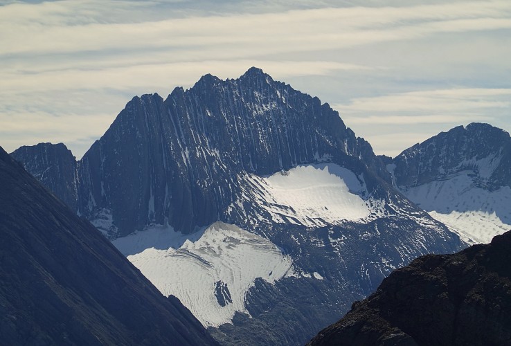
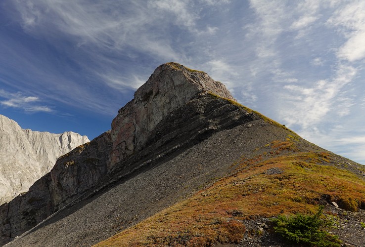
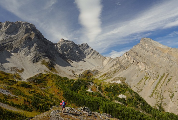
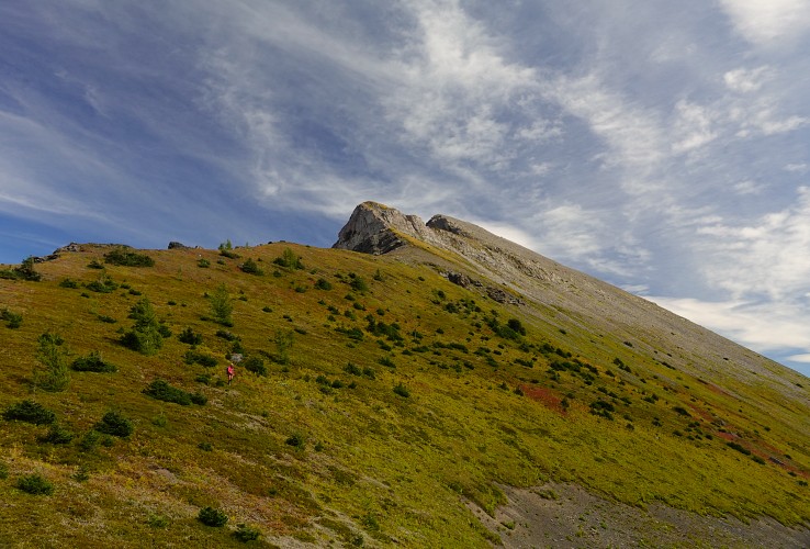
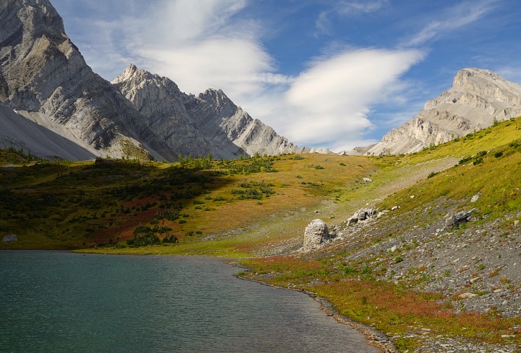
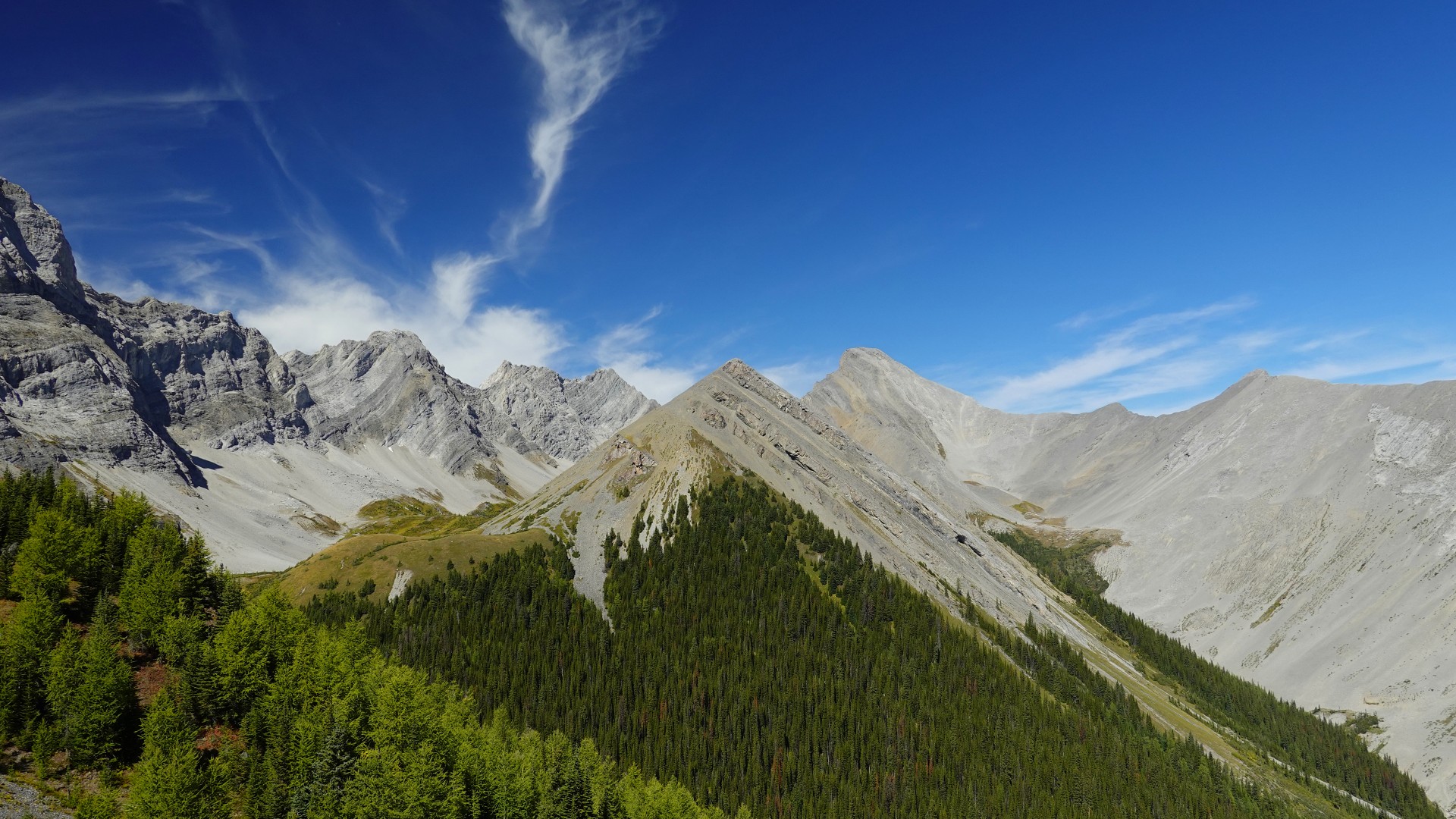
Leaving the last trail behind the route now goes straight up the steep, lightly forested slopes to the right, with bits of flagging and game trails here and there. Eventually we topped out on a partially wooded grassy ridge where we encountered a faint trail going up the ridge crest. with first views of Mount Nomad to the north, a relatively small peak dwarfed by the more intimidating looking Mount Warspite, Hermione Peak, and Mount Invincible behind.
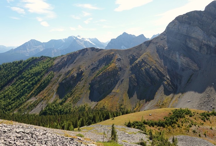
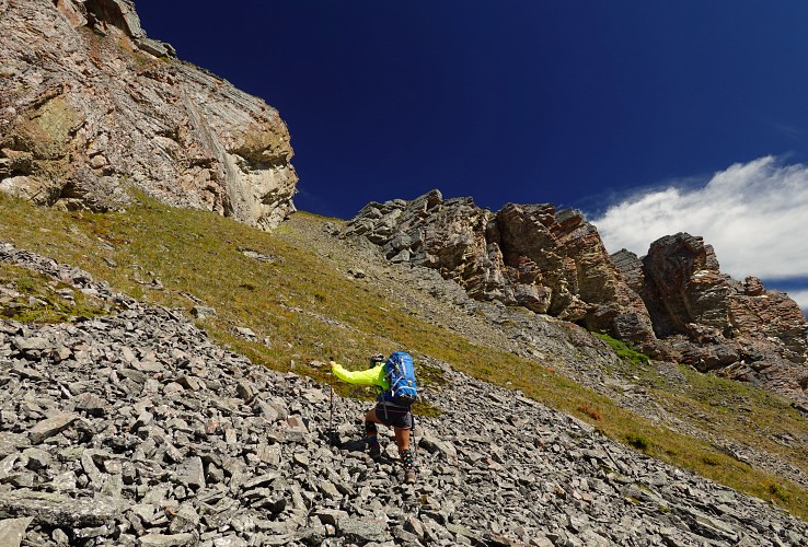
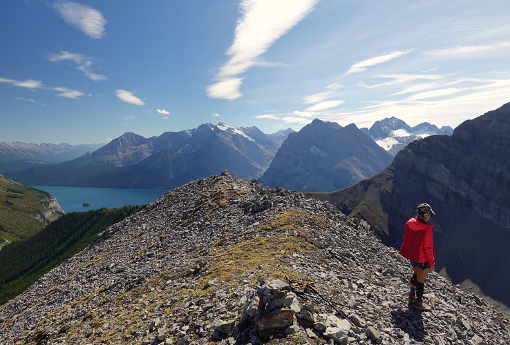
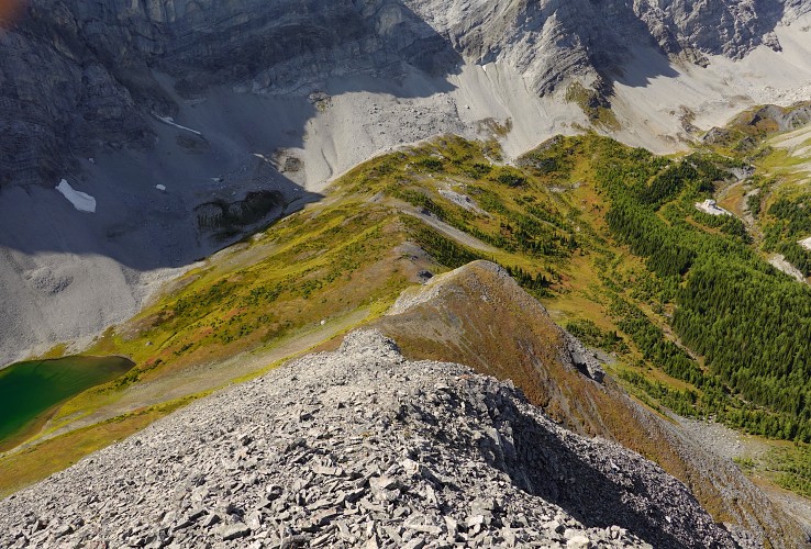
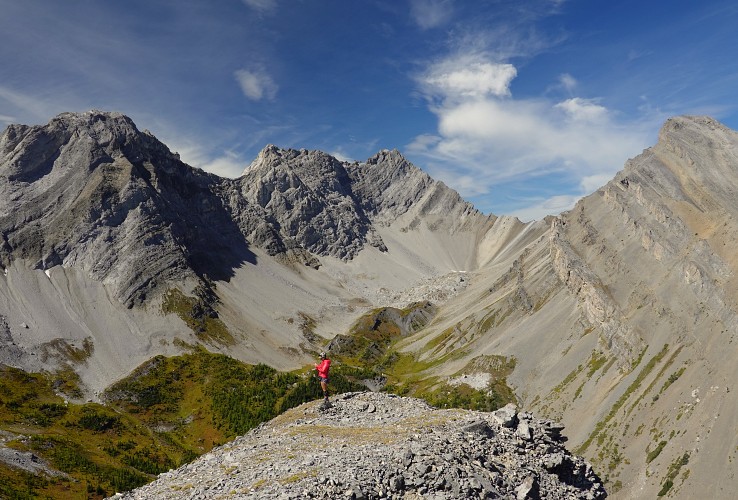
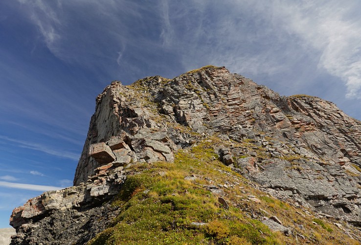
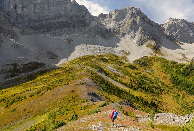
There is a narrow connecting trail that takes you from this grassy ridge across a small valley (with an elevation loss of about 130 m) to the southern slopes of Mount Nomad, which are easily ascended on grass, scree and rock ribs to the top. Since pretty much all the ridges and peaks around Mount Nomad are higher you don’t get any sweeping vistas from here, but it does feel special in its own way to be here in this lonely “dead-end” valley sitting on top of a summit. You know you’re far off the beaten track, yet close enough to get back to your car in a few hours. If you look hard, you can even see the weather station on the south peak of Mount Indefatigable across the valley to the southeast.
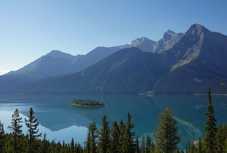
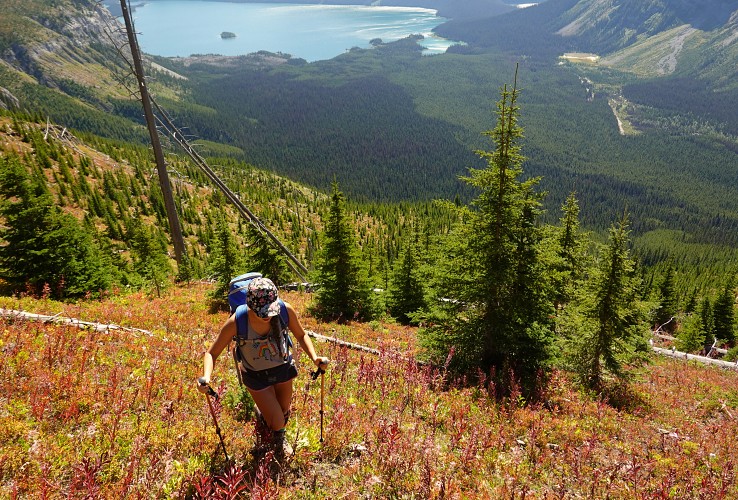
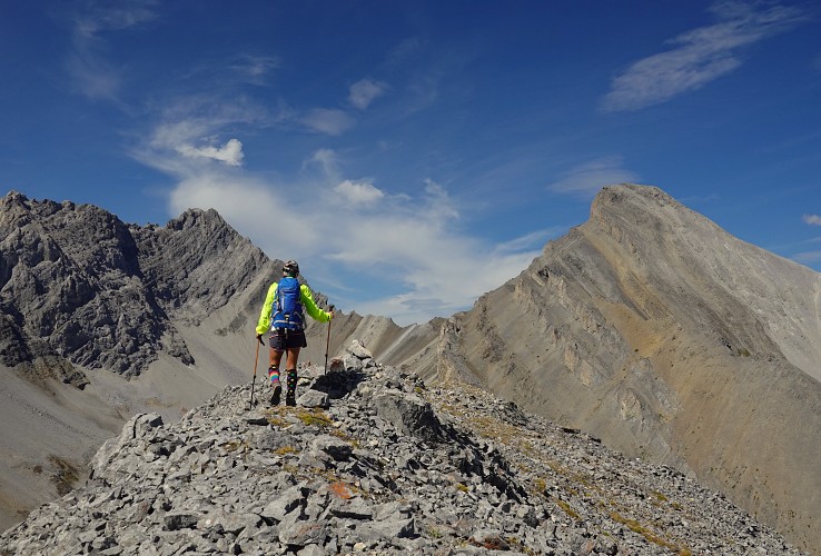
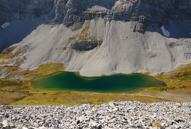
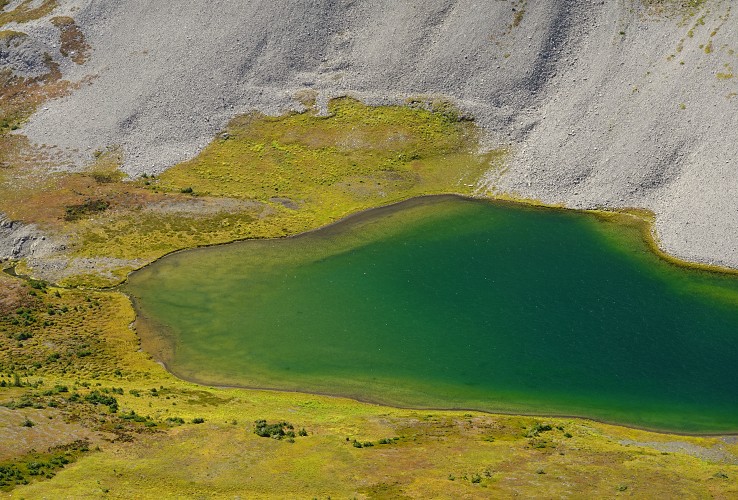
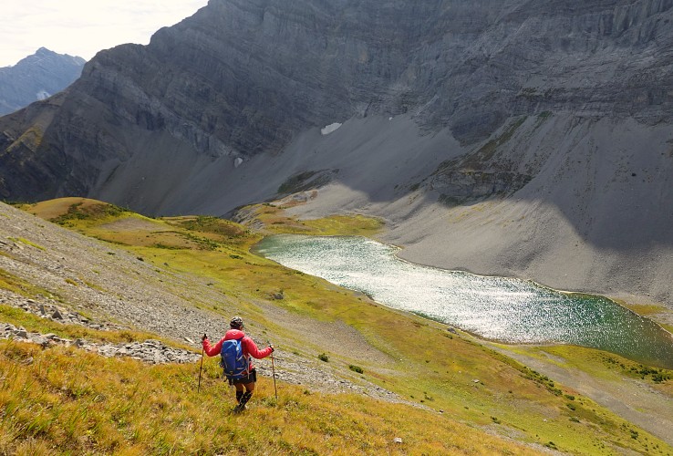
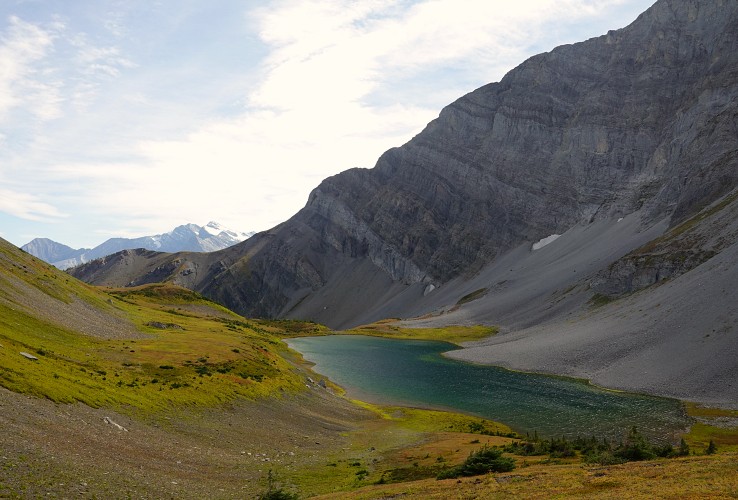
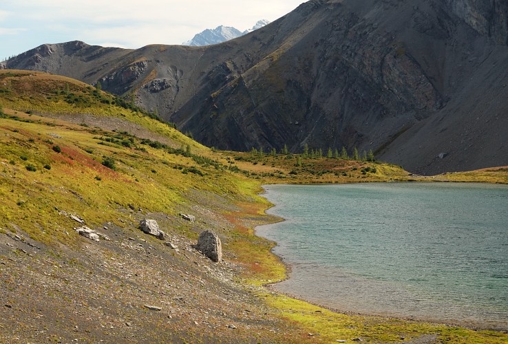
We only ran into one other group on the way up and didn’t see a soul for the rest of our trip. On the way back we came down the northwest side of the mountain (one short section of easy to moderate scrambling) and then headed south to stop by the little lake that sits tucked away in the valley west of the mountain, officially called Invincible Lake. A lovely place that reminded me of a lot of the lakes I’ve seen in the Swiss Alps.
From the lake we headed south and SE to connect up with the narrow trail to get back to the grassy ridge again and then followed the same route back to the car. A great easy to reach mountain in very scenic surroundings, highly recommended!
|
Elevation: |
2549 m |
|
Elevation gain: |
1270 m |
|
Time: |
8.5 h |
|
Distance: |
17.0 km |
|
Difficulty level: |
Easy – mostly a hike (Kane), T4 (SAC) |
|
Comments: |
The only scrambling is along the NW ridge (easy to moderate), but this section can be avoided |
|
Reference: |
Bob Spirko |
|
Personal rating: |
5 (out of 5) |
NOTE: This GPX track is for personal use only. Commercial use/re-use or publication of this track on printed or digital media including but not limited to platforms, apps and websites such as AllTrails, Gaia, and OSM, requires written permission.
DISCLAIMER: Use at your own risk for general guidance only! Do not follow this GPX track blindly but use your own judgement in assessing terrain and choosing the safest route. Please read the full disclaimer here.