Kananaskis, Canada
27 April 2024
With Wen
Scenic year-round ridge walk
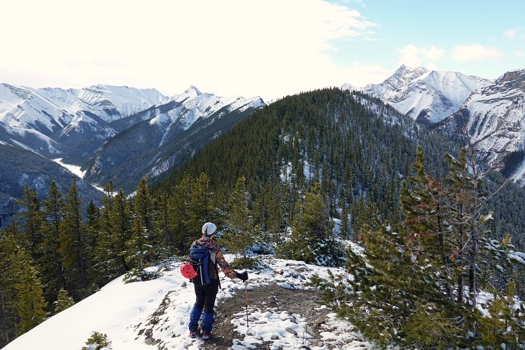
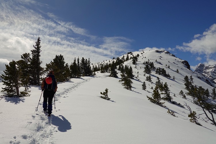
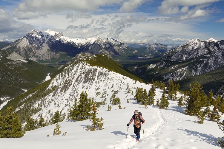
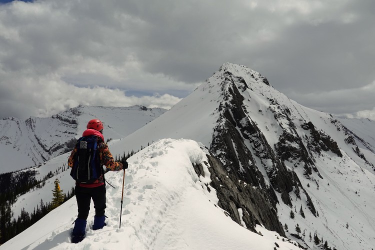
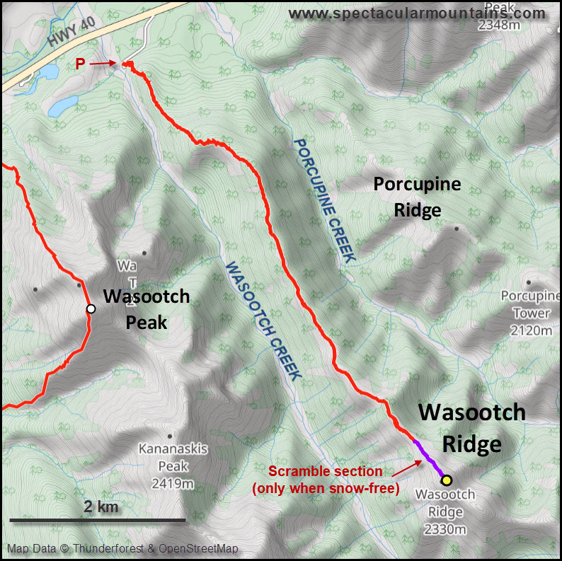
After climbing neighboring Wasootch Peak a week earlier, Wen and I headed out again to do Wasootch Ridge. This is a super popular outing that’s a bit lower in elevation but longer in distance. Reaching the true summit of the ridge is about a 14 km trip and only doable in dry conditions. I had done the full trip a few years ago in drier conditions, but this year soft snow and the risk of avalanches stopped us a few hundred metres before the summit.
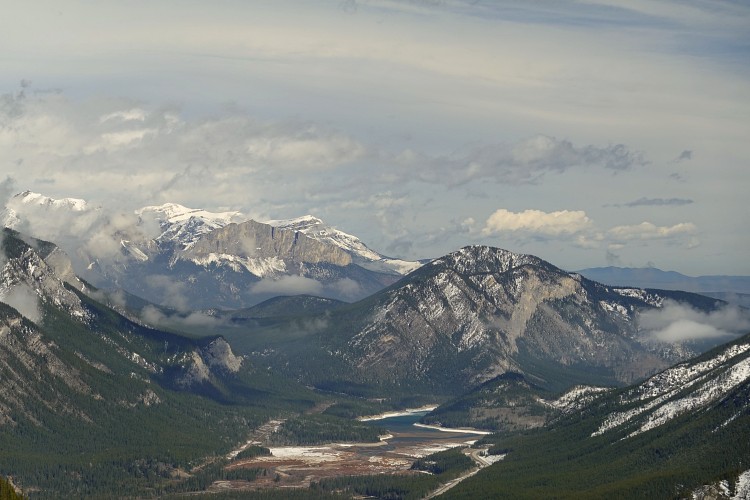
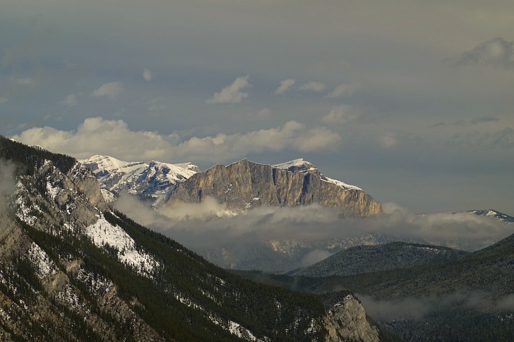
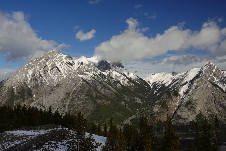
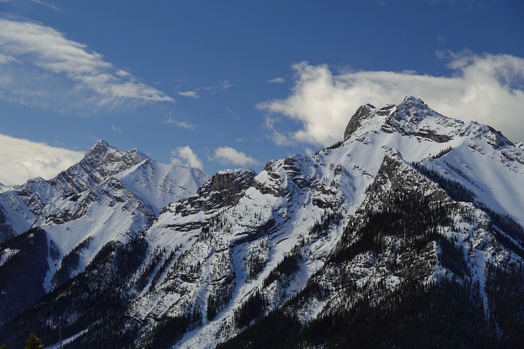
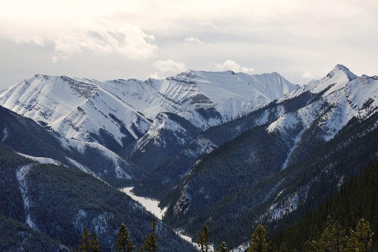
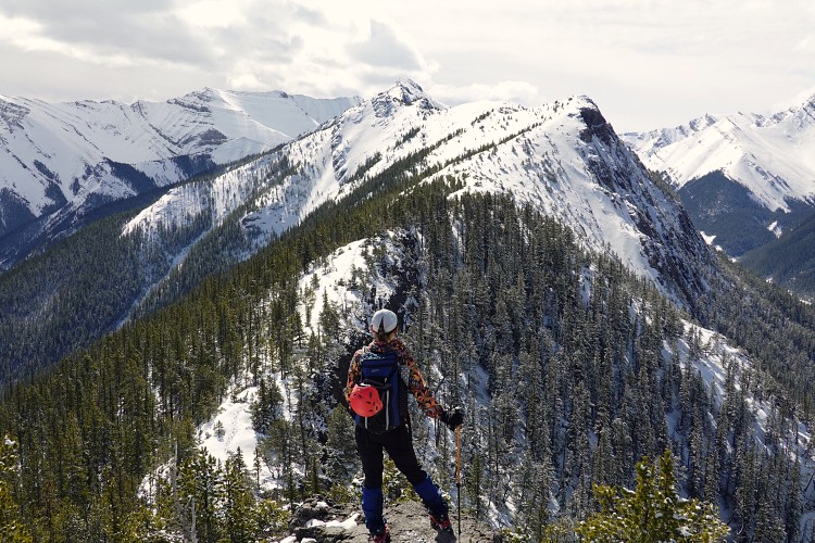
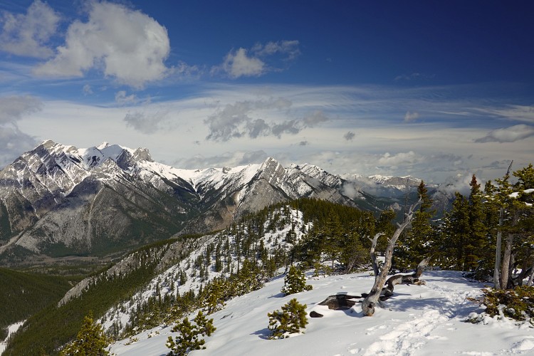
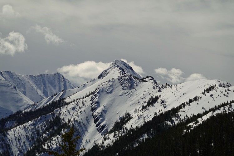
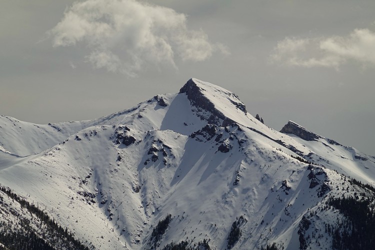
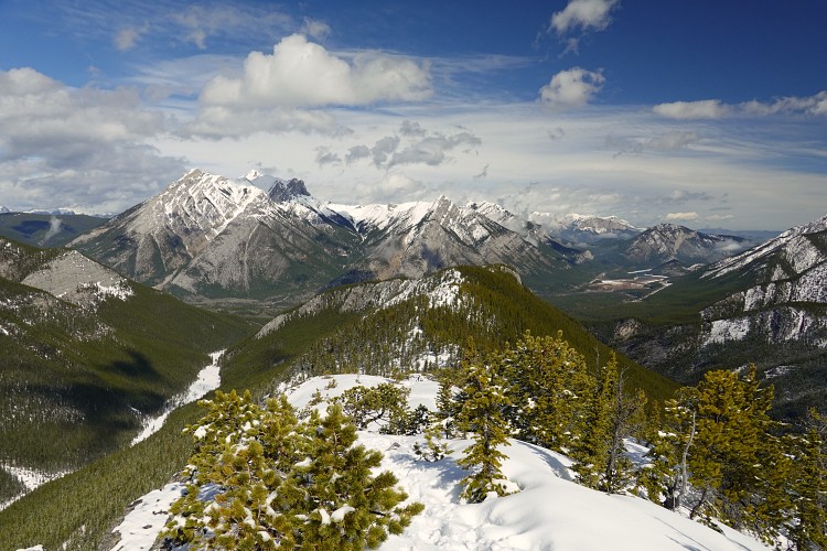
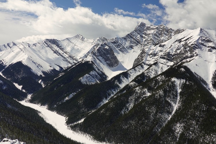
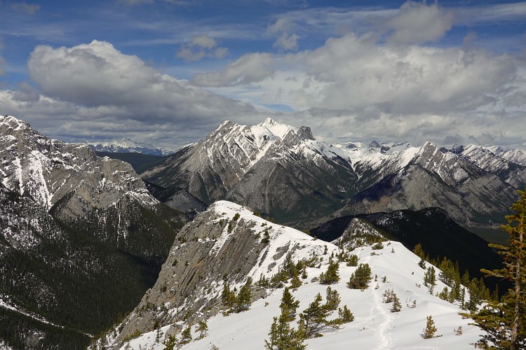
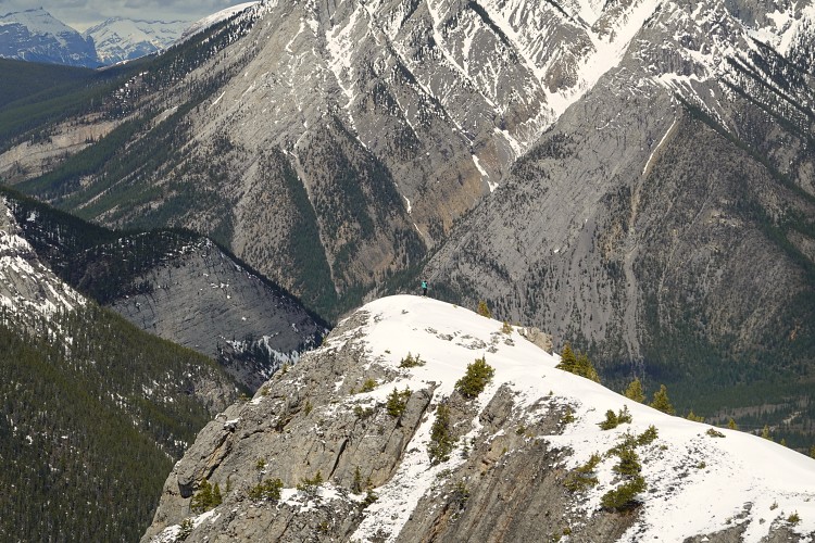
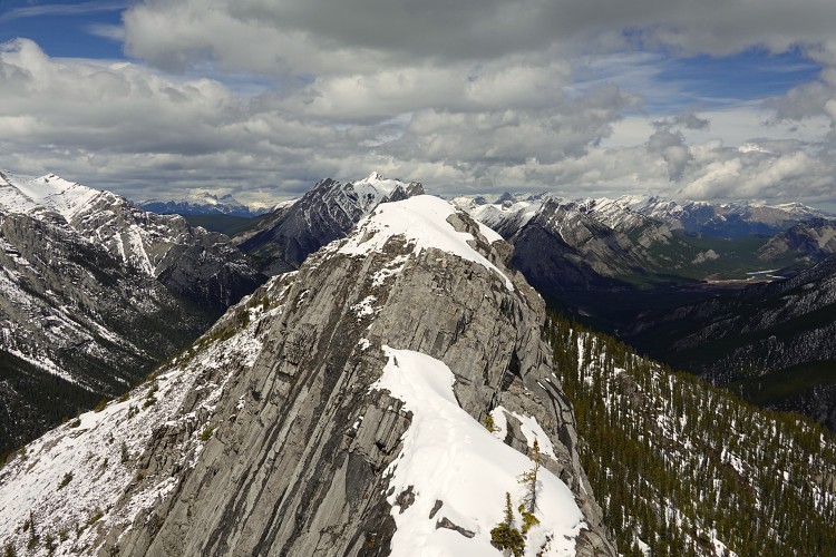
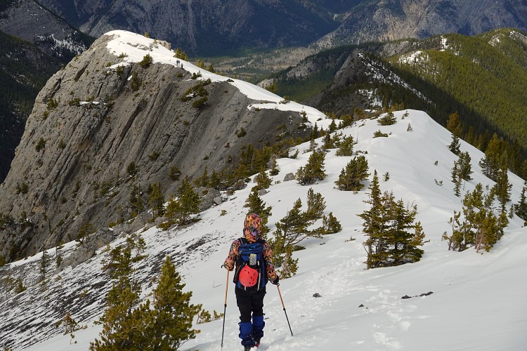
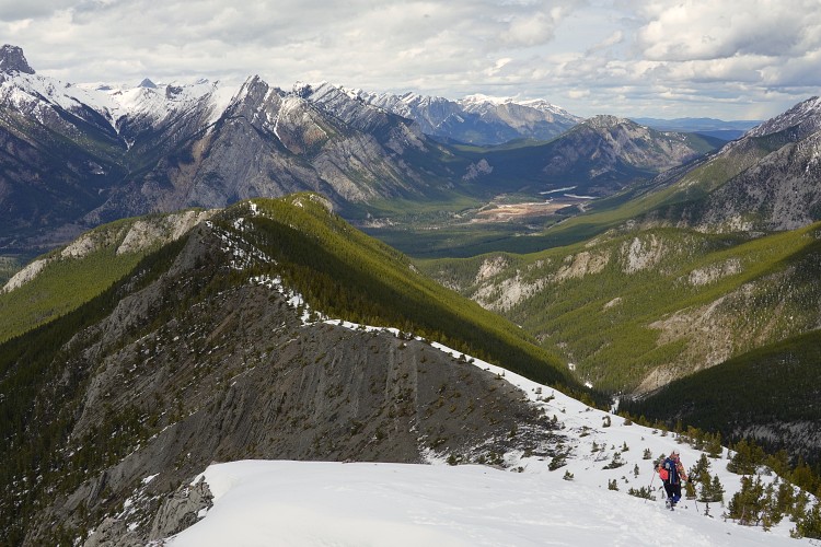
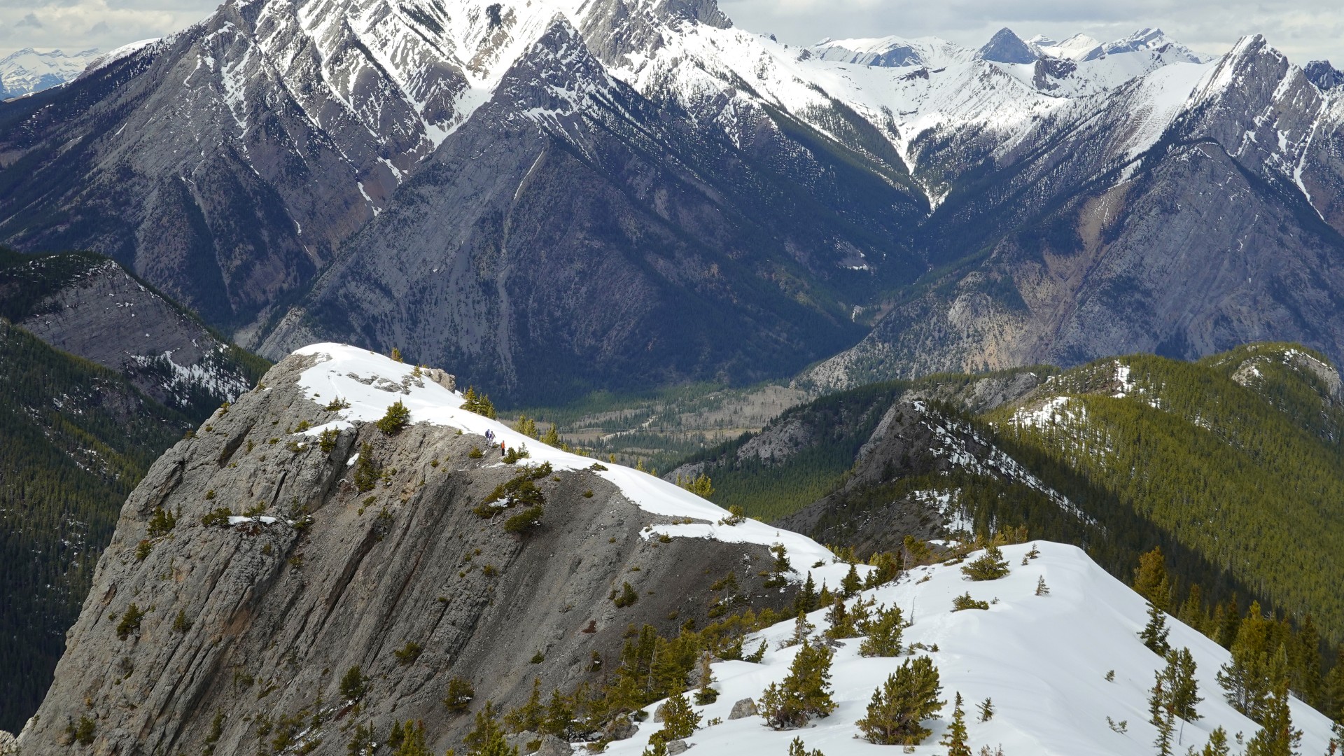
What I love about Wasootch Ridge is that it’s a relatively short drive from Calgary, the trail starts right from the parking lot, the area is super scenic, and you can go as far as you want and turn around at any of the many high points. The first few km are mostly in the trees with occasional views here and there, then the trees gradually disappear and the ridge opens up with great vistas of higher mountains all around. To the west are the craggy and imposing Kananaskis Peak and Old Baldy Mountain, while to the east you can see Porcupine Ridge with Tiara Peak at its eastern end, plus Baldy Peak and Midnight Peak further in the distance to the north. Even the distinctive cliffs of Mount Yamnuska north of highway 1 can be seen from here.
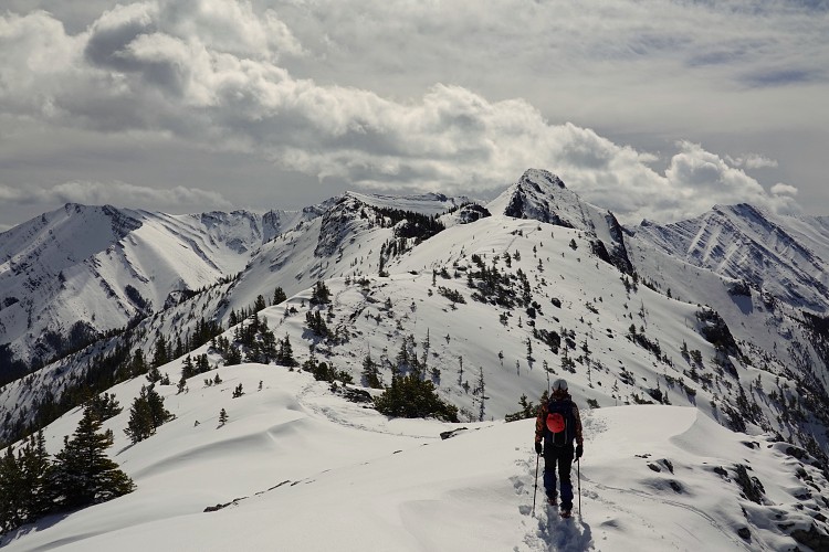
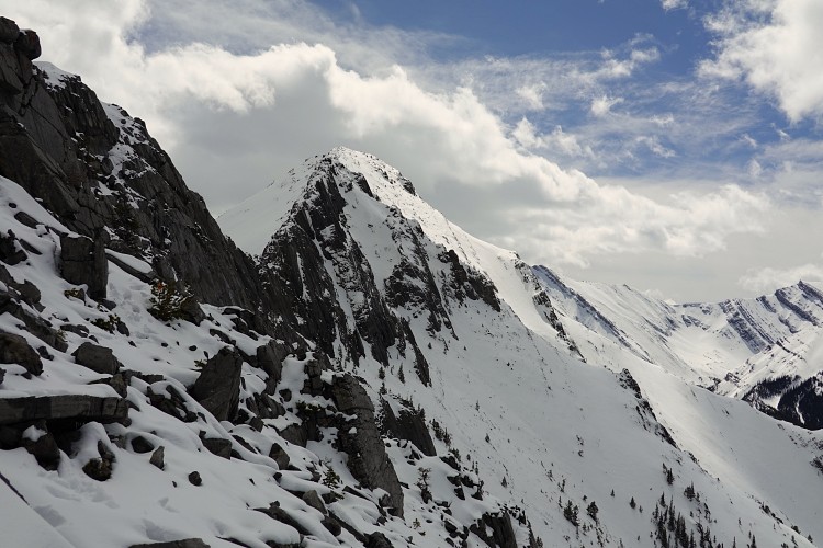
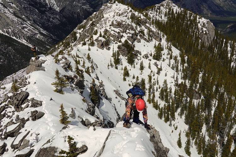
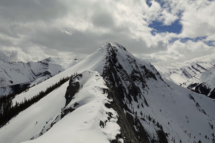
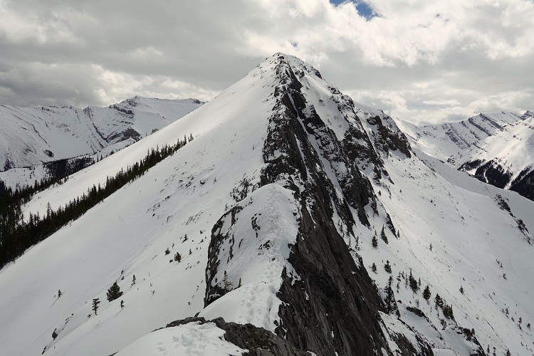
The trail is easy to follow and never difficult, except in the very last portion where you near the summit mass. Here the ridge crest narrows with significant exposure on either side. In summer, this part can be bypassed on the west side, but today with so much snow around neither option looked safe. With beautiful views of the summit tower above us we took a good break here and then decided to turn around. We ran into at least 10 other groups on our way back. On any given summer weekend this ridge is teeming with hikers so this is a great winter or shoulder season trip when it’s not quite as busy. Definitely a hike I will do again!
|
Elevation: |
2319 m (true summit) |
|
Elevation gain: |
1180 m (to true summit and back) |
|
Time: |
8.0 h |
|
Distance: |
14 km |
|
Difficulty level: |
Easy to below the summit tower, moderate to true summit in dry conditions |
|
Reference: |
Own routefinding |
|
Personal rating: |
4 (out of 5) |
NOTE: This GPX track is for personal use only. Commercial use/re-use or publication of this track on printed or digital media including but not limited to platforms, apps and websites such as AllTrails, Gaia, and OSM, requires written permission.
DISCLAIMER: Use at your own risk for general guidance only! Do not follow this GPX track blindly but use your own judgement in assessing terrain and choosing the safest route. Please read the full disclaimer here.