Kananaskis, Canada
20 April 2024
With Wen
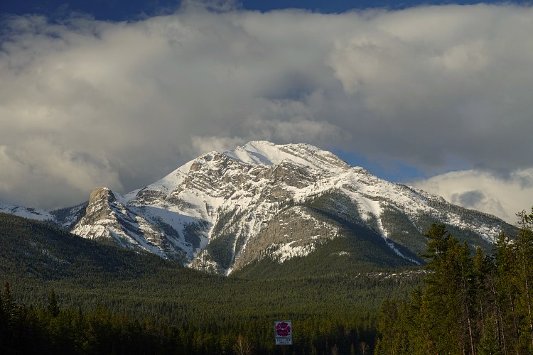
A great winter challenge
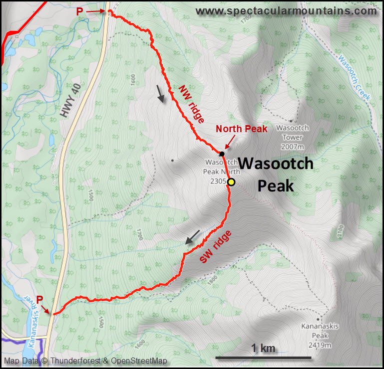
Having done Wasootch Peak via the “normal” route on the southwest ridge before, Wen and I opted to try out the northwest ridge today. It’s not very well documented but there is a clear, straightforward line on this ridge and a very short approach from highway 40. To sum up the difference right away: the NW ridge is an off-trail scramble with some bushwhacking and is much more challenging than the SW ridge, which is a steep but easy on-trail hike.
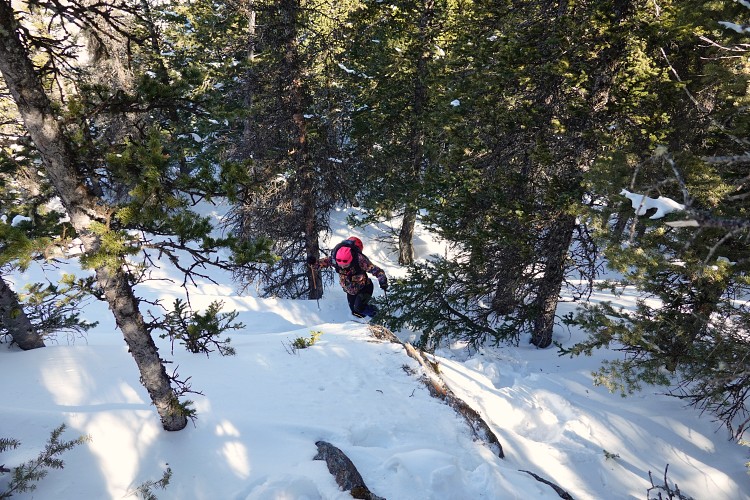
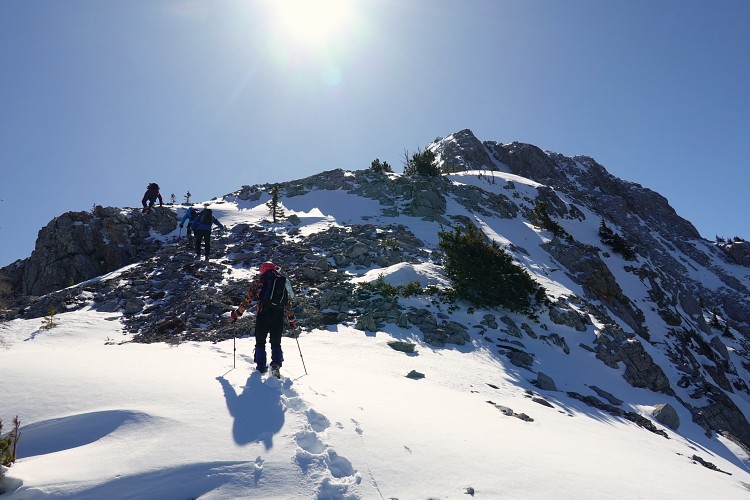
We parked in a flat spot next to the road near the start of the northwest ridge and just headed straight up the slope through light forest to gain the top of the ridge about 40 minutes later. As luck would have it, it was at the exact same time that we ran into a group of three other scramblers right here and after a friendly chat and quick introductions we joined forces and continued up the ridge together. It soon became clear that our new friends – two of them already in their 70s! – were in better shape than us, so they went ahead and we were thankful to follow in their footsteps as they broke the trail for us all the way up.
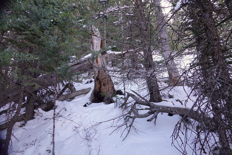
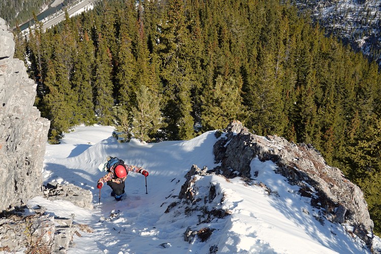
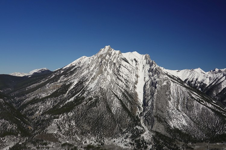
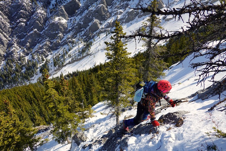
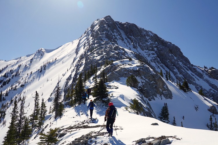
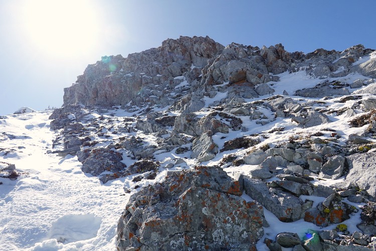
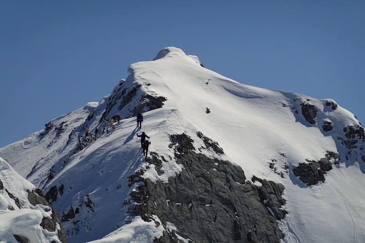
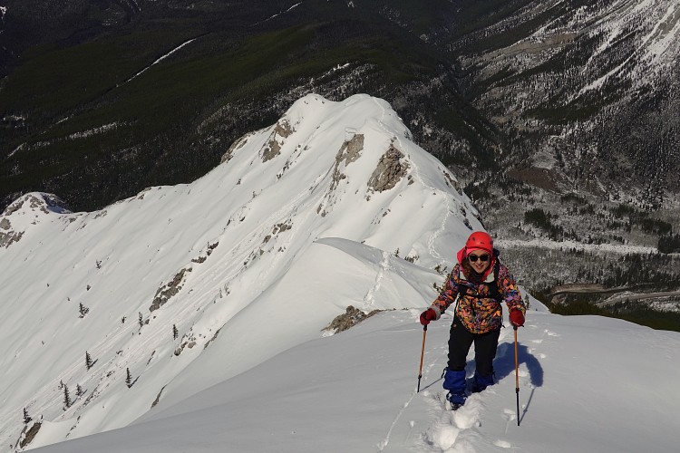
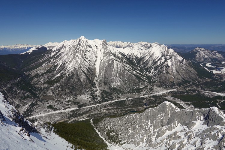
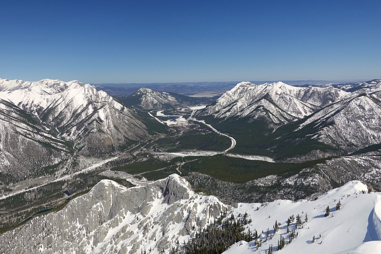
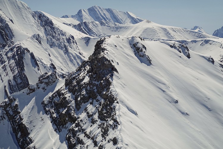
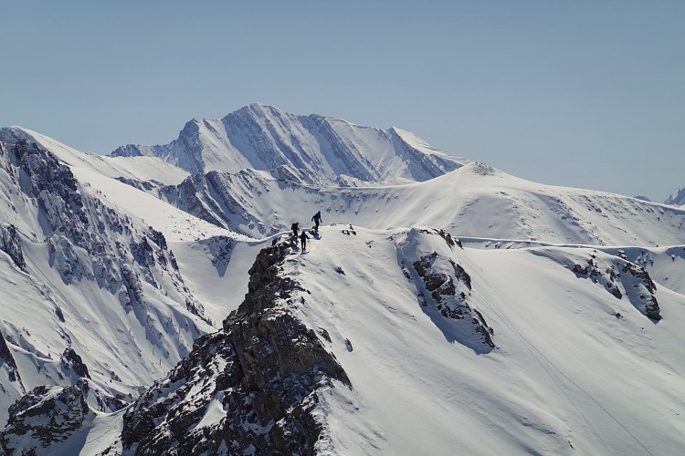
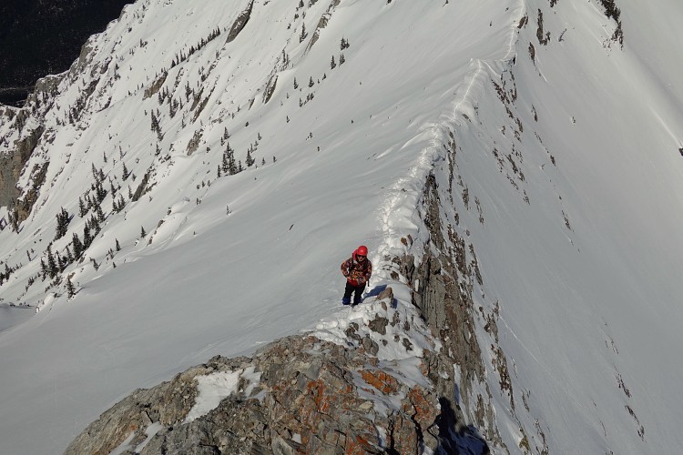
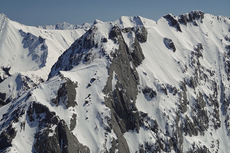
About the first half of the northwest ridge is in the forest and the bushwhacking varies from very light to moderately annoying. Once past treeline the ridge becomes A LOT more enjoyable. Almost instantly there are tricky sections to overcome, with many rock steps, short gullies, and steep ribs to provide plenty of good hands-on scrambling opportunities. I would say the scrambling ranges from easy to upper moderate, but in the conditions we had with lots of snow still covering some of the holds it was certainly in the difficult scrambling realm. The views were fantastic throughout, especially looking back down into the valley towards the highway. We were lucky to have a completely cloudless and windless day.
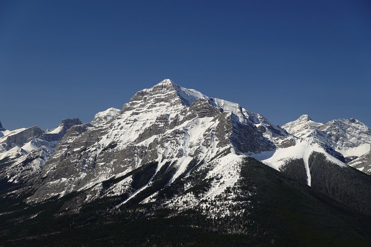
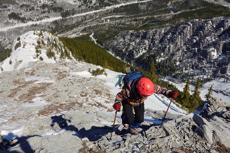
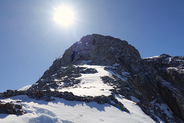
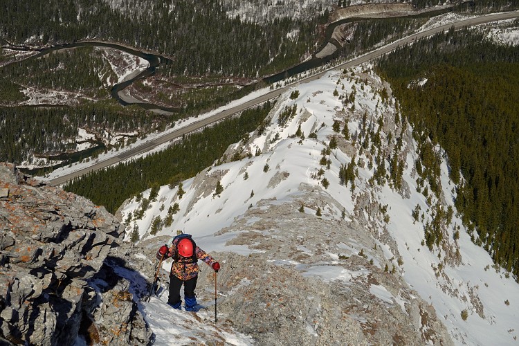
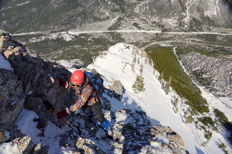
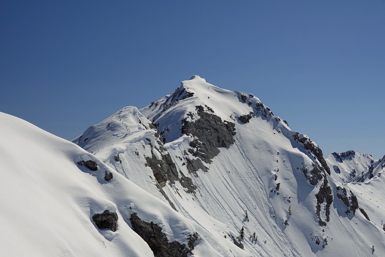
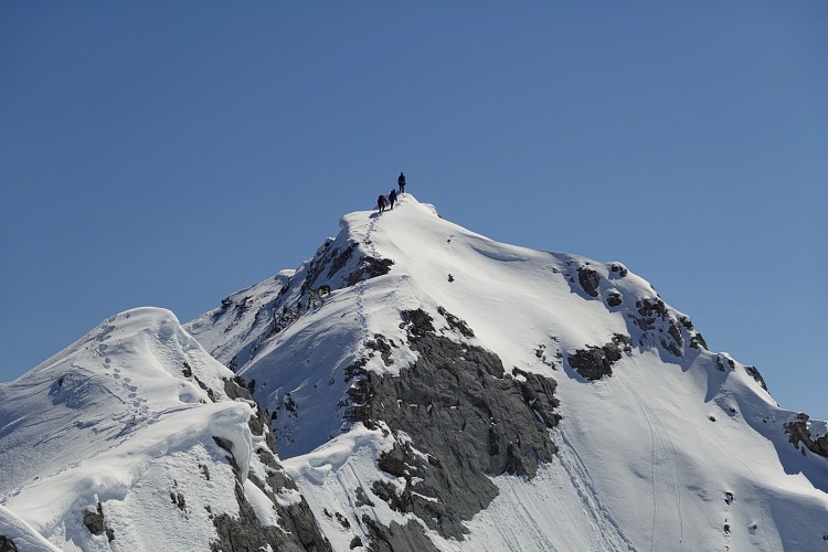
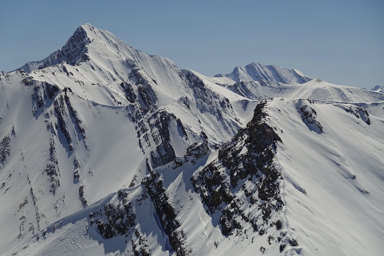
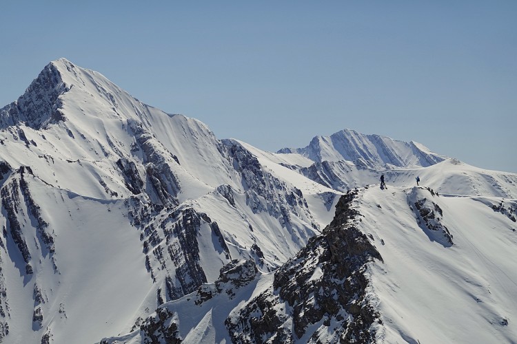
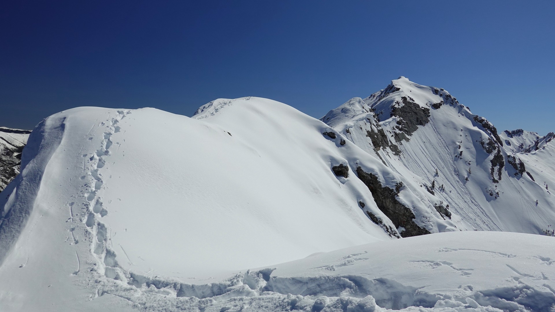
The difficulty level progressively increased as we neared the north summit, which is only 6 m lower in elevation than the south summit. The ridge became more exposed and it started feeling like a bit of a mountaineering endeavour with steep, snow-clad slopes dropping off on both sides of a narrow crest. After a short break on the north summit we followed our friends’ tracks to the south summit. To be completely honest, I don’t know if we would’ve tried this part if it hadn’t been for someone else having paved the way. One section in particular looked quite sketchy from afar and much of the connecting ridge is a no-slip zone when snow-covered (in summer it’s an easy scramble). There are also no options to bypass any steep steps on the ridge by detouring onto the slopes to the side as these are clearly avalanche terrain in winter. We slowly and carefully worked out way across and thankfully the tricky section turned out to be quite manageable once you were leaning right into the rock.
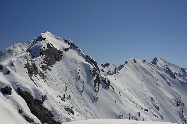
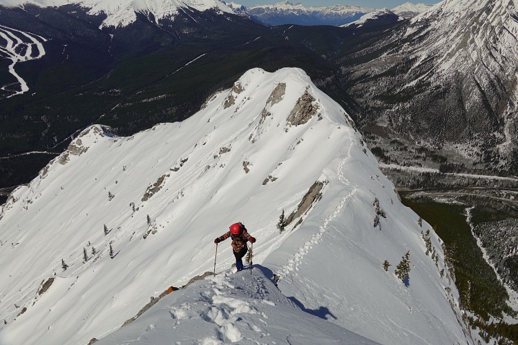
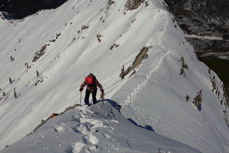
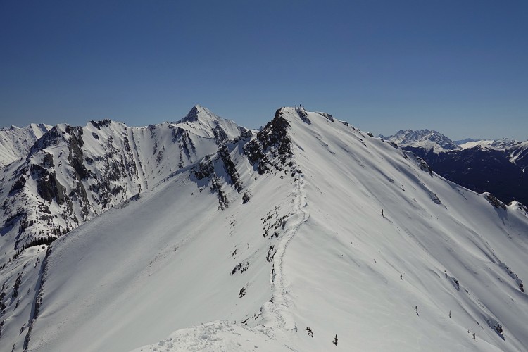
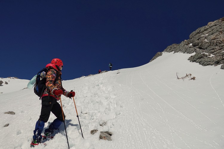
There was a noticeable feeling of relief once we reached the south summit as the rest was now easy. We had already decided half way up that we weren’t going to return via the same route – there were too many snow-covered downclimbs to negotiate, and with the snow now warming up in the afternoon the risk of a small slide or snow collapse was much greater.
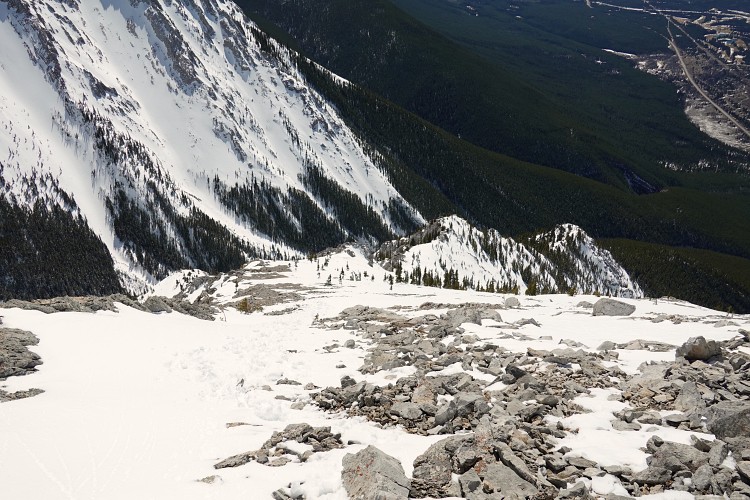
The south ridge was perfect for a quick and stress-free descent. We were now facing the sun and it was getting quite hot. Time to reapply some sun screen and plunge step down the beaten trail. Clearly, this route is much more popular judging by the tracks in the snow and several groups of hikers we met. There is virtually no scrambling on the south side and thankfully also no bushwhacking – no wonder this is the more popular route!
In another stroke of luck, the three climbers we had met on the way up had patiently waited for us at the trailhead on the south side to offer us a ride back to our car. Wow, we were speechless. Hats off to these kind and generous individuals!
The Wasootch traverse was a surprisingly fun and challenging outing that I highly recommend, especially in dry conditions. Bring a helmet, and in winter microspikes are a must and an ice axe is a very good idea. Ascending via the north and descending down the south side is preferable due to the many steep steps on the northwest ridge that are easier to go up than down.
|
Elevation: |
2349 m (south summit) |
|
Elevation gain: |
1050 m |
|
Time: |
6.0 h |
|
Distance: |
7.1 km |
|
Difficulty level: |
Moderate to difficult (NW ridge), easy (SW ridge) |
|
Reference: |
Own routefinding |
|
Personal rating: |
4 (out of 5) |
NOTE: This GPX track is for personal use only. Commercial use/re-use or publication of this track on printed or digital media including but not limited to platforms, apps and websites such as AllTrails, Gaia, and OSM, requires written permission.
DISCLAIMER: Use at your own risk for general guidance only! Do not follow this GPX track blindly but use your own judgement in assessing terrain and choosing the safest route. Please read the full disclaimer here.