Kananaskis, Canada
8 October 2020
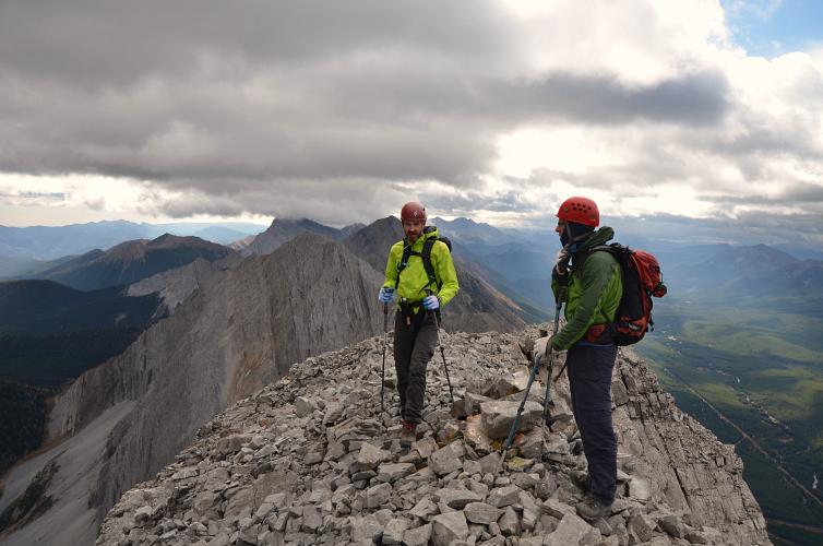
With Trevor and Richard
Nice short trip with some unexpected challenges
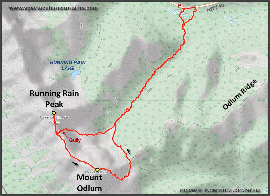
Mount Odlum had a few surprises in store for us today. Or rather the northern “outlier” of Mount Odlum, which is informally named Running Rain Peak after Running Rain Lake below. The latter seems to be a fairly well-known destination for anglers out to catch cutthroat trout and even has a trail going to the lake from highway 40.
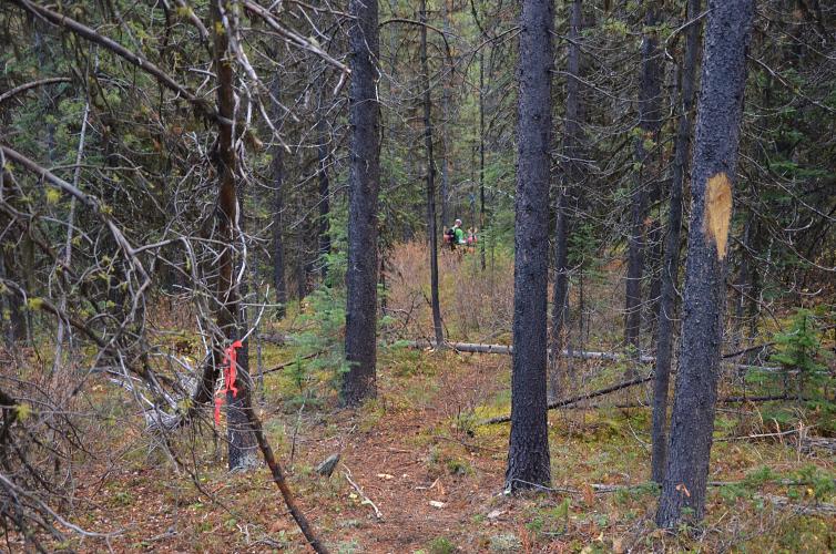
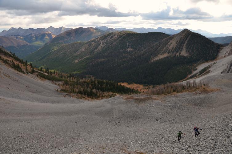
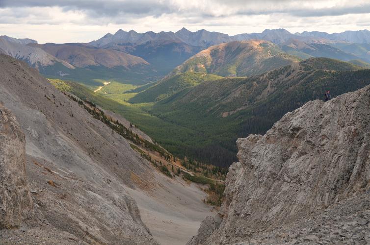
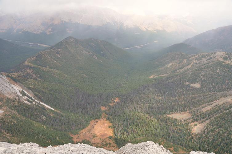
We took the regular Nugara route to access Mount Odlum from the east, with a pleasant approach on a surprisingly good trail that featured – as described in the guidebook – an “abundance of flagging”. We counted four different colours of flagging… someone really had fun marking this trail! We figured it’s probably mostly used by hunters who head up the valley to a broad open meadow at its head, directly east of Odlum’s summit. This certainly looks like a favourable place to see some moose or elk in the early morning.
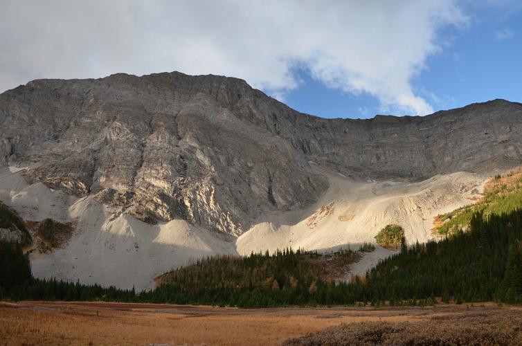
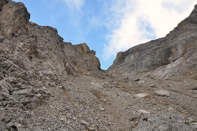
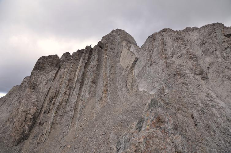
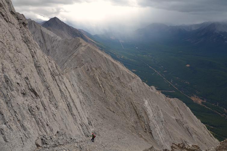
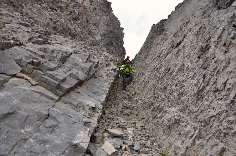
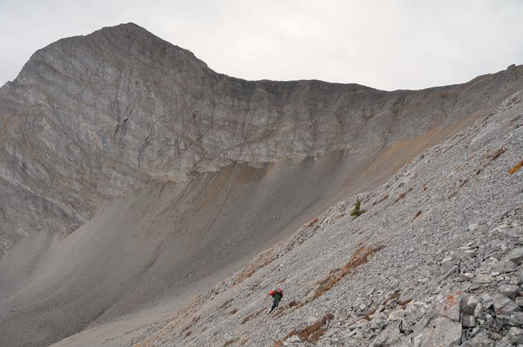
After passing the meadow we easily hiked up grass and rubble to a scree cone below a chute that leads up to the ridge top, north of Odlum’s summit. Helmets are an absolute must here! The gully is full of horribly loose rubble and mud, a lot of it is soft and uncompacted because it’s normally filled with snow and ice that had melted over the summer. It’s also not very well-travelled, so there are no traces of a trail or cairns. Several times we triggered some noisy rock avalanches when huge chunks came loose and bounced down this funnel. Not a good place to have someone below you!
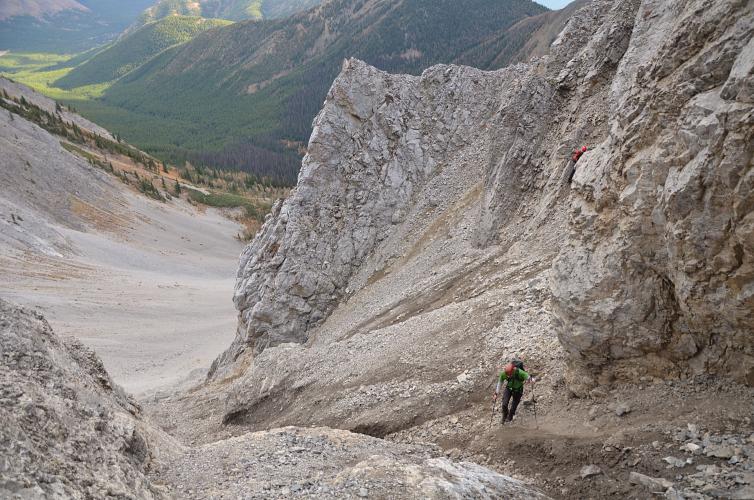
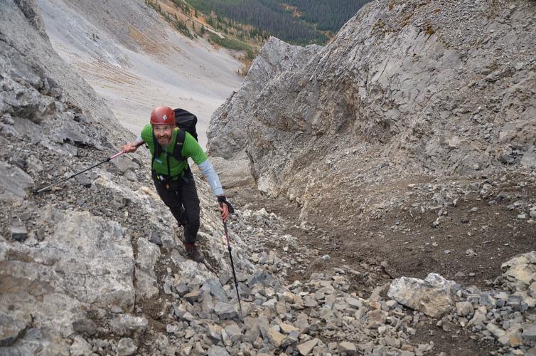
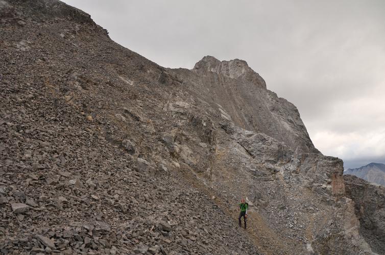
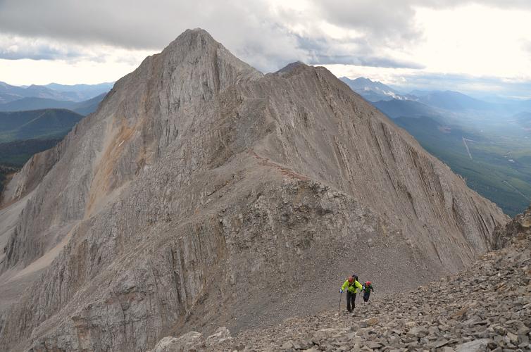
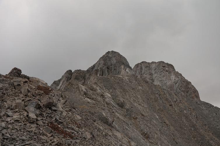
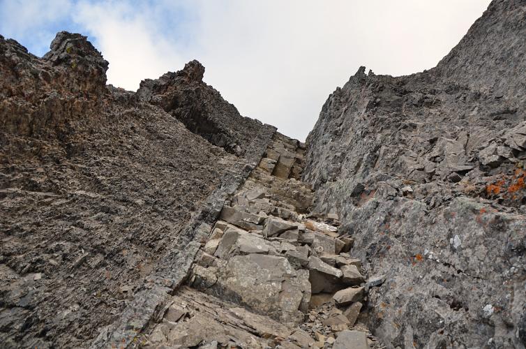
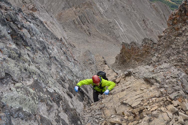
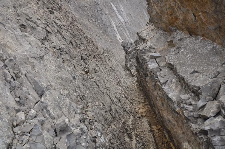
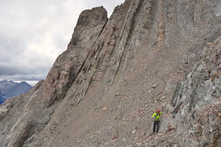
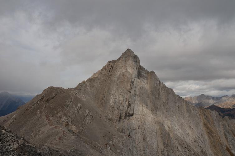
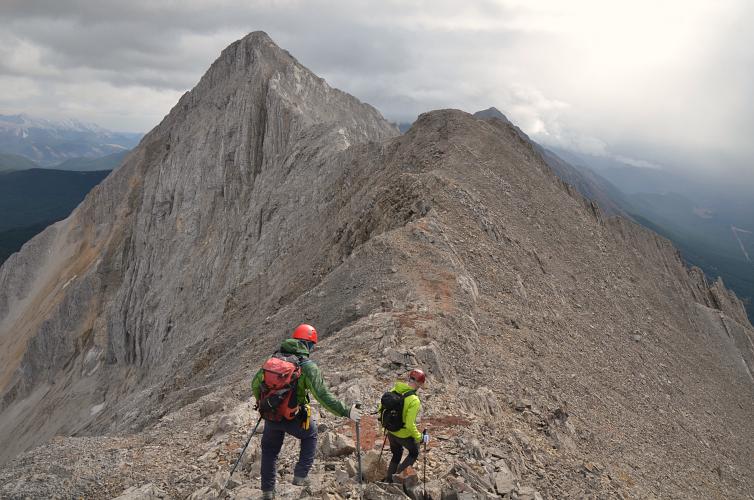
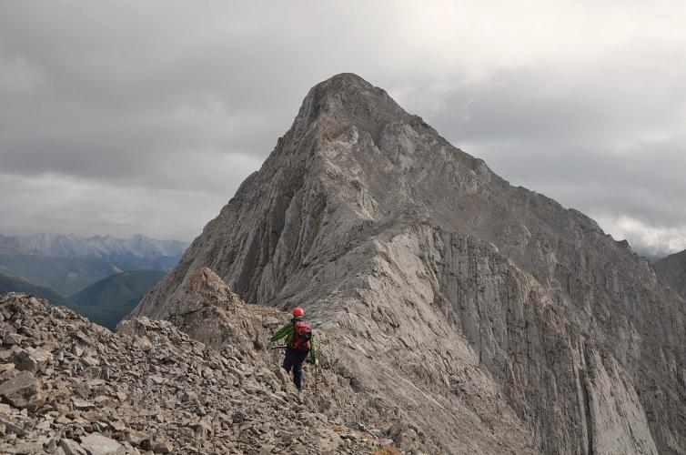
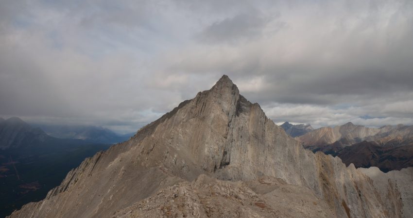
Once on the ridge we turned right to head up Running Rain Peak, which we thought was just a little “outlier” easily hiked as an add-on to Odlum. It turned out to be the most challenging and interesting part of our day, with quite a bit of routefinding and difficult scrambling involved. The ridge crest can be followed for a short while before it becomes too steep and exposed. We had to drop down into a small scree bowl on the west side and were then faced a choice of several steep couloirs that basically follow the bedding of the rock. Richard and I chose the light-brown coloured bed more on the right side, which had a few awkward steps with an overhanging piece of rock at the top. It was ok to go up, but downclimbing it would probably be beyond the comfort level of most people. Trevor found a slightly better line further on climber’s left, and we all ended up on a small rib of near-vertically tilted strata. The ridge crest was still too steep to go back on, so we scrambled through a second small scree bowl on the west side, which was significantly easier to overcome than the first. We were now on another small rib directly below (west of) the summit. A few more moderate to difficult steps on loose rock led to the cairned top, which incidentally is 25 m higher than Mount Odlum’s summit!
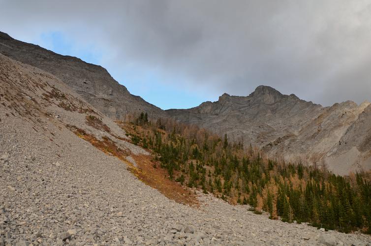
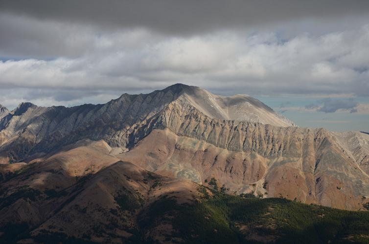
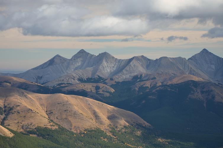
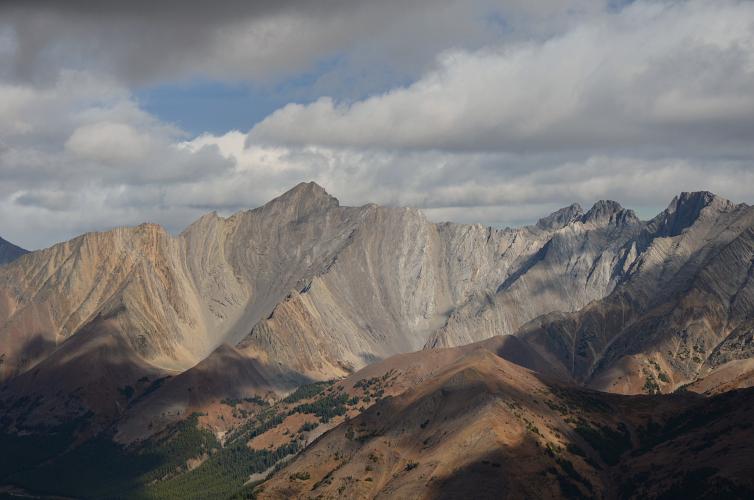
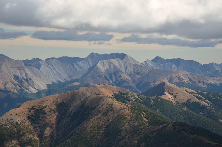
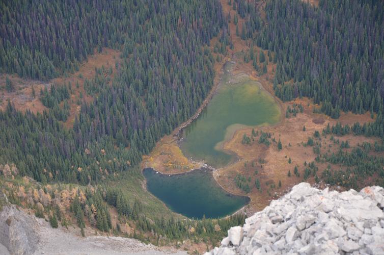
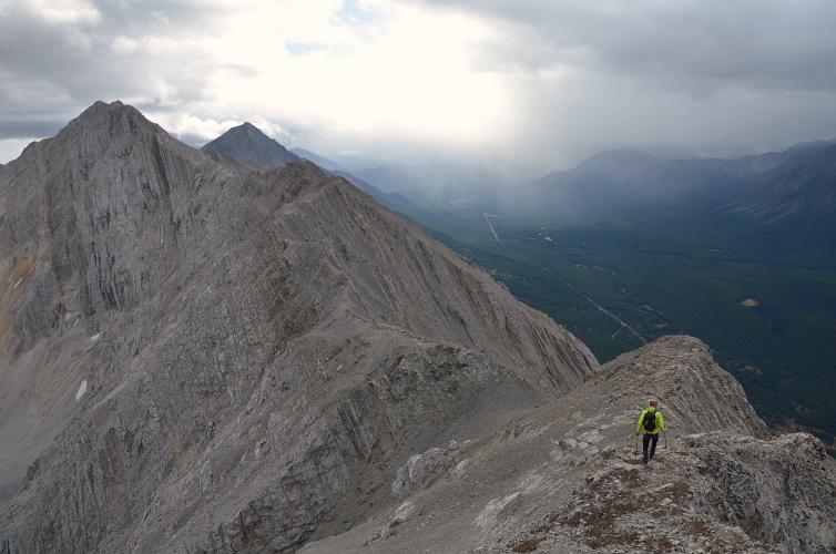
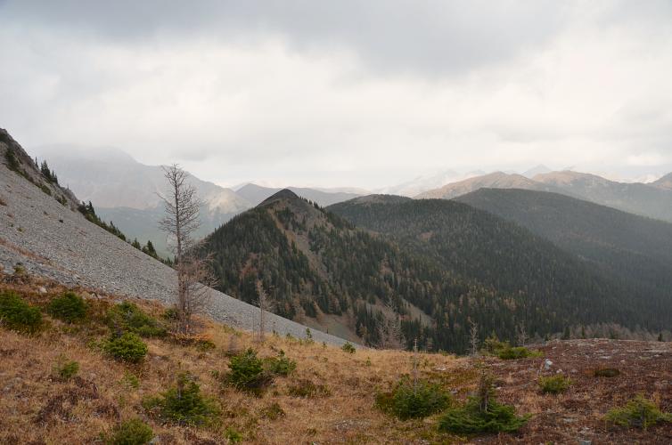
Great views of Running Rain Lake below, the arrow-straight Elk Range with Storelk to the north and Odlum to the south, beautiful Mist Mountain to the east, plus many lesser known peaks to the west in BC.
The descent was certainly more demanding than going up, but we did find a slightly easier couloir in the first scree bowl: it’s the most deeply eroded groove that starts from a distinctive v-shaped notch at the top, with good “side walls” to help with stemming moves. Reminded me a bit of the alternative (and absolutely not recommended) Arethusa descent route, but shorter and less difficult.
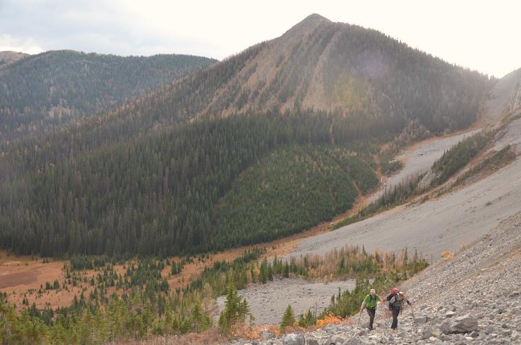
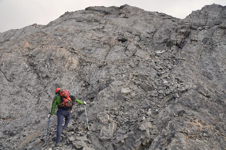
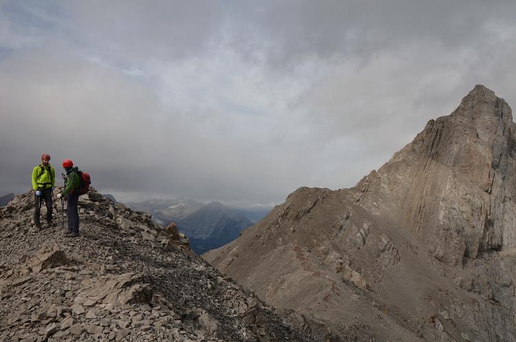
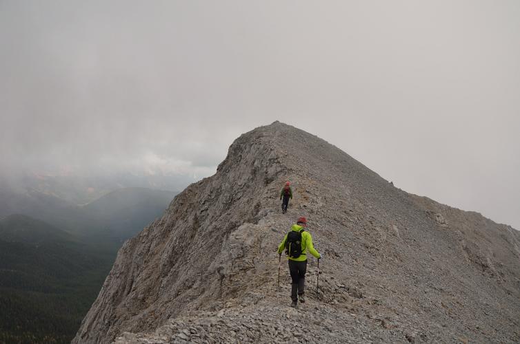
The rest of the way to Mount Odlum was a really pleasant ridge walk and went by super fast. After Running Rain Peak, it felt almost too easy as there are pretty much no more hands-on challenges. The clouds were rolling in as we sat down for another summit break and signed the register. This was to be our last snow-free peak for the season.
The descent route from Odlum suggested in Andrew Nugara’s guidebook goes down the SE side of the mountain and then loops back north to the original approach valley. It definitely turned out to be easier and probably quicker than going all the way back to the horrible scree chute, but we were a bit confused as to where exactly the best way down was since there was no obvious route that stood out. Instead of following the south ridge “for a few minutes”, as Nugara suggests, we headed down the SE ridge until it became easier to just hike/scree-ski down open slopes into the valley below. We eventually found a decent trail that took us back over a small saddle (between Mount Odlum and Odlum Ridge) and into the approach valley, where all we had to do is follow the flagging back to the highway. An excellent day out, especially with all the interesting challenges on Running Rain Peak!
|
Elevation: |
Running Rain Peak: 2756 m (my GPS) |
|
Mount Odlum: 2731 m (my GPS) |
|
|
Elevation gain: |
1240 m |
|
Time: |
8.0 h |
|
Distance: |
14.5 km |
|
Difficulty level: |
Difficult (Kane), T6 (SAC) for Running Rain Peak |
|
Moderate (Kane), T4 (SAC) for Odlum alone |
|
|
Comments: |
Stats for loop route. |
|
Reference: |
Own routefinding for Running Rain Peak. Nugara for Odlum. |
|
Personal rating: |
4 (out of 5) |
NOTE: This GPX track is for personal use only. Commercial use/re-use or publication of this track on printed or digital media including but not limited to platforms, apps and websites such as AllTrails, Gaia, and OSM, requires written permission.
DISCLAIMER: Use at your own risk for general guidance only! Do not follow this GPX track blindly but use your own judgement in assessing terrain and choosing the safest route. Please read the full disclaimer here.