Kananaskis, AB, Canada
Winter ascent (attempt) on 2019-10-06
A winter scramble on a beautiful Kananaskis ridge
6 October 2019
With Richard
It was definitely a bit of a gamble to head out this weekend after almost all of the front ranges had seen a huge dump of snow a week earlier. But with nothing but sun and blue skies in the forecast, we simply couldn’t resist the temptation to get out again. We were glad we did – although we didn’t make the summit, it was no doubt an absolutely fabulous day.
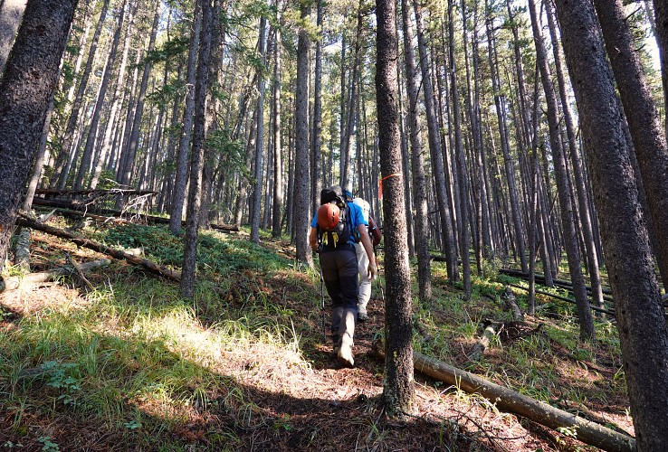
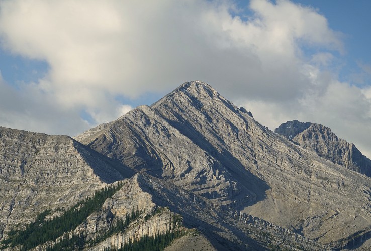
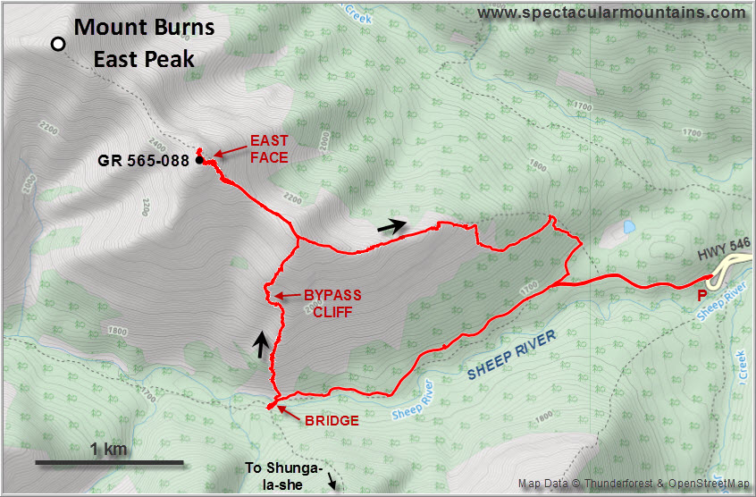
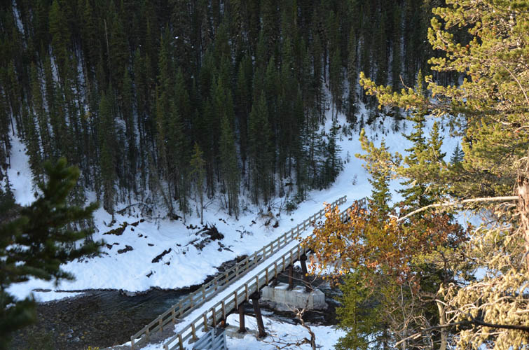
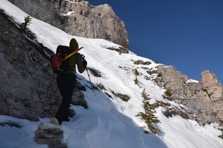
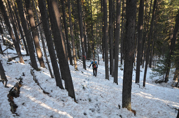
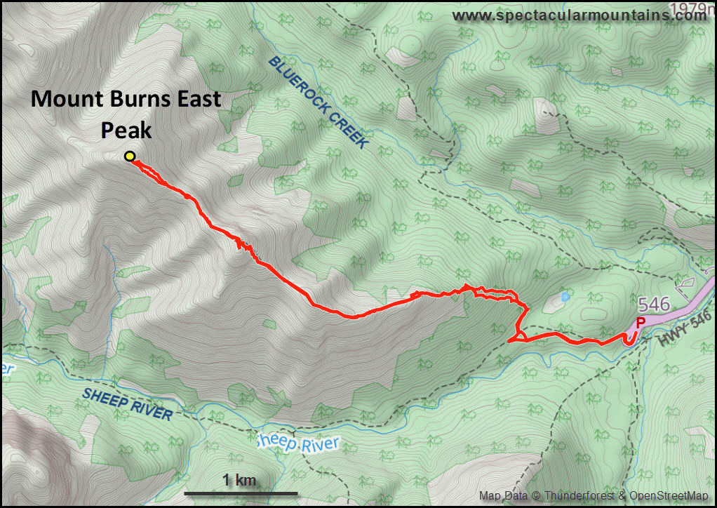
The initial goal was Shunga-la-she, but after arriving at the start of the north ridge ascent route just past the bridge and seeing how much snow was still around in the forest, we decided against it. On the other side of the Sheep River north of the bridge the slopes looked much more inviting – in the sun and largely free of snow. These were the south slopes of Mount Burns’ east ridge. Ok, objective changed… Mount Burns East Peak it was!
Little did we know how involved and complicated this ridge can be when snow-covered. I vaguely remembered reading Nugara’s route description in his More Scrambles book, but didn’t recall any details. If I had, I would’ve known that even in summer this is a scramble with difficult sections that are not to be underestimated.
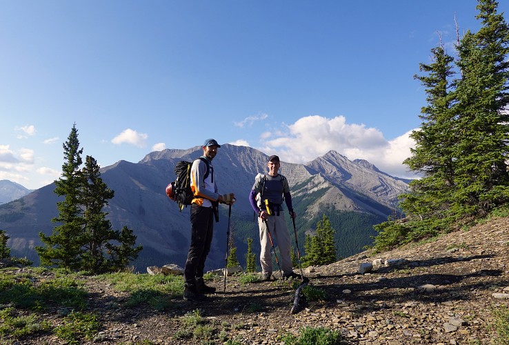
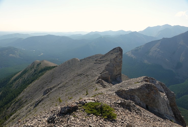
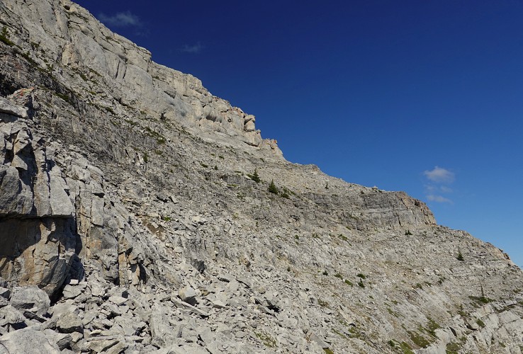
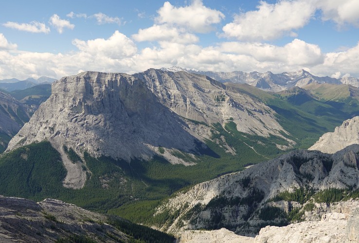
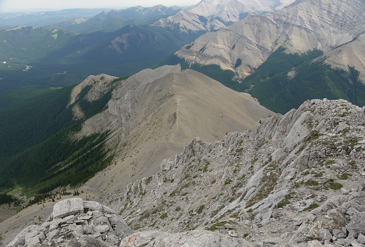
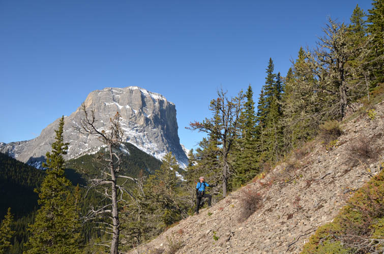
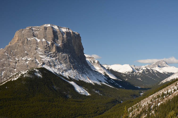
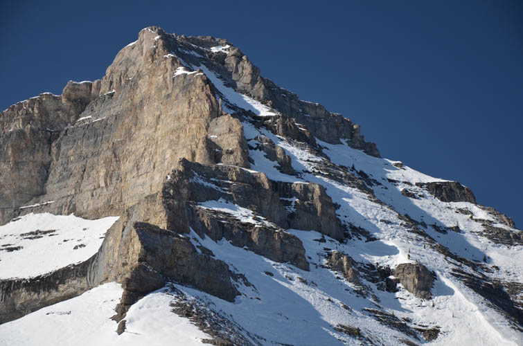
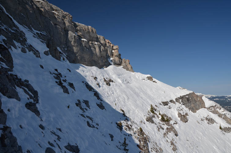
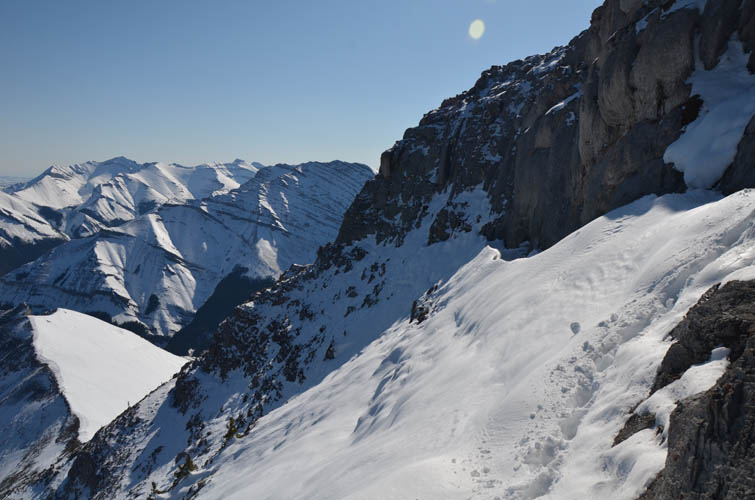
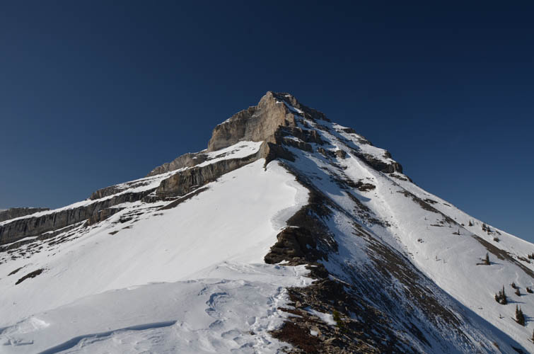
The ascent up the south slopes was straightforward and quite enjoyable. It was steep, but sticking to patches of grass and snow made it easier. Gibraltar Mountain’s dramatic east face provided a beautiful backdrop. About half-way up we encountered a vertical cliffband running horizontally across the mountainside. It was easily bypassed on climber’s left, followed by a simple slog up to the top of Mount Burns’ east ridge. The views up here were breathtaking: golden-brown crags and cliffs, partially covered in streaks of bright white snow, with deep blue skies above. It’s amazing how winter landscapes can be so much more dramatic and the experience more intense than in the summer.
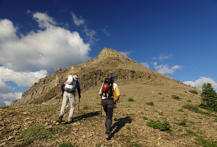
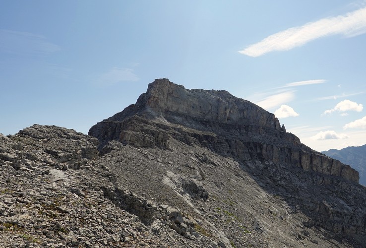
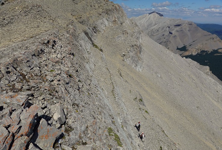
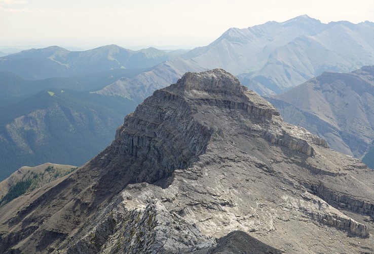
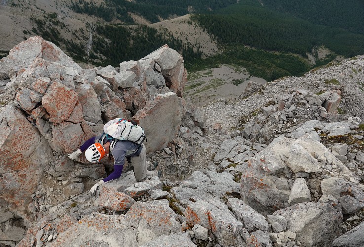
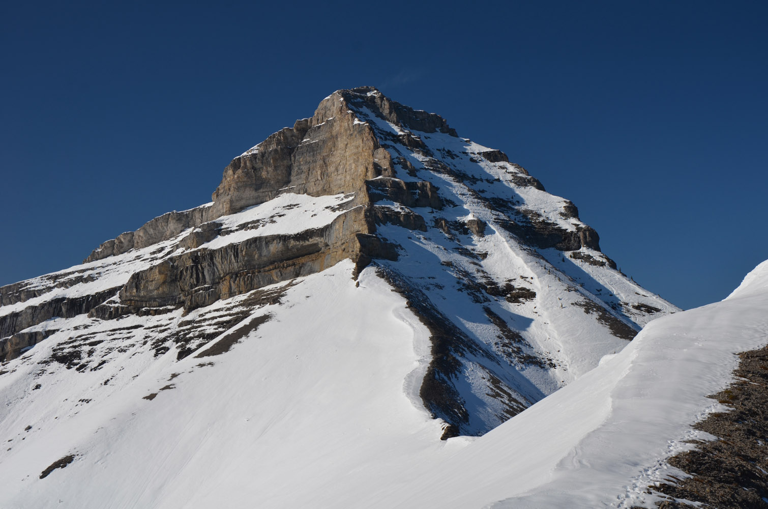
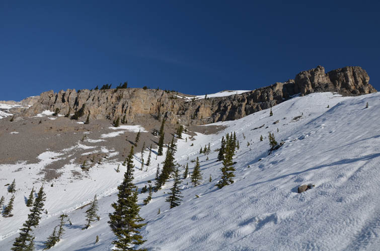
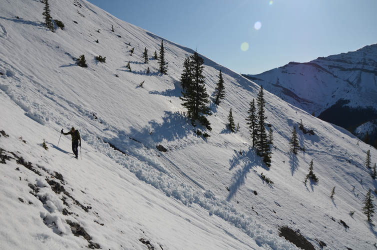
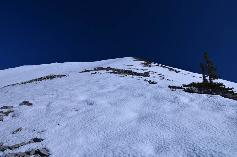
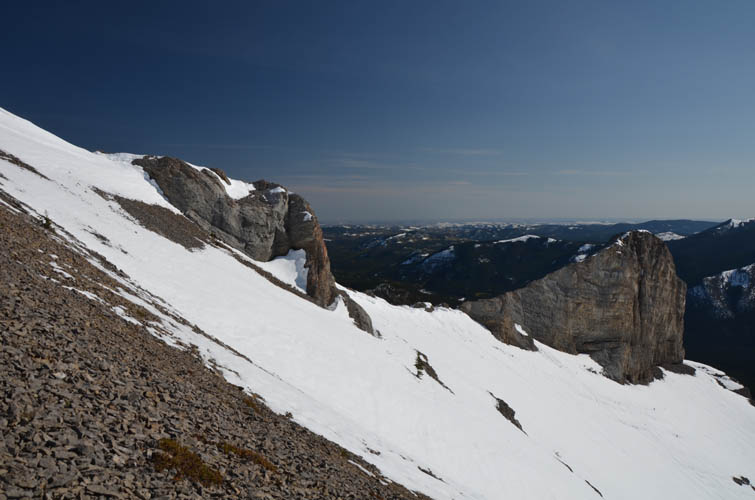
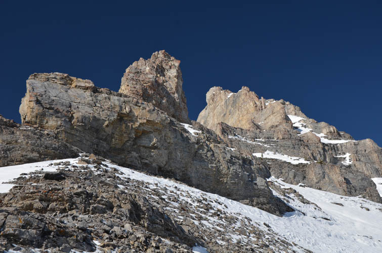
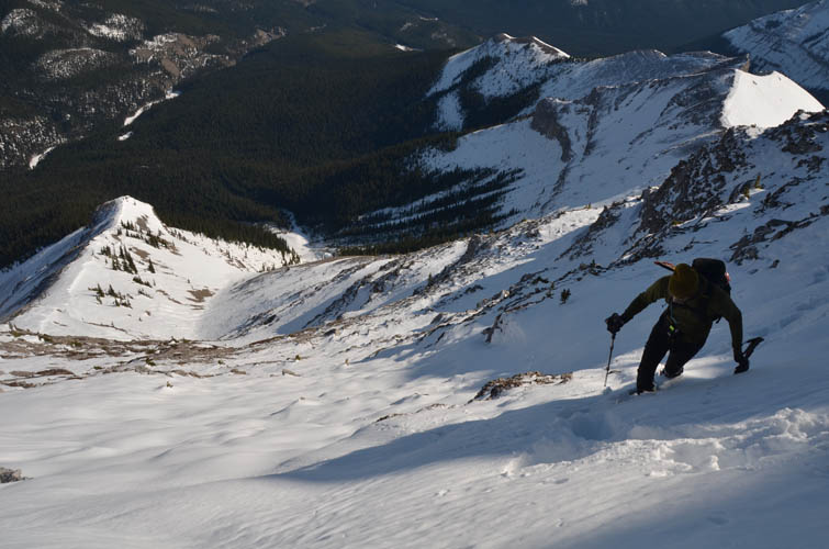
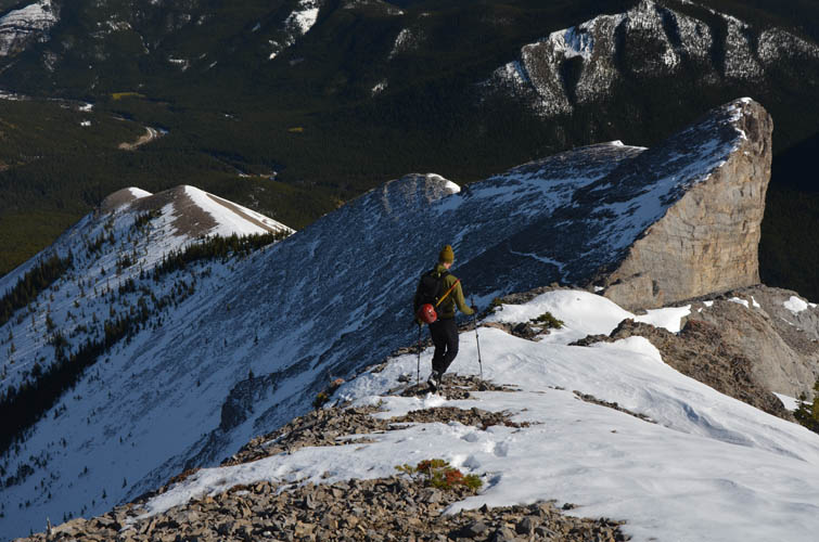
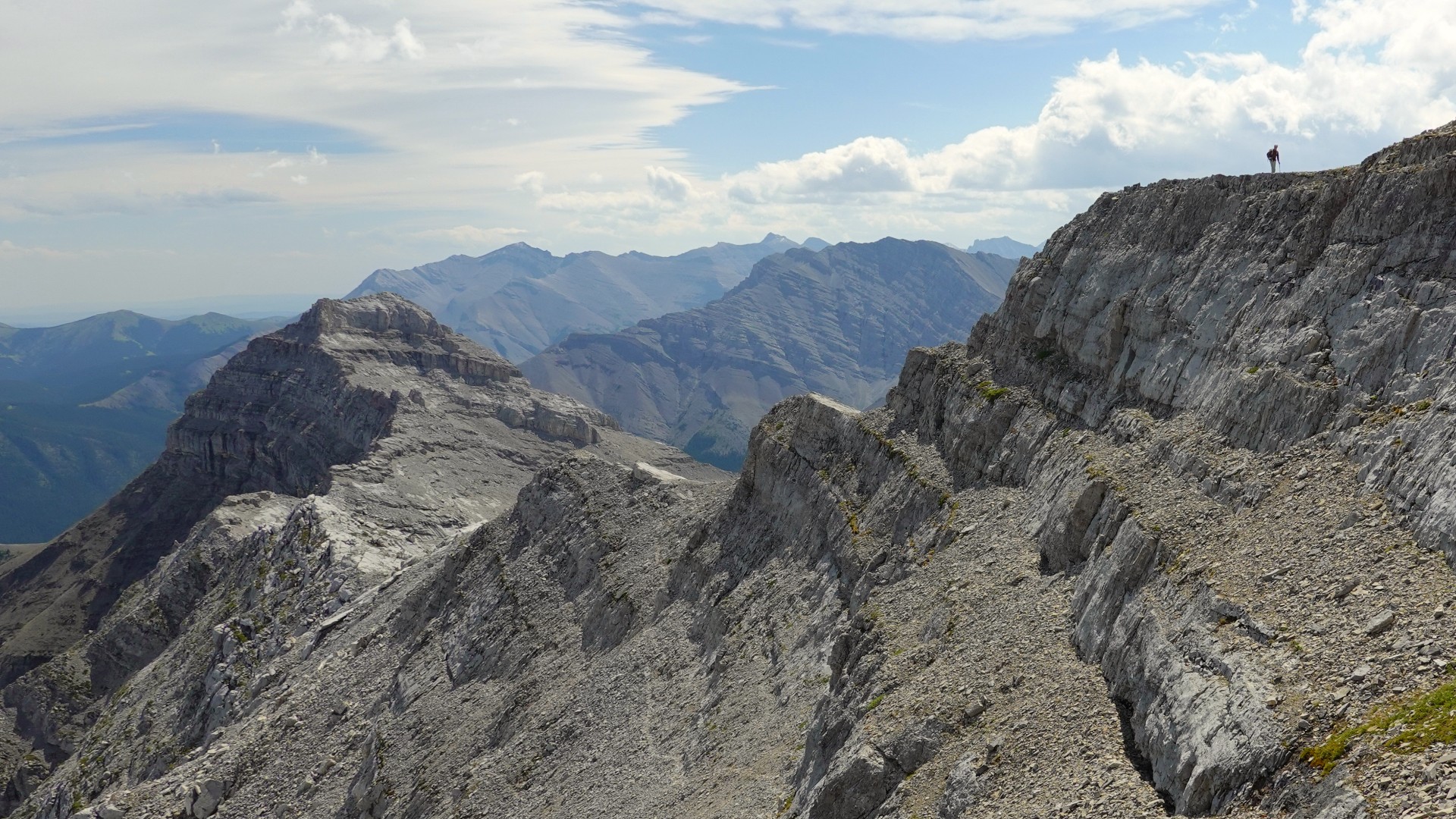
The next big high point along the ridge (GR 565-088) looked beautiful but also a bit intimidating, especially with all that snow on the east face. Sure enough, after hiking up to it along the ridge crest our progress slowed significantly. The steepness of the slopes on the east face, combined with heaps of snow that reached up to our waist in places, was making it considerably more difficult than we had expected. A few cairns and flags provided some welcome guidance on these slopes as any traces of a trail were hidden under a blanket of snow. Some of the steepest sections were really tough to ascend and we thought about turning around several times. Eventually, we made it across the last steep slope to the edge of the uppermost cliffband and turned a corner, revealing the remainder of the ridge leading to the East Peak. Still a long way to go! Too long for our liking, considering how much time it had taken us to struggle up the last section, how tired we were, and that Richard was still recovering from a stubborn cold. It probably would’ve taken us at least another hour and a half to reach the East Peak, provided we would be able to negotiate the narrow ridge that looked like it was going to be pretty dicey if not impossible to do with snow on it.
It didn’t matter, though. We were just very happy to be here and equally happy to turn around at this point. We found a nice spot along the cliff to sit down and enjoy our lunch while tanning in the warm sun before heading back. The return trip was easier yet still required a lot of care and concentration. While the terrain on the east face was steep and slippery, the snow was pretty packed so thankfully there was no risk of avalanches on these slopes.
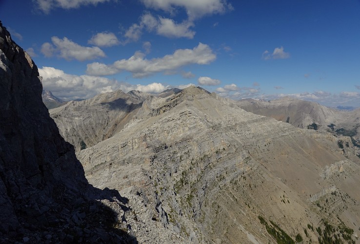
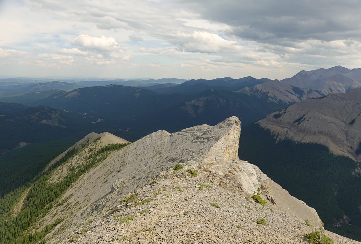
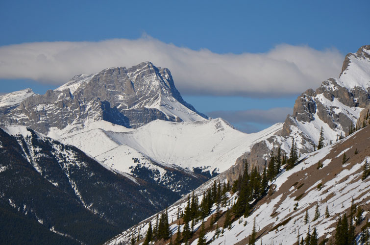
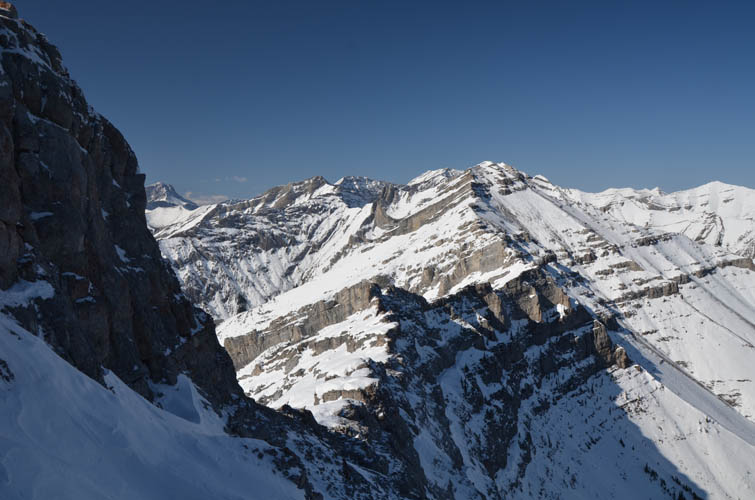
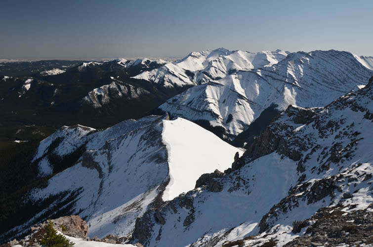
The normal route for this scramble goes up and down the length of the east ridge, and this is the route we took on descent. There’s a trail that we were able to follow most of the way and several small cliffbands that had to be downclimbed or bypassed made it fun and entertaining. The ridgewalk also offers magnificent views of nearby Junction Mountain and Shunga-la-she, both completely snow-covered.
Further down in the forest we encountered some orange flagging that, in the absence of a visible trail, guided us more or less efficiently back to the Sheep River trail. When we arrived at the parking lot we were surprised to see the whole trip had taken us almost eight hours. This was a fantastic scramble in full-on winter conditions, but to make it to the East Peak this trip is better left to the summer months. We’ll be back next year!
|
Elevation: |
2518 m (highest elevation attained) |
|
Elevation gain: |
1160 m |
|
Time: |
7.5 h |
|
Distance: |
11.6 km |
|
Difficulty level: |
Difficult (Kane), T5 (SAC) in winter conditions |
|
Comments: |
Snow and ice make this a significantly more challenging undertaking. Potential avalanche hazard on steep east and north facing slopes. |
|
Reference: |
Nugara |
|
Personal rating: |
4 (out of 5) |
NOTE: This GPX track is for personal use only. Commercial use/re-use or publication of this track on printed or digital media including but not limited to platforms, apps and websites such as AllTrails, Gaia, and OSM, requires written permission.
DISCLAIMER: Use at your own risk for general guidance only! Do not follow this GPX track blindly but use your own judgement in assessing terrain and choosing the safest route. Please read the full disclaimer here.


Sustained and highly enjoyable scrambling on a long scenic ridge
23 August 2021
With Trevor & Richard
Richard and I had some unfinished business after our unsuccessful winter attempt last year. Trevor was keen to join and the three of us completed what we all agreed was a generally highly underrated trip and one of our most enjoyable ridge scrambles ever.
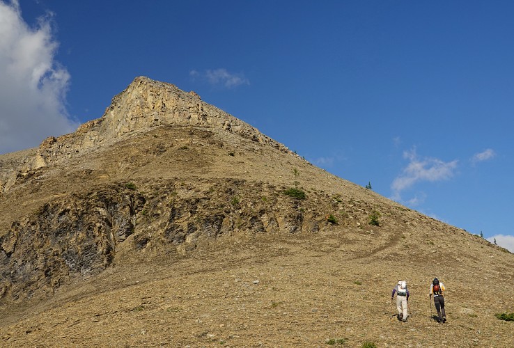
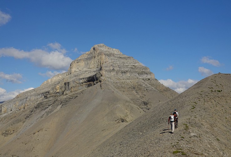
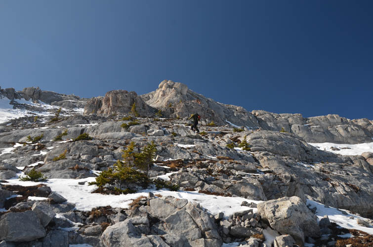
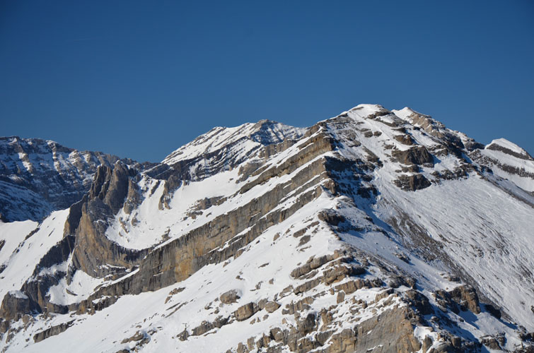
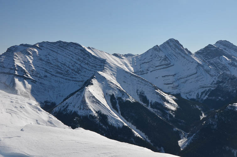
We took the “normal” approach up the forested eastern end of the ridge (as per Nugara’s route description) as opposed to the steeper but arguably more scenic SE slopes, the route we chose on our first attempt. There is some orange flagging in this lower section of light forest, but it’s really not necessary and you can pretty much follow your nose. Bits of trail turn into a proper scree trail above treeline, where brilliant views open up, with Bluerock Mountain on the right and Shunga-la-she and Jägermeister Peak on the left.
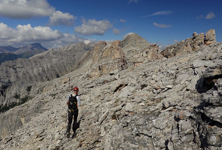
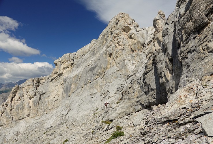
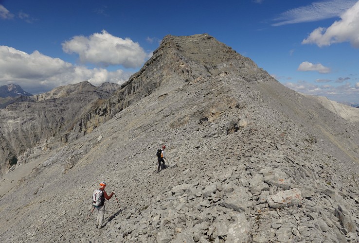
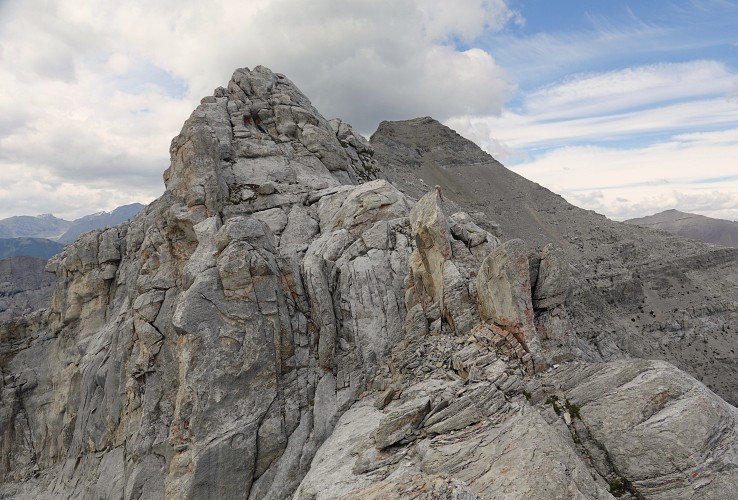
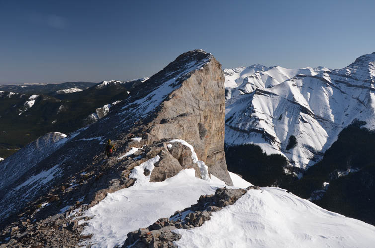
After passing the striking rock fin and a small, rounded highpoint, we reached the base of the false summit – GR 565-088. Compared to what we had encountered back in October 2020 with a layer of snow on these steep slopes, it felt easy and straightforward today. It still requires attention of course, and careful routefinding (watch for boot-worn ledges, cairns and the odd piece of blue flagging) will determine how much easy and/or moderate scrambling you’ll encounter.
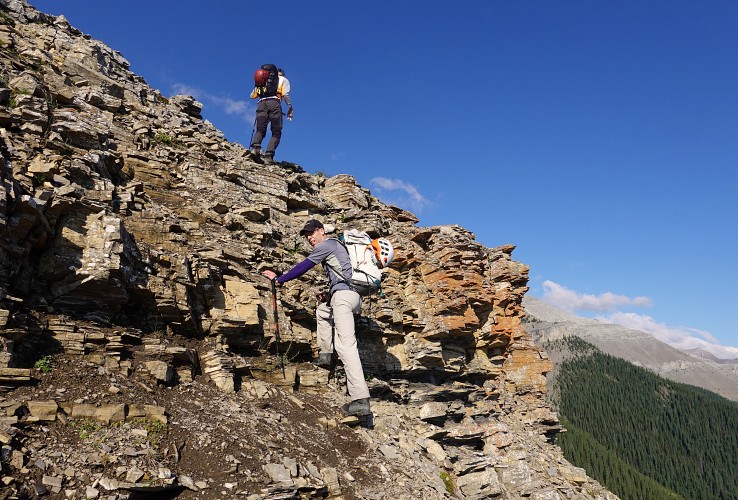
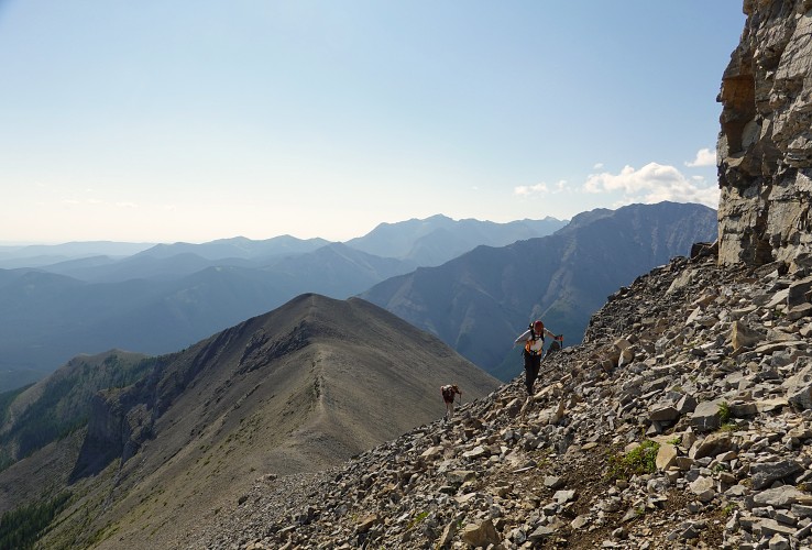
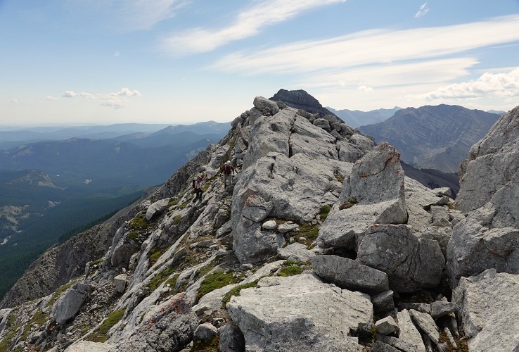
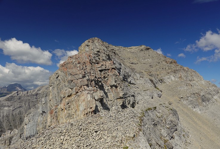
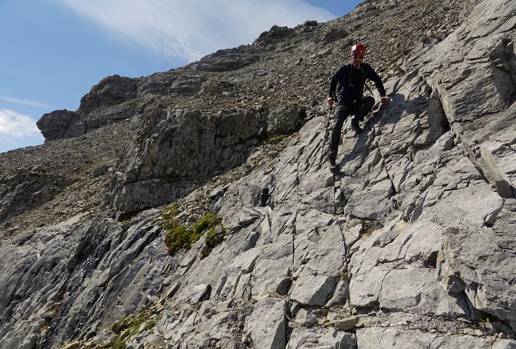
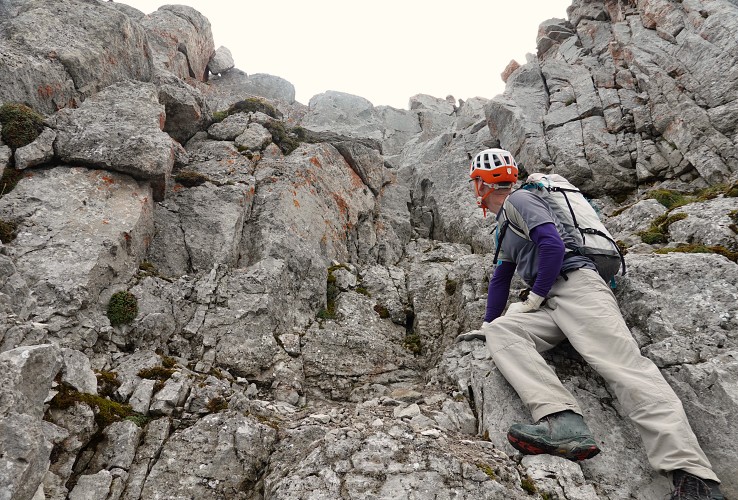
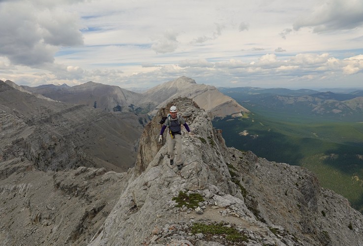
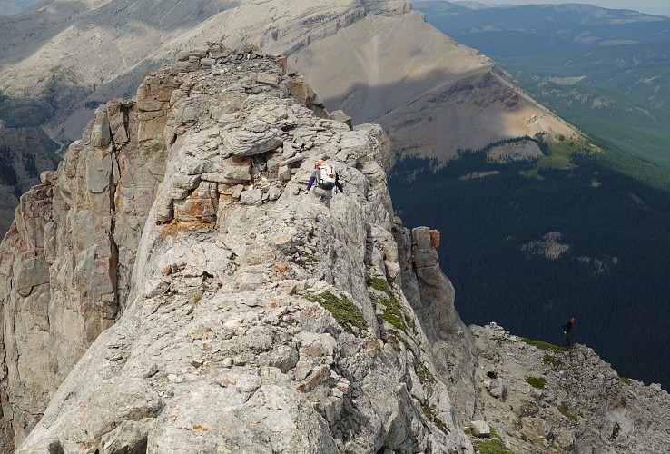
We worked our way up the right side of the false summit, turned the corner at a big cairn, and then continued west along the remainder of the ridge. This is the most interesting part of the trip – lots of small cliffs and steps to navigate, most of it easy to moderate scrambling but here and there a few difficult steps are thrown in as well. Trevor pointed out that all the difficult sections can be avoided if you search long enough for a better route and he’s right. Most difficult sections can be circumvented on grassy ledges on the north side of the ridge, some requiring minor elevation loss.
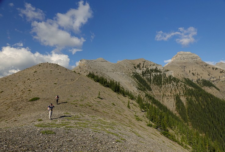
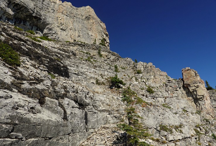
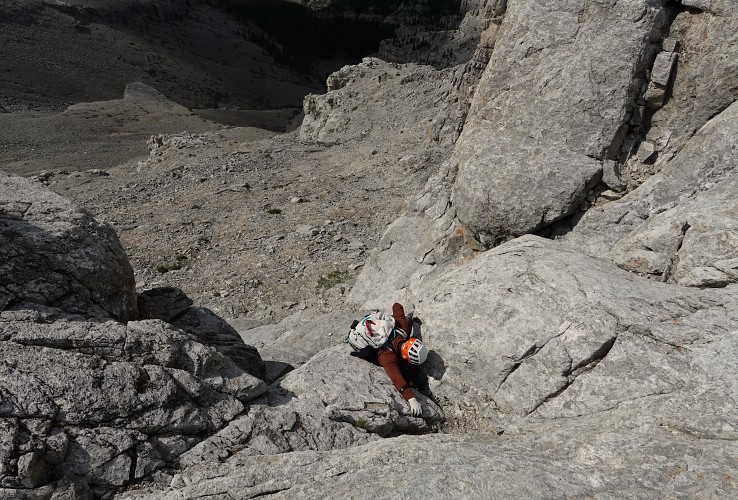
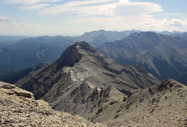
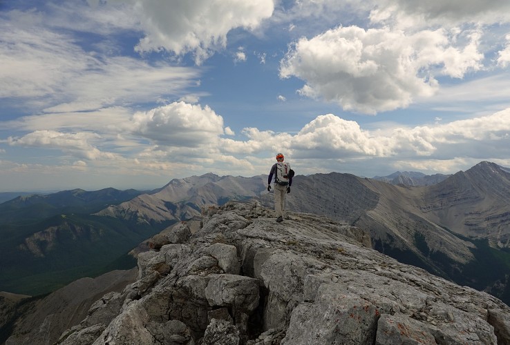
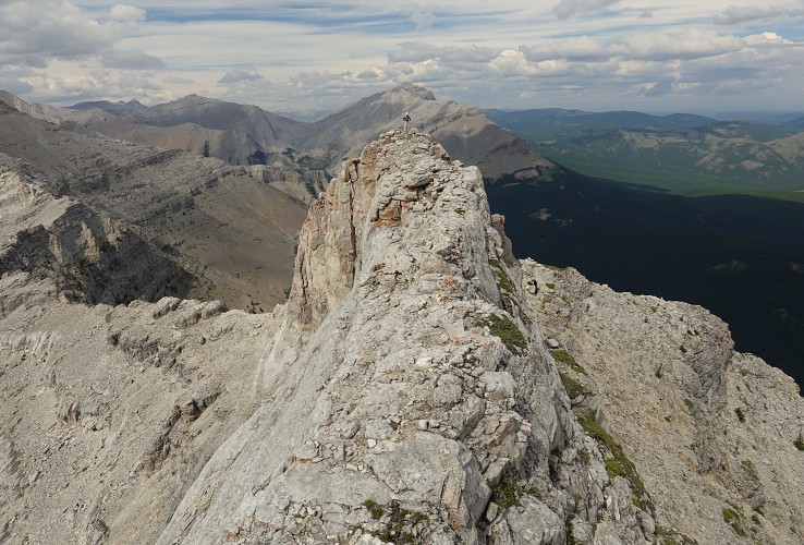
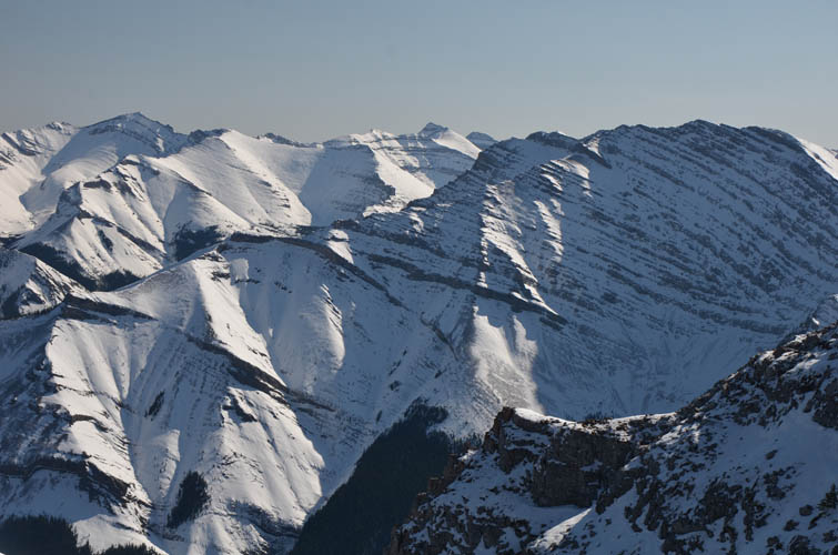
Close to the summit Trevor and Richard followed ledges and scree off the north side of the ridge and then had to scramble up a prominent light grey cliffband left of a small waterfall (more of a trickle), while I decided to stay on the ridge crest which offered fun but difficult scrambling. After months of hiking in smoky weather it was such a joy to finally enjoy some clear views again at the summit! Most prominent are of course Mount Burns further west as well as Gibraltar Mountain to the south and the Highwood trio of Mist, Storm and Rae on the horizon further west.
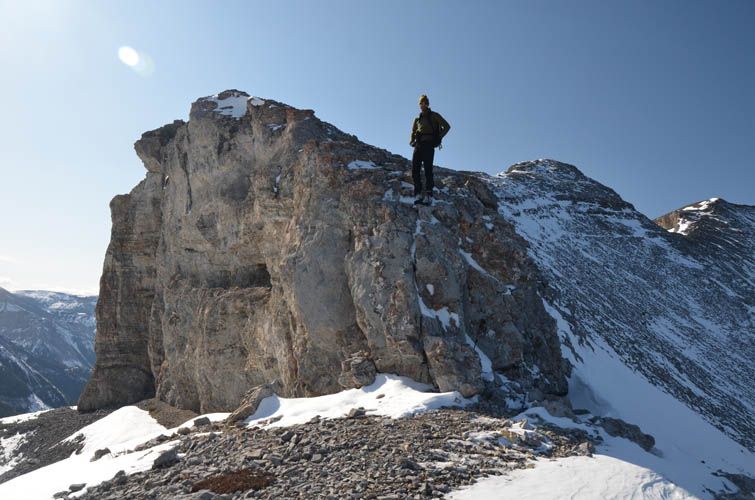
We returned the same way we came, which was a little easier now that we knew where to bypass obstacles. A fun diversion was a short but steep scramble up the false summit at GR 565-088 – we accessed it from an obvious gully on the north side. Once up the gully there is a short narrow and very exposed section of ridge that leads to the cairned summit.
This is a scramble I’d definitely do again! Our time of 9 hours is quite generous as we took our time and had lots of breaks to admire the beautiful landscape around us.
|
Elevation: |
2617 m |
|
Elevation gain: |
1200 m |
|
Time: |
9.0 h |
|
Distance: |
12.7 km |
|
Difficulty level: |
Moderate to difficult (Kane), T4/T5 (SAC) |
|
Comments: |
Not recommended in snowy conditions. E and W slopes are avalanche-prone! |
|
Reference: |
Nugara |
|
Personal rating: |
NOTE: This GPX track is for personal use only. Commercial use/re-use or publication of this track on printed or digital media including but not limited to platforms, apps and websites such as AllTrails, Gaia, and OSM, requires written permission.
DISCLAIMER: Use at your own risk for general guidance only! Do not follow this GPX track blindly but use your own judgement in assessing terrain and choosing the safest route. Please read the full disclaimer here.