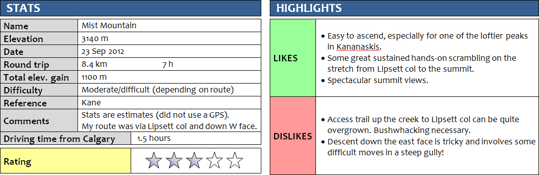
23 September 2012
Solo
What a scramble! Literally, I was scrambling to get on and off the mountain for this one! Overall Mist Mountain was quite enjoyable, but certainly more challenging than I thought and really not what I had expected, especially the descent down the west side.
My big mistake was that I started way too late. Feeling overconfident after several late starts recently and absolutely perfect weather conditions in the previous few weeks, I decided leaving Calgary around 12 pm and arriving at the trail head for Mist Mountain at 1pm was ok and would still leave me with enough time to complete this scramble that is supposed to take between 6 and 10 hours. Considering it was now late September and sunset was now around 7:30 pm, I was really pushing my luck on this day.
Fortunately, I didn’t waste any time searching for the start of the trail, which was clearly marked by a cairn on the left side of the small drainage a few hundred metres south of the Lost Lemon Mine pull-out along highway 40. The path started off in excellent condition, with pink flags at regular intervals and every 5-10 metres in places. It didn’t look like this trail had seen a lot of traffic this summer, but it was easy enough to follow, even through thickets of bush and across small swampy areas as it snaked its way up the small valley always within 10-20 metres of the stream. After about an hour the path grew substantially smaller and eventually faded away where a small side-valley intersected the main valley on the left. I wanted to do the full loop described in the book, which would take me up the main valley to Lipsett col, then left up Mist Mountain and down the ridge to the left and back down to the valley again along the steep west face. To to this loop, I now had to bushwack up the remainder of the main valley, since the path had disappeared to my surprise. Instead, trees and bushes and scrub took up most of the streambed and the embankments. I zig-zagged through this maze of vegetation and eventually had enough, escaping up an animal trail to the right into fir tree forest, where clearings and animal trails facilitated travel significantly, even though I knew I had gotten off route. After tramping through the forest for some time, I ended up high above the valley on the eastern slopes of Mount Lipsett in a rocky area that I had to sideslope for a while to get to the gully leading up to Lipsett col. I was sweating profusely by now, having spent quite a bit of energy just getting up here.
A beautiful view on a calm Saturday afternoon soon eased my fatigue and I relaxed on the col for a nice later lunch. It was not a full two hours after I had set off, around 3 pm in the afternoon. I had to get on with it and decided to cut short my half eaten lunch so I would make it up and down the mountain before sunset. A hellish slog up treadmill rubble followed and I felt like I wasn’t getting anywhere for almost another hour before I finally reached the start of the ridge. Now, finally, the fun scrambling began – enjoyable hands-on climbing on easy to challenging rock with fine, solid holds. My mind was elsewhere, though; I was pushing myself constantly to make up for the late start and finally get up to the final summit ridge. The approach ridge seemed endless, consisting of a series of parallel ribs that had to be crossed and tramped up in between. It took a long time until the summit appeared in sight at last. I think it was close to 5 pm when I actually reached the summit and put my name in the register.
The views were beautiful, but there was definitely a sense of isolation and loneliness on this peak, being up here so late in the day with no one else around. The sun was already getting low and the shadows getting longer… I hastened to continue down the north ridge, carefully tiptoeing on the ridge wherever I could, or plodding along the ridge in places where the crest was too rotten or steep. There were plenty of ups and downs involved in crossing the many undulations of the ridge, which cost me a lot of energy and time, but overall it was enjoyable to be up here walking “over” the mountains with beautiful views all around. Ridge-walking is definitely one of my favourite things to do in the mountains, especially if the terrain is diverse and challenging in places. There were quite a few spots where deviating from the ridge crest was necessary, leading to a rather unpleasant sidesloping tramp through nasty rubble, a real ankle-biter!
The descent gully wasn’t easy to find – I think I ended up going down the ridge a bit too early, but there were faint tracks of others that had gone down here so I decided to take my chances. Daylight was getting dim now and it wasn’t until I was climbing down some seriously steep cliffs in the middle of my descent gully, which had by now become a series of steep walls with a small dried out waterfall in the middle. At one particularly difficult section I stopped to catch my breath and looked at my watch: 7 pm. I looked around me and I could see the sun disappearing in the west, leaving me bathed in dark orange light on the side of a steep cliff. To make things worse, I had been out of water for the past hour (even though I had packed a total of about 4 litres!). I paused for a moment and started to realize that I might have to descend these challenging cliffs in the dark soon. Looking down, there was no end in sight. I told myself not to rush it, I had already had some near slips, and any fall wouldn’t be pleasant here. Although most of the steep sections could be broken down into smaller parts, each one of them required downclimbing around 2-5 metres, unroped of course. This is one of those scrambles that I would’ve preferred to do with someone else, where you can guide each other and boost each other’s confidence. Anyway, I kept going at a steady pace, took small “chocolate” breaks to keep up my energy levels, and eventually found my way down. Near the base of the cliffs I even found a trickle of water running down a steep rock face, providing me with some much needed rehydration. Once on easier terrain I was able to speed up and dash back down to the trail in the valley, reaching my car at 8 pm, just before it became completely dark.
I had dodged two major bullets – lack of water and lack of light – by a narrow margin, and certainly learnt a big lesson. NEVER leave late if you’re planning a decent trip in the mountains! And ALWAYS carry enough water, more than what you think you need!
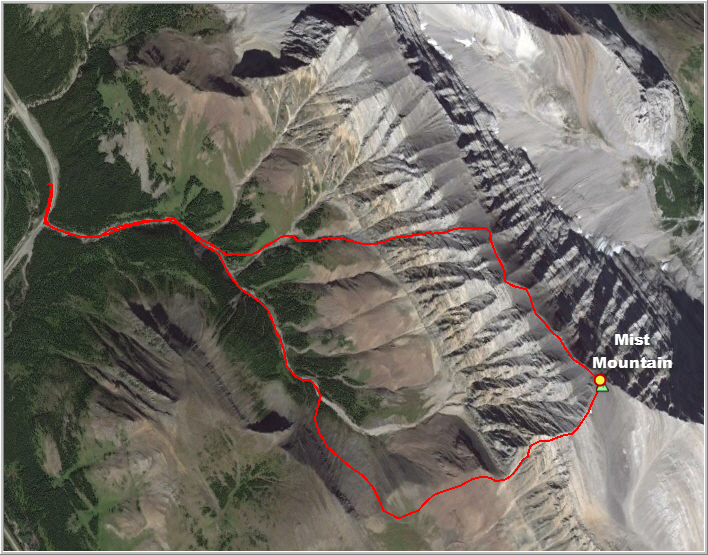
Route map
The route shown above is approximate only. I did not have a GPS with me when I went on this trip.
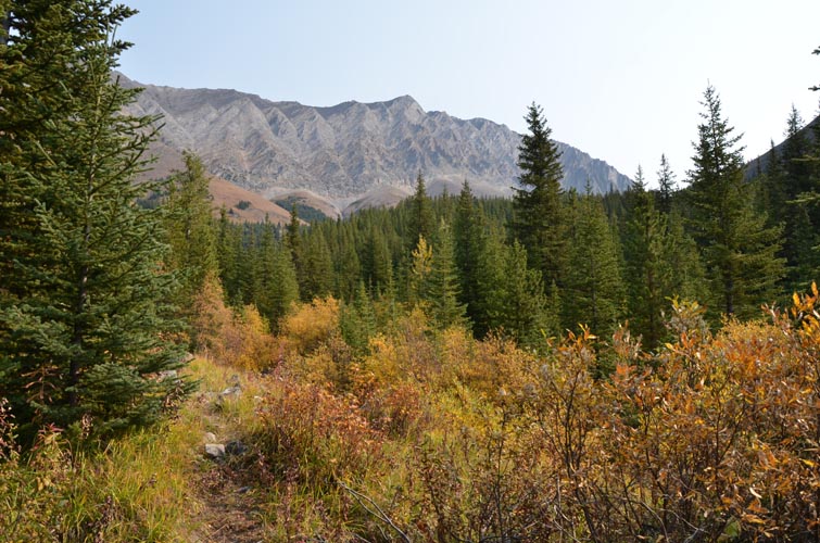
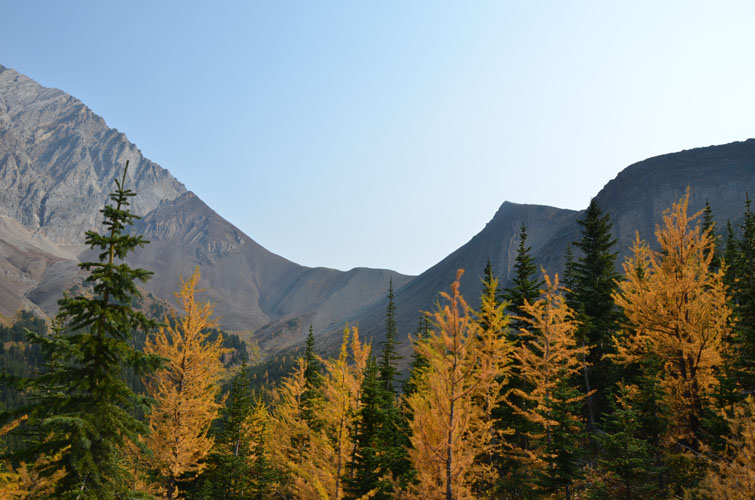
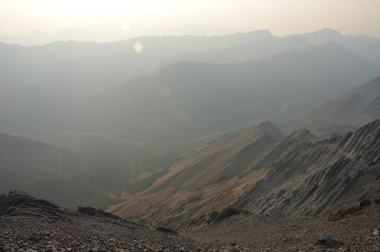
Approach along the creek toward the long ridge that has Mist Mountain at its high point (centre).
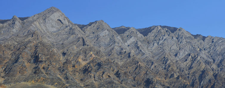
The jagged outline of Mist Mountain’s west face.
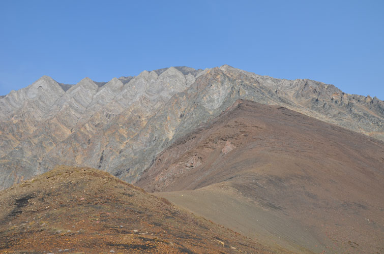
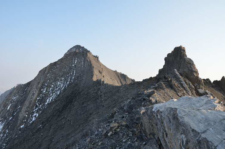
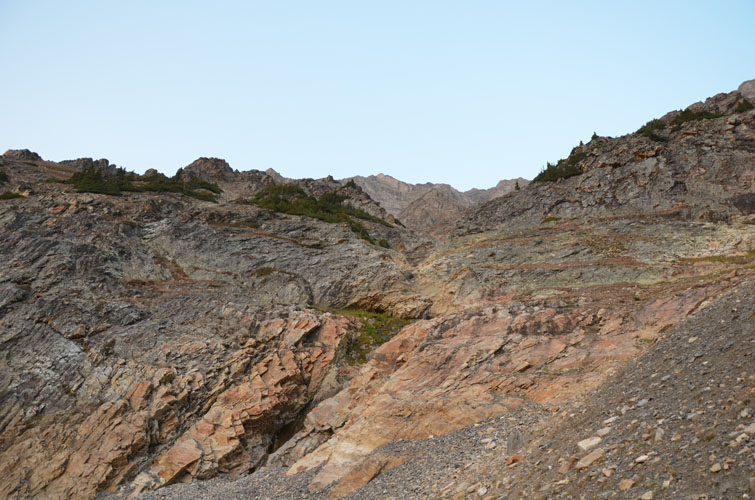
The saddle between Mount Lipsett (right) and the steep slopes leading up to Mist Mountain on the left.
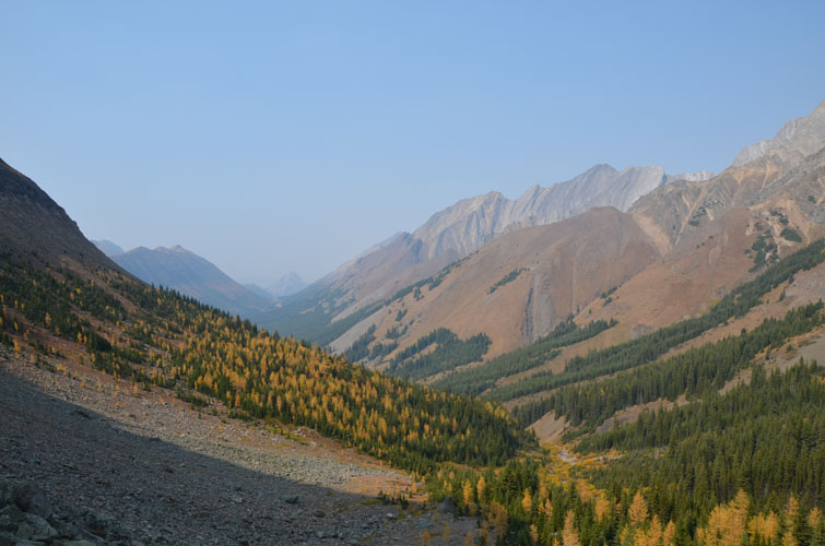
View from the saddle back down the approach valley.
At the saddle, I turned left and followed these slopes up to the ridge of Mist Mountain.
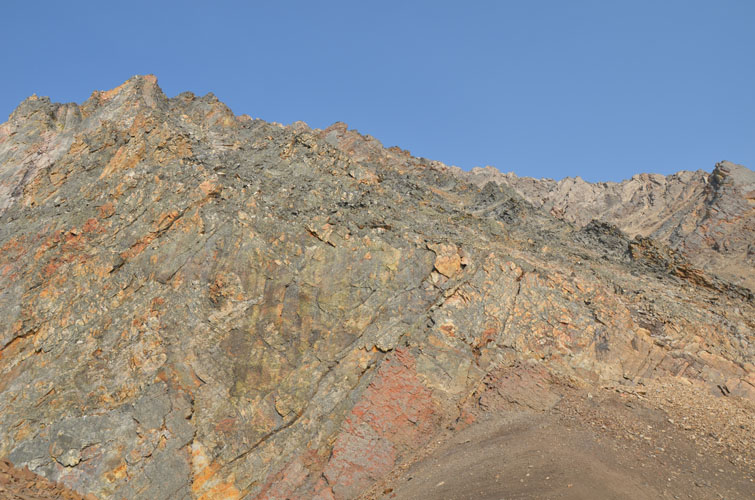
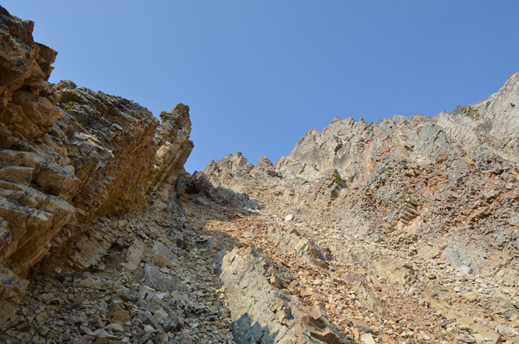
Lichen-covered rock marks the start of the fun scrambling section up steep, vertically tilted slabs and chutes.

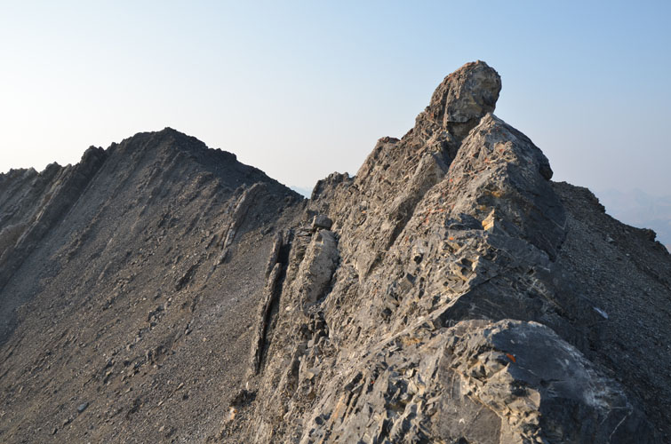
The first step is steep but offers good holds.
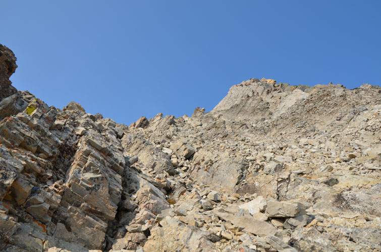
Typical terrain with numerous ribs and scree-filled furrows.
Many different routes are possible up this interesting microterrain. This is looking SE.

Coming up another scree chute between rocky ribs.
It’s pretty steep in places, but all very enjoyable hands-on scrambling here.
Looking down the SE ridge.
Finally, the summit (left) comes into sight. I was surprised how long it took from the saddle to the summit.
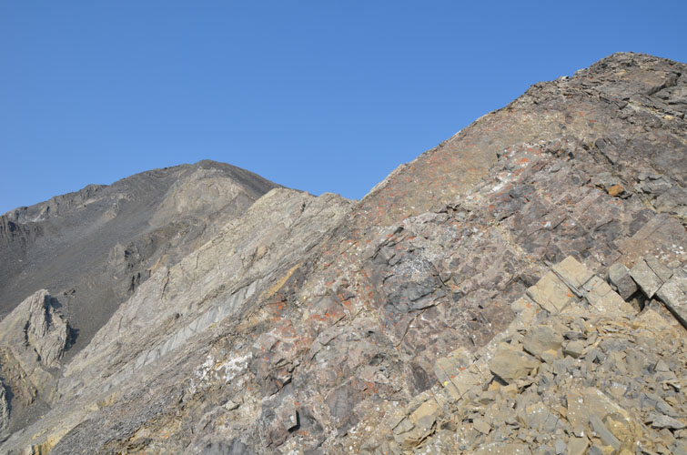
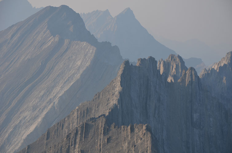
To the north, the western face of Mist Mountain looks like a messy deck of cards held upright.
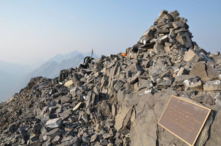
At the summit. A memorial plaque sits near the summit cairn in honour of a Polish hiker who died here in 1989.
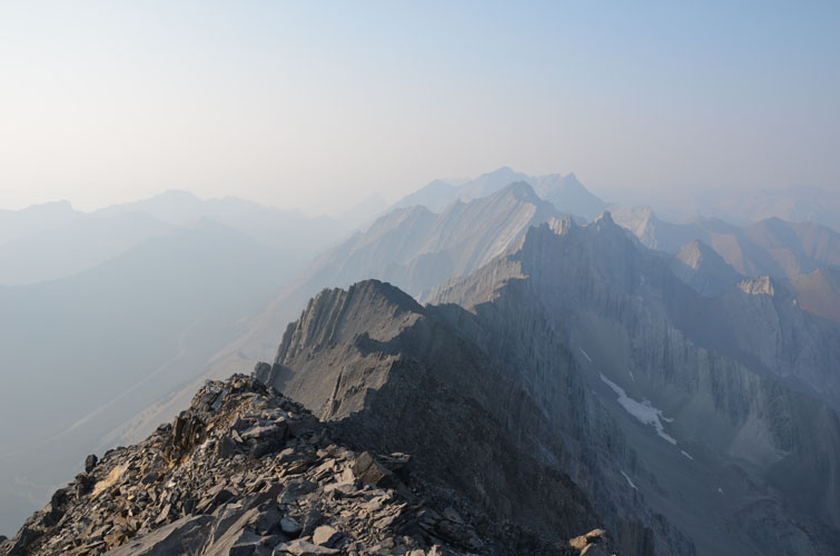
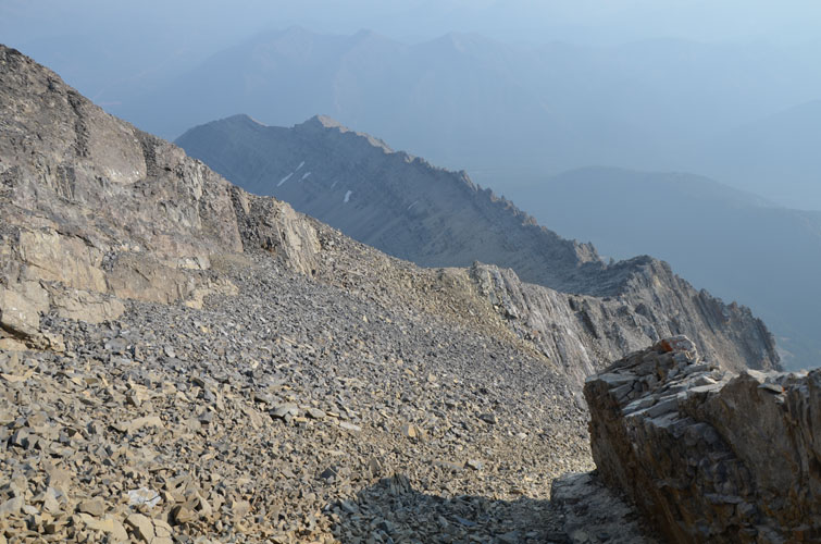
Spectacular views of the long, undulating ridge that runs north toward Storm Mountain and Mount Rae.
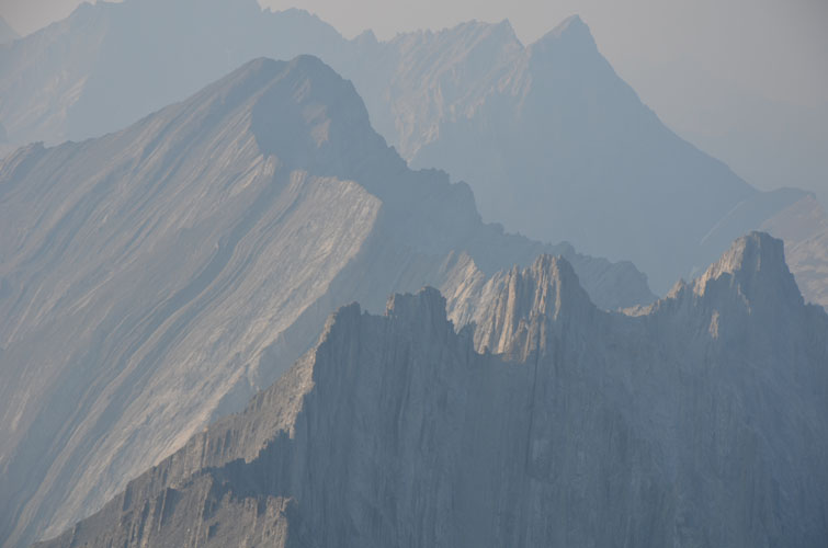
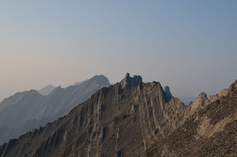
Close-up of what I call “Stist Peak” (foreground) and Storm Mountain (upper left).
Looking back (south) at the summit. A light dusting of snow is still clinging to the east face despite hot temperatures today.
Typical terrain as I continued along the ridge toward the north.
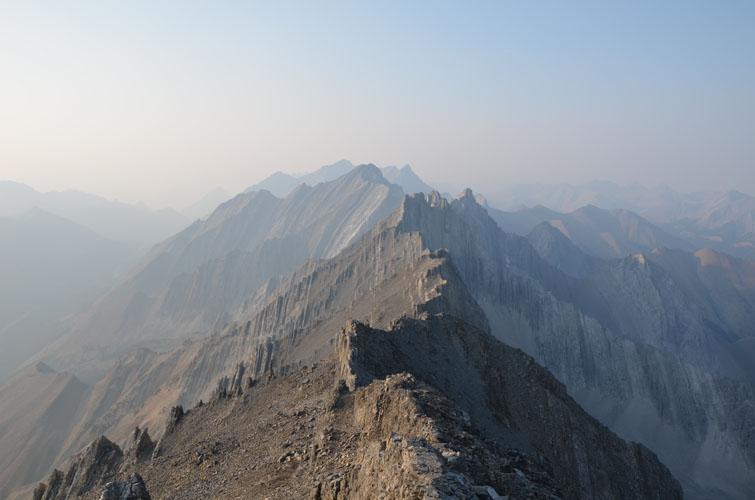
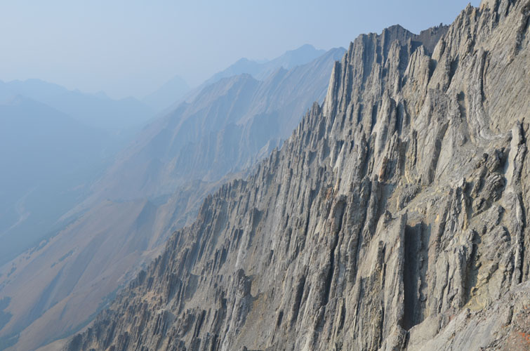
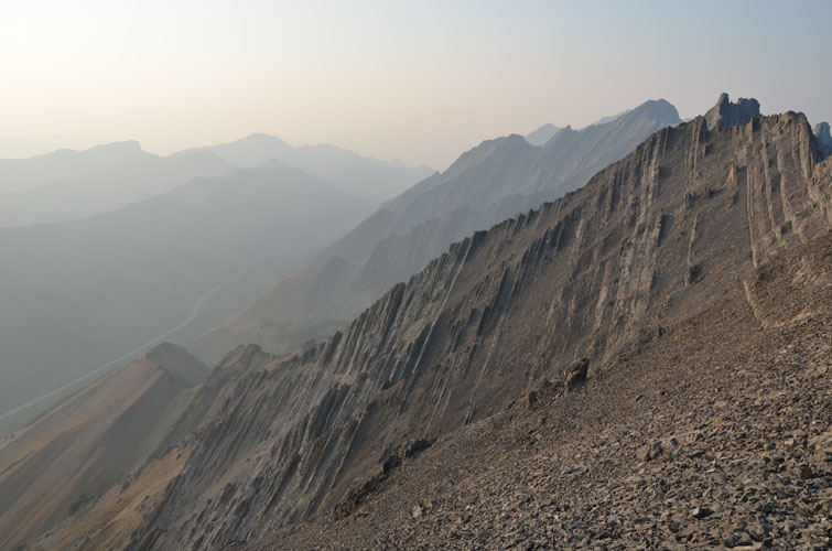
The sinusoidal ridge consists of perfectly vertical strata – a very crumbly and unstable affair in many places.
Another view of Stist Peak and Storm Mountain.
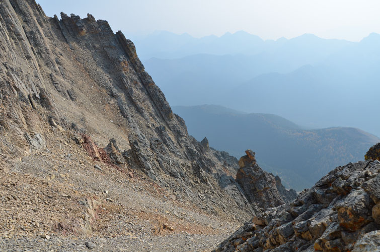
This is the last view of the ridge I had before I turned left (west) to head down the steep slopes back to the approach valley.
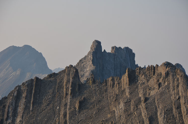
A close-up of “Stist Peak”, a terrifying scramble!
View of the scree slope dropping down to the west.
Heading down toward the valley. It was easy at first, but soon got more challenging at the gully narrowed.
One of many steep cliff bands in the gully that require careful downclimbing on the descent.
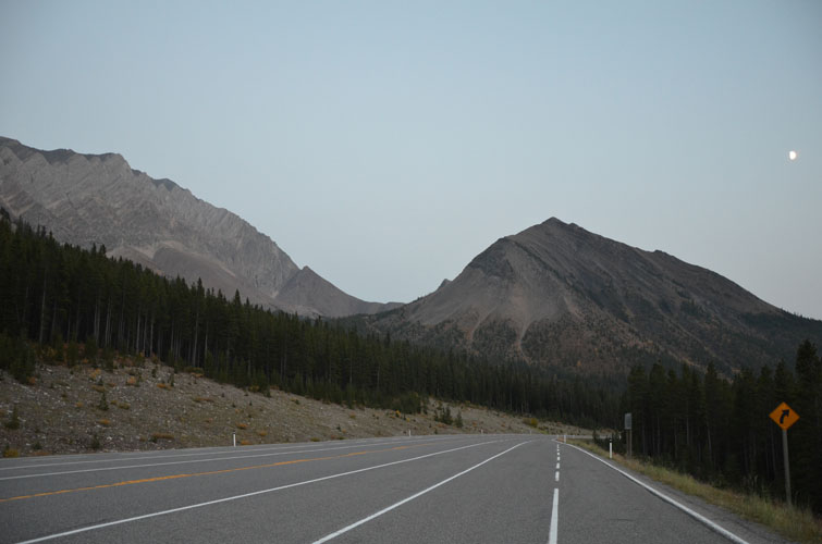
Back at the road by the Lost Lemon pull-out just after sunset. Just in time before it got dark!