9 September 2017
With Richard
Neither Richard nor I were feeling up for a big trip today, but despite our best intentions somehow curiosity and ambition (or more likely stubbornness!) got the better of us. Our “short trip” ended up taking 12 hours, definitely not what we had expected.
Bob Spirko’s report of an excursion to a small peak he named “Little Mythic Tower” was the inspiration for our outing today. The peak is located along the long ridge extending from Gap Peak to Fable Mountain to Mount Townsend in the Fairholme Range NE of Canmore. Looking north from “Little Mythic”, he describes two very peculiar rock towers along the ridge named Mythic Tower (the southern one) and Epic Tower (closer to Townsend). They were apparently first ascended by local climber John Martin, who has summited most or maybe even all of the peaks in the area. We couldn’t find much information on how to climb them other than Spirko’s approach before we set off. However, a few days after our return, I happened to come across this description by a group of scramblers that had gone up both towers as part of an impressive mammoth ridge traverse in 2015. Clearly, this is not exactly a popular destination!
Not much is to be said about the long approach up Exshaw Creek. From the edge of the hamlet of Exshaw we followed some of the faint tracks that have formed in the rubble by hikers that head up here to do the Fable-Gap traverse, which seems to have gained hugely in popularity in recent years. Past the turn-off for Mount Fable, about 4.5 km in, there are no more trails to be found in the dried out creek bed. We plodded a further 4 km to another small drainage coming in from the left (west) and then headed up here, first through a light patch of forest and then along a narrow valley with increasing steepness. There are lots of boulders so it’s slow going, but the area is very pretty and we really enjoyed the hiking here. Higher up the valley we encountered several steep slabs of rock that provided some fun scrambling challenges, either head-on right in the middle of the narrow gully or by bypassing the steepest parts via mud and grass slopes on the right.
Once past the steep slabs, we arrived at a beautiful Alpine cirque featuring glacial moraines, big rock boulders, and little stands of trees here and there. A scree ramp at the end of this bowl leads right (north) and up a steep slope of loose shale to the ridge.
Intense wind gusts on the ridge crest immediately left us seeking shelter on the protected east side below some rock bands. After another 20 minutes we reached “Little Mythic Tower”, a rather unassuming bump that sits at 2596 m elevation according to my GPS. It had taken us 5 and a half hours to get here – now it was clear this wasn’t going to be just a short hike today!
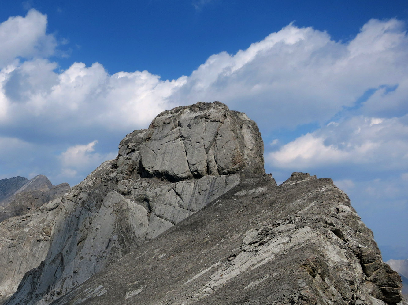
An excellent game trail hugs the left (western) side of the ridge. It is surprisingly well-trodden, so much that it almost looks man-made! There is not much of interest for goats up on the craggy summit of Mythic Tower, though, so the path runs past the peak a distance below. We scrabbled up the scree slopes to the base of the tower and stopped to admire its imposing walls and steep drop-offs, like a fortified watchtower jutting out from a defense line. The west face is dominated by a massive vertical sheet of rock with a series of cracks running across it. We first considered following the narrow ridge crest, but upon close inspection it looked too steep and rubbly from below with extreme exposure and we weren’t sure how far it would go. The keys to the tower, so to speak, are to be found in the main crack that runs horizontally across the middle of the flat east wall. It may look impossible from a distance, but the ledge is actually wide enough to traipse across. At the end of the ledge we turned right and scrambled up a narrow chute with a chockstone blocking the middle. A bit awkward, but a fun challenge. This was immediately followed by the second crux, a narrow and slanted crack with a small overhang above it that required some stemming moves to get up. Both are probably in the realm of a climber’s scramble when dry, but if the rock was wet or snowy a rope would definitely be required.
The narrow summit was barely wide enough for us to huddle down. The rock is very loose and crumbly up here and requires extreme caution as there are steep drop-offs on all sides. We carefully poked around the southern and northern edges of the summit mass a bit, but nothing looked like a viable alternative to the way we had come up. The downclimb was actually not much harder than going up, but having a long reach certainly helped.
Back on the game trail, we continued heading north. The trail contours around the west slopes below Mythic Tower and soon leaves the scree, crossing an area of steepish rock slabs where the path is a little harder to follow. It loops around several rock ribs and, after a few minor ups and downs, gains the ridge crest again and leads directly to the base of Epic Tower. Really fun stuff with lots of easy to moderate hands-on scrambling on this traverse! The scenery along the ridge is simply breathtaking.
Epic Tower proved much easier to crack than its edgy neighbor to the south. The rock is also quite crumbly here, but there is much less exposure and the terrain is not as steep. We scrambled up a short rubbly section to a small platform and followed it north to the cairned summit. Along the way you could glance down the east side of the ridge with fantastic views of the precipice. Much of it is simply a steep, undulating wall, and there seems to be no other way off the ridge to the east. We spotted one possible route between Mythic and Epic where the sharp edge of the ridge crumbles away into a scree saddle, but it is questionable whether the many unseen cliffs further down would allow safe passage.
The dramatic cliff bands of Mount Townsend, another enjoyable scramble in this area, immediately catch the eye when looking north. They can easily be reached by the same game trail that carries on towards Townsend, an option we didn’t even consider at this point. We had reached our goal for today but it had taken us 7.5 hours, much longer than we had expected! It was already 4 pm so after soaking up the incredible views at this remote and magical place, we embarked on the long return journey the same way we came.
This was another terrific trip close to the city. In exchange for a long and tedious approach, we were rewarded with opportunities to explore and some very enjoyable scrambling challenges in a remote area. Not a short trip, but definitely worth the effort!

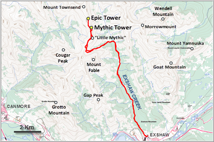
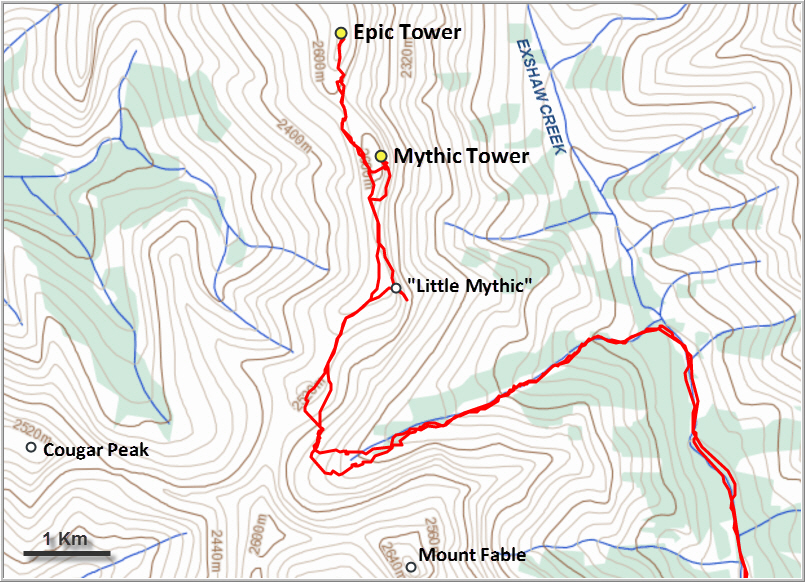
DISCLAIMER: Use at your own risk for general guidance only! Do not follow this GPX track blindly but use your own judgement in assessing terrain and choosing the safest route.
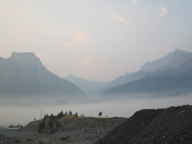
Smoke from nearby forest fires settles in the Bow Valley in the early morning. On the left is Heart Mountain, on the right Mount McGillivray.
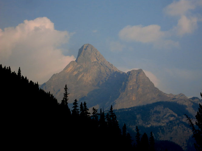
Mount Fable comes into view after a couple of km of hiking in Exshaw Creek.
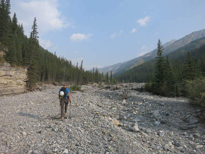
Exshaw Creek – mostly dry at this time of the year.
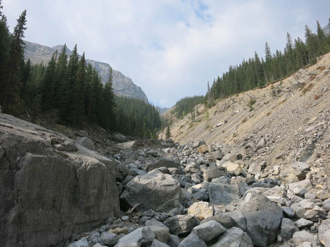
The side valley leading towards the Fable-Mythic ridge is full of large boulders.
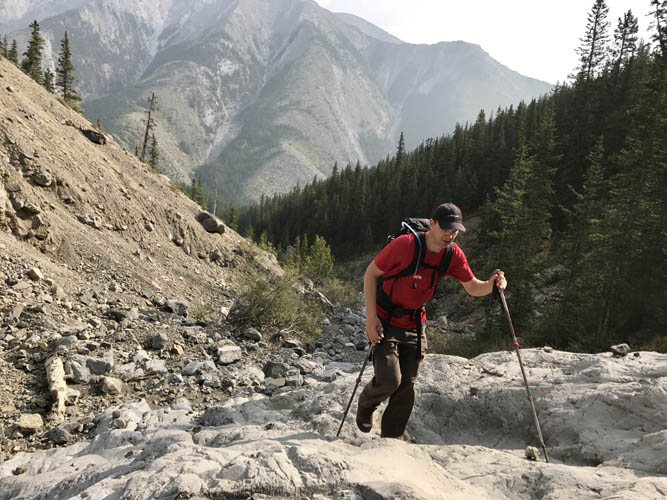
There are some nice, firm rock slabs higher up where the valley narrows into a gully.
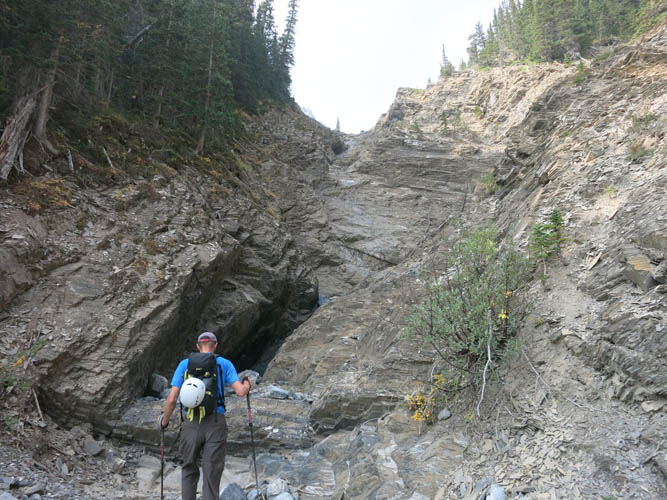
This section required a short detour around the right, but most of the slabs can be tackled head-on.
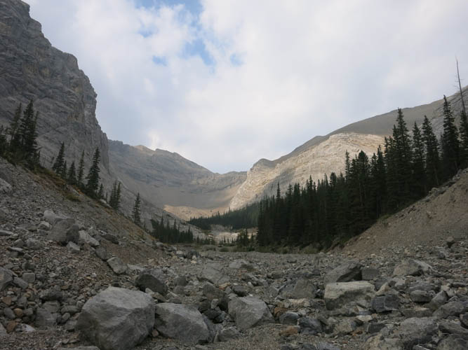
The pretty Alpine cirque near the end of the side valley.
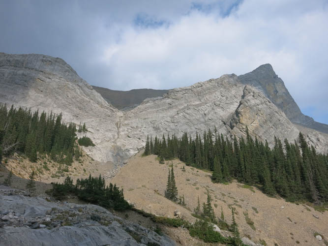
“Little Mythic Tower” looks like a prominent nose, almost like Ha Link Peak, but in reality it’s just a minor bump along the ridge.
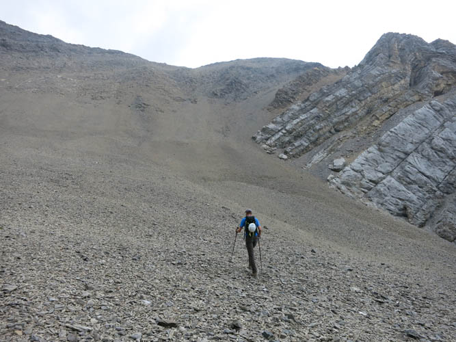
Slogging up endless scree to the ramp on the right at the end of the side valley.
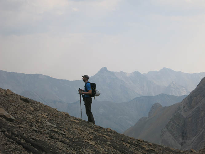
Richard pauses to take a breather. The knob behind him in the centre of the photo is called Hassel Castle.
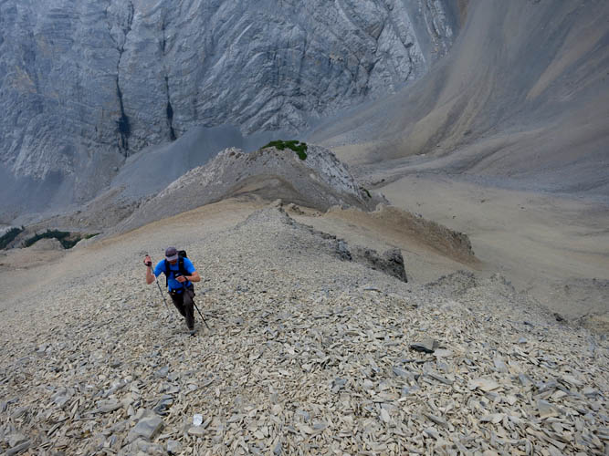
Fable’s north side reveals beautifully folded strata in a sheer cliff. Fortunately, the rock we’re on is brown shale – brittle enough to form an easy ramp up the ridge.
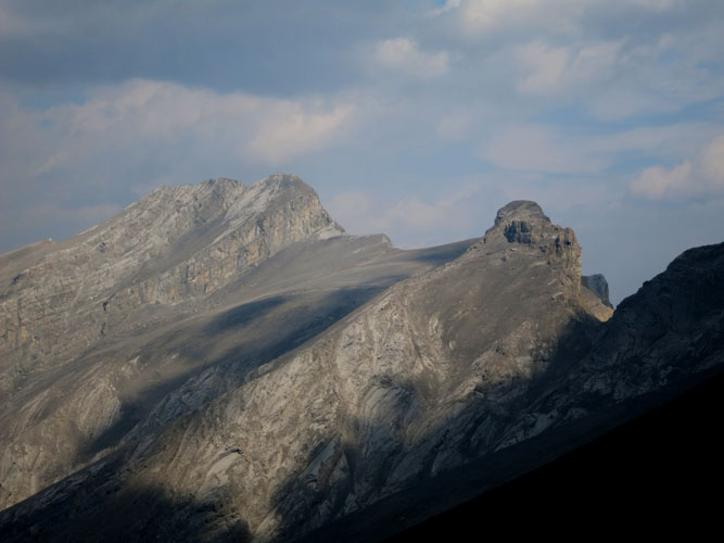
First view of Epic Tower (R) and Mount Townsend (L) from the ridge.
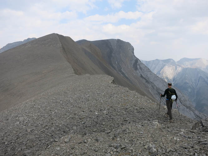
An easy ridge walk on broken shale takes us to Little Mythic Tower.
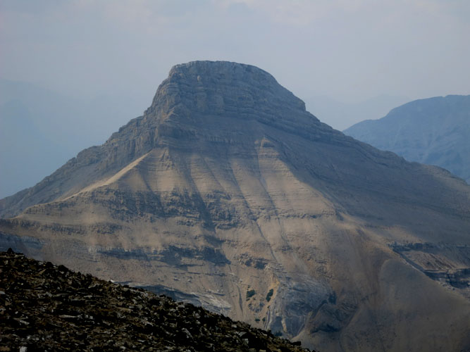
To our left, Cougar Peak‘s east and north faces look frighteningly steep.
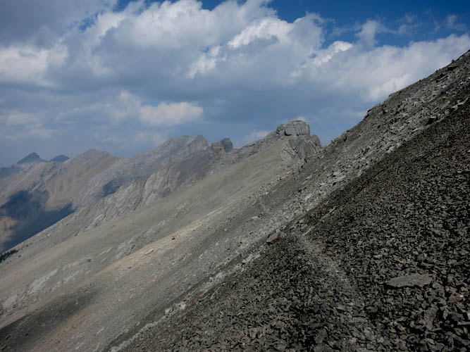
A good game trail has formed in the shale slope, making our hike a lot easier! Directly above the path here lies Mythic Tower with its impressive grey rock slabs.
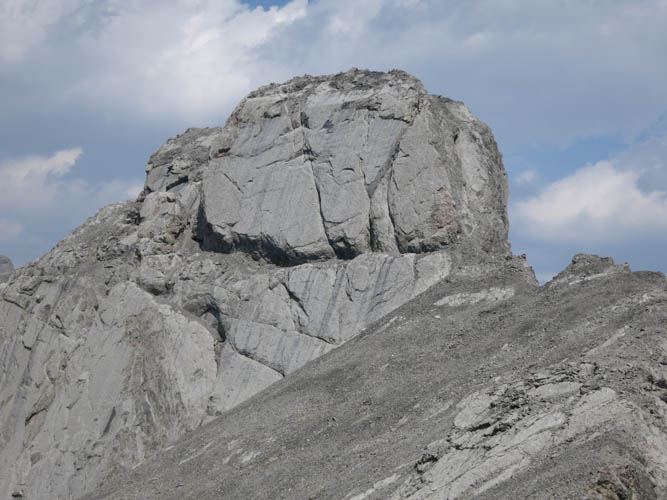
Close-up of Mythic Tower. The horizontal crack in the middle probably offers the easiest route to the summit.
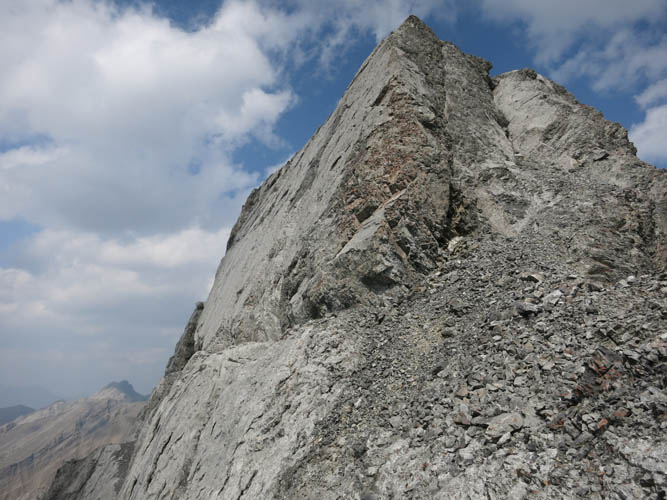
The steep south ridge of the summit tower is extremely exposed. The horizontal crack can be seen here on the left.
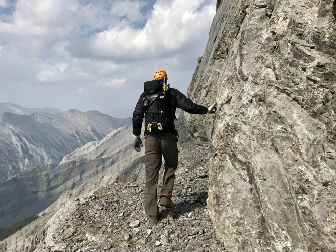
The crack is wide enough to form a ledge to walk on.
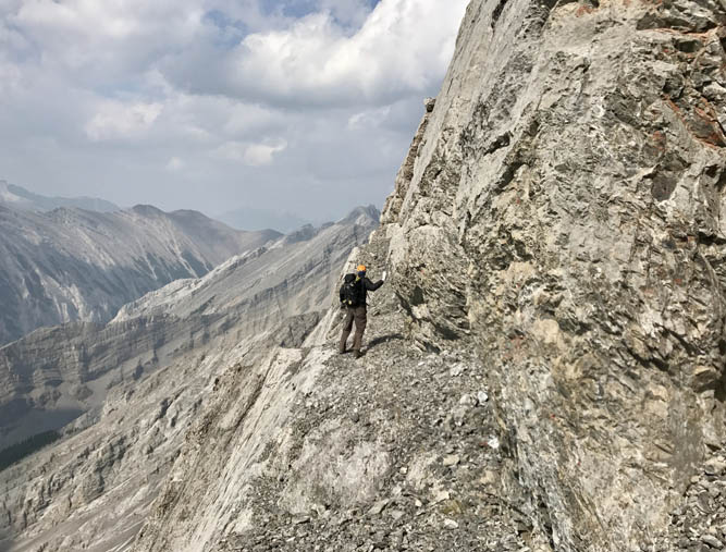
It does get pretty narrow, though, and the exposure can’t be ignored…
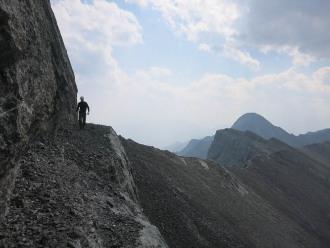
Richard along the ledge. Mount Fable on the right.
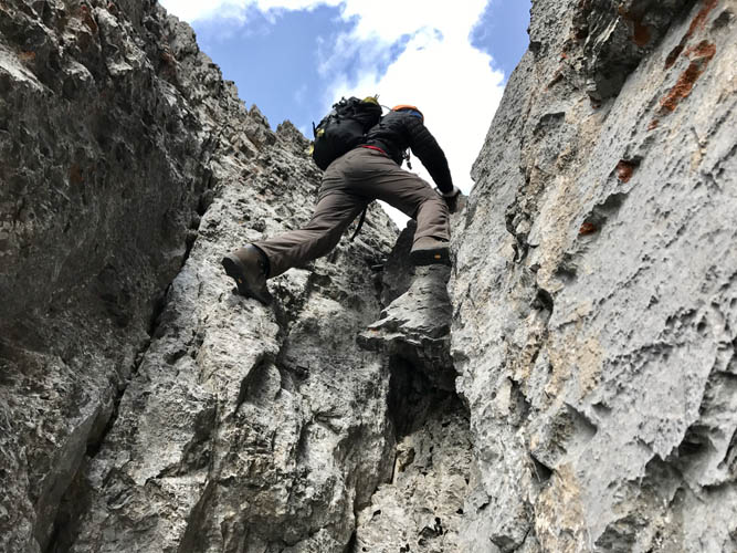
The chock stone in the chute requires a few difficult moves.
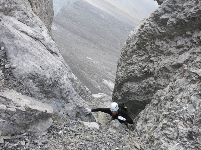
Looking back just above the first crux.
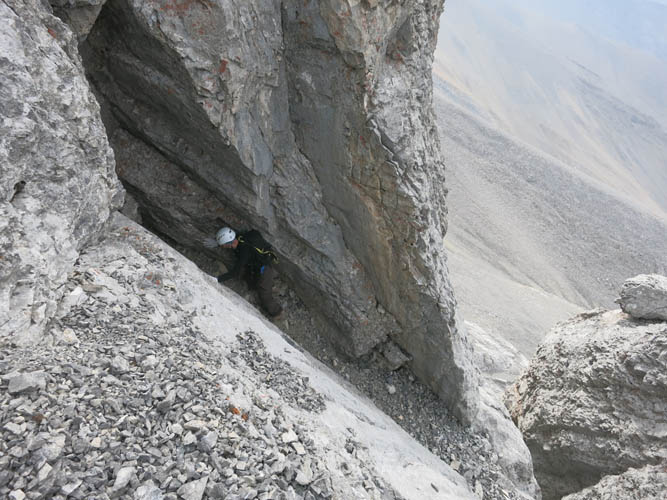
Looking down the second crux, which is a narrow crack and rock slab requiring some stemming/friction moves.
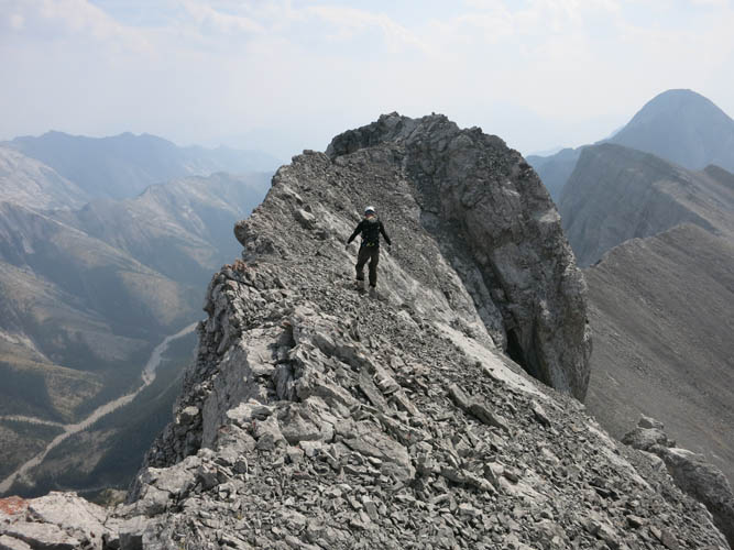
Approaching the summit of Epic Tower.

There’s not a lot of space on the crumbly summit here!
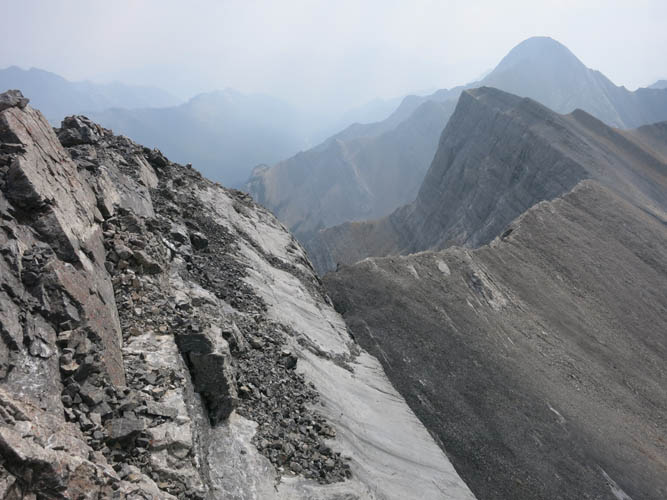
Looking south: Little Mythic Tower with Mount Fable behind.
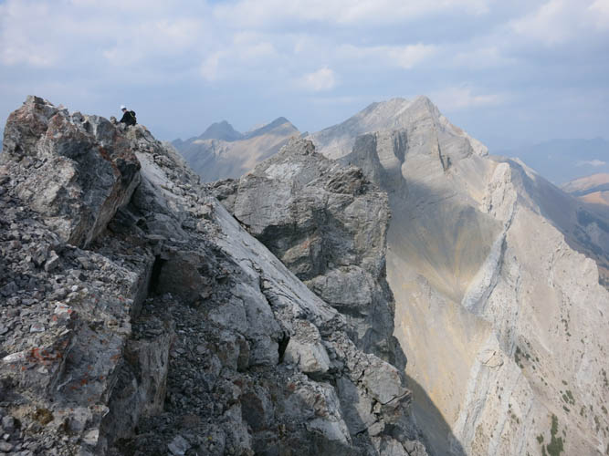
To the north lies Mount Townsend. The drop down the eastern side is exhilarating!
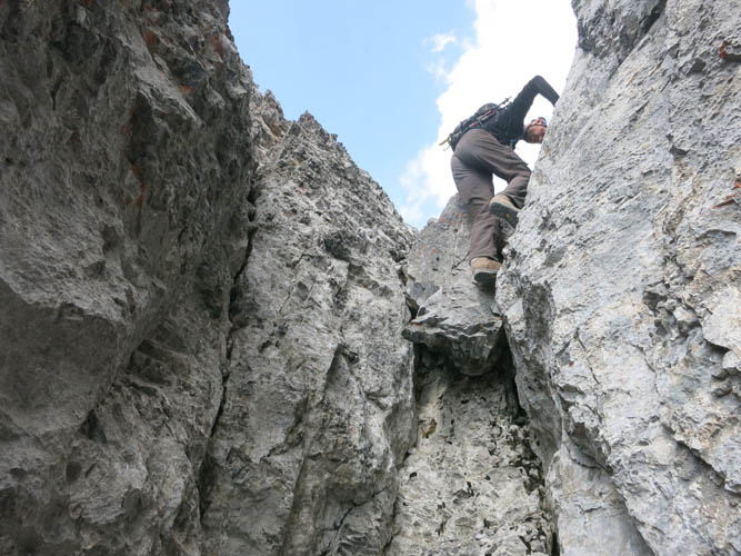
Climbing back down and over the chock stone.
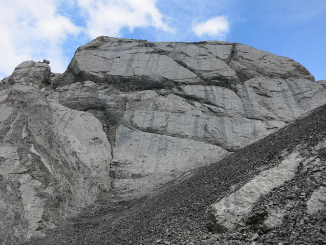
We traverse the scree below the slabby west face of Mythic Tower to get back to the game trail and head northward.
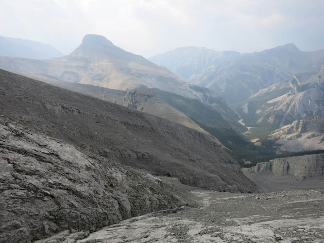
Looking down the headwaters of Cougar Creek, with Cougar Peak on the left. Unfortunately, it’s a very smoky day with poor visibility.

Some slabby terrain ahead on our traverse to Epic Tower.
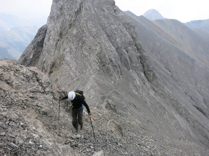
Back on the crest of the ridge – mostly moderate terrain.
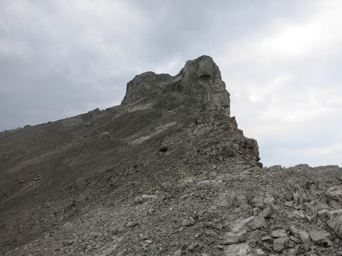
Epic Tower ahead.
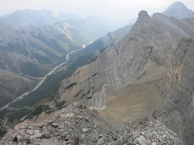
Upon ascending Epic, we turn back to take a look at Mythic Tower. Looks like a pinnacle from here! Exshaw Creek is down in the valley to the left.
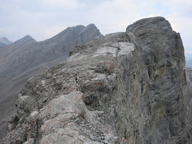
Climbing Epic Tower is a lot easier than going up Mythic. The eastern side goes straight down for 100s of metres, but most of the exposure is avoidable.
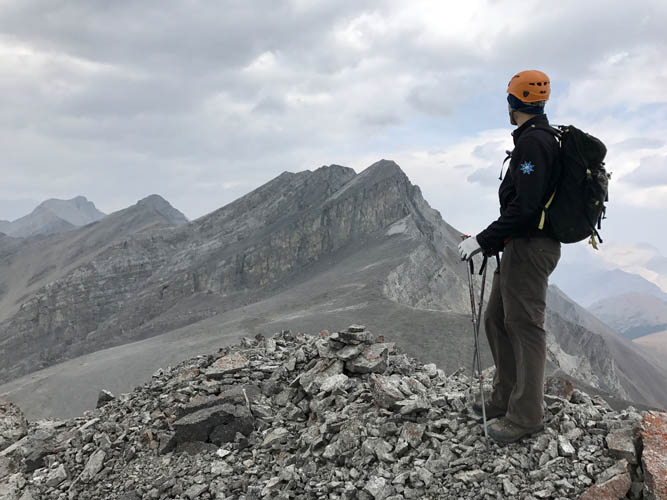
On the summit of Epic Tower, looking over to Mount Townsend (centre) and Stenton Peak (second peak from left).
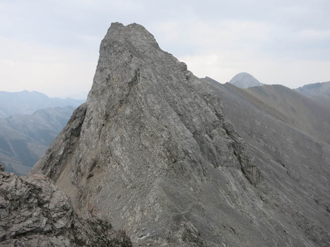
Behind us, the north face of Mythic Tower looks steep and uninviting.
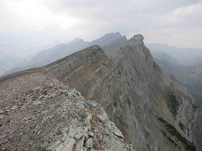
On our return, we stop at Little Mythic Tower to take a look back at the ridge.
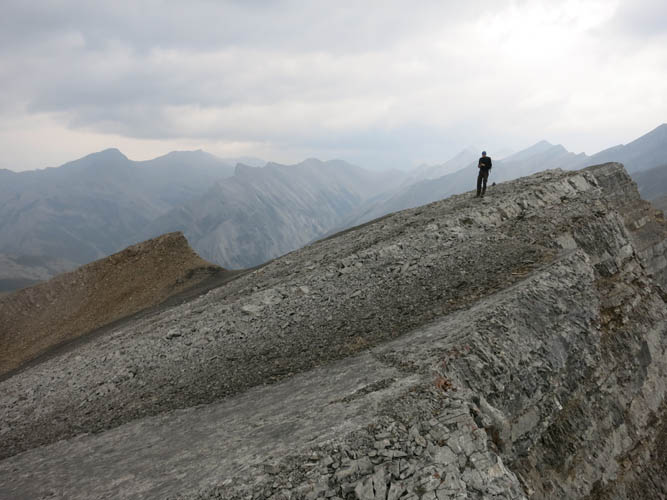
Richard on Little Mythic. Too bad it was such a smoky day today, but the views were still incredible!