24 September 2017
With Richard
Mount Oliver, a lonely peak at the edge of the Ghost, has never gained much attraction from climbers and scramblers in the past. It is situated in the “armpit of the front ranges”, as I call it – that remote corner where the N-S trending Rockies of the Ya Ha Tinda abruptly turn east towards Ghost Peak. Richard and I had seen Mount Oliver from afar and hiked part way along its approach valley when we ventured up Zombie Peak last year, but we had never seriously discussed ascending it given that the approach seemed exceptionally long. Until this weekend, that is, when we somehow ended up making plans for Mount Oliver… out of all peaks we could possibly pick! I must absolve Richard of any responsibility here as I fully admit it was my idea to pay this area another visit – too strong was the draw of the Ghost, particularly these remote parts of the front ranges, to come back and experience its beauty once again.
Having completed the trip in one very long day we can now fully understand, quite bluntly put, why this mountain will never become a popular climb!
The drive itself to the trailhead near the North Burnt Timber Creek is rather lengthy, some 2.5 to 3 hours from Calgary, with the last 40 km or so on a gravel road (doable in a normal car). We knew from our Zombie Peak trip back in November 2016 that the first 4.5 km are in pretty good shape: it’s an old road that leads to an abandoned well site, and that stretch is perfect for biking. After passing a small, improvised camp site and an outfitter’s tent we continued for another 700 m on a horse trail and abandoned the bikes before it petered out in the gravelly creek bed.
A few hundred metres further upstream on the other side of the creek we picked up an old track, perhaps a former ATV or forestry road. It was such easy and enjoyable hiking that we completely missed a good horse trail that branches off to the left, which is the route we should’ve followed as we soon found out! We just kept on going uphill on the ATV track for quite a while, but soon had to lose all the elevation we had gained and cross meadows and forest to drop all the way back down into valley bottom.
This unnecessary detour was quickly forgotten, however, as we came across the horse trail again. It had deteriorated a little by now and was harder to follow. And sure enough, only about an hour later we were again wondering what we were doing, veering up the wrong mountainside too far to the left this time… Some light bushwhacking brought us back down to the creek, where our pace slowed down considerably and we really struggled to make any headway. It was frustrating: a mix of jumping over water, fighting through nasty shrubs, and dancing over fallen logs… not fun! We still had a long way to go and couldn’t afford to go at this pace if we ever wanted to make it up and down the mountain in one day, so we decided to try out the forest on the right side. Perhaps this was any better? It definitely was!! We found a TRAIL again and were jumping for joy! Cut logs showed that this was clearly a man-made trail, although overgrown deadfall blocking the path in many places also indicated that it hadn’t been maintained or used in many years. Regardless, it was still infinitely better than monkeying about in the meandering creek bed below.
The old trail was a blessing as it took us literally out of our mess and all the way to the upper part of this long valley, always staying well above the creek on the right (west) side. The valley eventually flattened out, the trees disappeared, and the creek turned into a small stream. We were still quite far from our objective and still couldn’t see the mountain at this point, now 4-5 hours into the trip. From Rick Collier’s report, we knew that his party had run into very difficult terrain on Oliver’s north ridge that they avoided by contouring around the summit tower on the NE side. With all the snow that had fallen in the last few days, there was no way we wanted to follow the same route and take any risks.
Our plan was to ascend treeless slopes to the NE ridge, which in a long, curved arch turns into Oliver’s east ridge and leads all the way to the summit. Easier planned than done, of course! Ascending the slopes was nothing more than a tedious but straightforward slog. And once on the NE ridge, we were excited to see Mount Oliver up close for the first time. The ridge was a joy to scramble! At the turn towards the east ridge, things got a lot more serious, however.
An elevated rise with a sub-peak along the ridge was flanked by a vertical drop for hundreds of metres on one side and smooth rock slabs on the other that were getting steeper and steeper. They were also covered in snow, which made things much trickier than they should’ve been. The snow made the slabs extremely slick, and a slip on these tilted rock plates would’ve probably led to an unstoppable slide quite a ways into the valley to the south side which might leave you bruised and battered – or worse. We were thus confined to the narrow crest of the ridge, which just kept on getting narrower. Testing each step carefully, we slowed down to snail’s pace, but felt increasingly uncomfortable. About half way in, at one particularly spicy section, we stopped and seriously started to consider abandoning our trip. All that delicate manoeuvring on the 1-2 foot wide band in front of us felt like tiptoeing through air, and it got to our heads. After evaluating different options, we decided it was best to continue instead of backtracking, since easier terrain was only some 40 m away, then look for a safer route to bypass the ridge on our return. It took a lot of mental and physical energy to complete the ridge walk and by the time we reached the small col between the sub-peak and Mount Oliver itself, we were drained and took a much-needed break. The “Spicy Ridge”, as we nicknamed it, had been an unexpected and overwhelming challenge!
The final ascent up the steep east side of Mount Oliver seemed to take forever. The terrain was generally in the easy to moderate scrambling realm, with a few short difficult steps consisting of loose rock. Nothing could be trusted, and the snow didn’t help either. We were quite astonished to see several feet of snow that had accumulated in patches, and our feet were now quickly getting cold and wet. There was definitely some deep post-holing here and it really slowed us down. We hadn’t quite reached our turn-around time yet and, determined to make it after coming all this way, just kept on trudging. Just below the summit we encountered the crux (although crux is relative here, as the “Spicy Ridge” was definitely more challenging!): a short, angled rock band that required a few difficult steps with moderate exposure. A rubble-strewn slope led a short distance to the summit, complete with register, where my GPS recorded an elevation of 2988 m. After the first recorded ascent on June 22nd, 1982 and the last one in 2012, we were apparently only the fifth party to pay Mount Oliver a visit. Clearly, this isn’t exactly a popular objective and after having gone through the confusing and lengthy 9-hour approach ourselves we could totally understand why.
The elation of having reached the summit was short-lived and our minds were soon preoccupied with thoughts about the taxing descent over the “Spicy Ridge”. The weather was changing as well. More and more clouds were moving in from the west, while a dark blanket was already covering the sky over the prairies to the east. We had no time to waste and after a brief rest started to descend again. By this time we knew that we’d be hiking back the last few hours in the dark, so the faster we got down the more time we would have to try to follow that faint trail in the forest.
Alternatives to bypass the “Spicy Ridge” didn’t look too inviting when we got back down to the col from the summit tower. After a short discussion we both agreed that simply backtracking our steps across the ridge would be the best option if we focussed hard and just took it one step at a time. In the end, it wasn’t as bad as on the way up, probably because we knew exactly what to expect and following our footsteps was easier on the mind than breaking a new trail into unknown terrain.
Past the difficult ridge we decided to descend gentle slopes straight into the valley to the east instead of continuing on the curving NE ridge. It was a pretty easy and quick way to lose elevation and we soon found ourselves back on the old trail in the valley. Mindful of the fading daylight, we pushed ourselves as much as possible, hardly taking a break for hours. Eventually, though, the darkness caught up with us and we lost the trail…then found it again, only to lose it once again. This continued a few more times, but it was still less strenuous and faster than the creek thrash we had to endure on the way up. It’s clear that the trails in this valley are hardly used by anyone, and they are certainly not maintained, so staying attentive while you’re on a path and careful route finding when you’re off it definitely pay off.
Fortunately, we found the correct horse trail near the end that avoided the old ATV track higher up the side of the valley. The bike ride in the dark was actually fun (perhaps Richard will disagree here!), especially with all the balancing acts we had to do to complete the many creek crossings again. We got back to the car at 10:30 pm with wet, cold feet, hungry and tired, wondering if it was all worth it.
And was it? This was an adventure that we really had to work for. One that was unique being so close to nature in beautiful remote surroundings. A real challenge, but with rewards that are priceless. Yes, it was most definitely worth it!

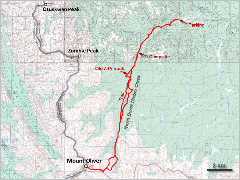
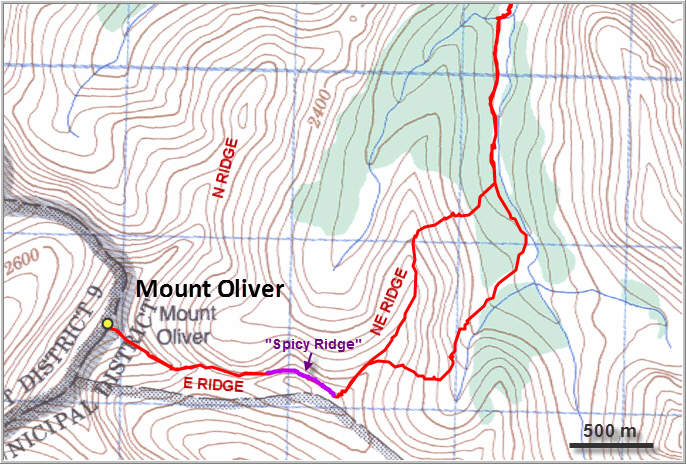
DISCLAIMER: Use at your own risk for general guidance only! Do not follow this GPX track blindly but use your own judgement in assessing terrain and choosing the safest route. Please see the full disclaimer here.
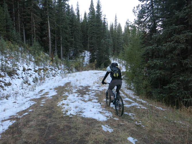
Riding along the disused wellsite road. Fresh snow from the last few days lingers in sheltered aspects.
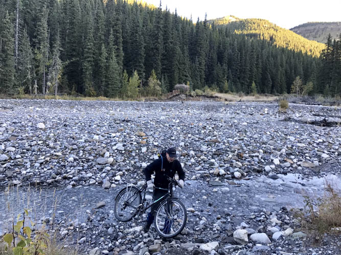
There are several creek crossings, but all are pretty easy at this time of the year. [Photo by Richard]
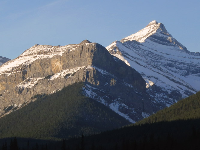
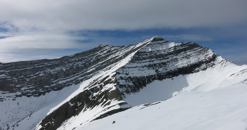
A first glimpse of our objective, still far in the distance: Mount Oliver’s north ridge with some impressive cliffs underneath. Our route follows the NE and E ridges (not seen here).
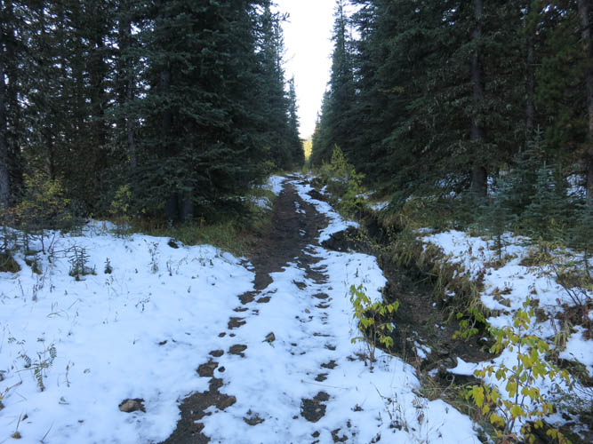
The old ATV track.
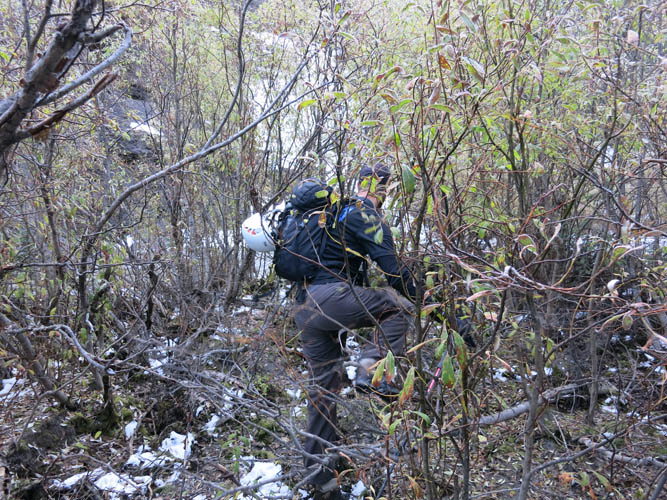
Bushwhacking down in the creek. It’s as miserable as it looks!
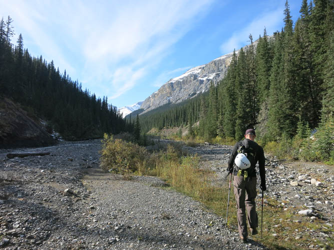
Some stretches of North Burnt Timber Creek are nice and open, but that tends to be the exception.
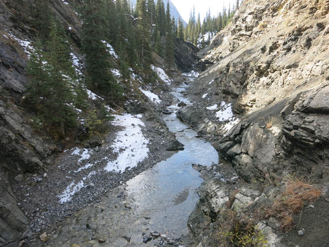
This is where we abandon our creek bash and head up the sides to the right (north).
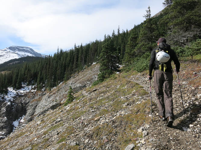
Following a fair trail that appears to be no longer in use.
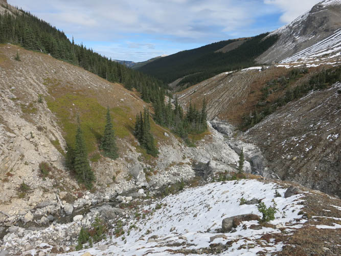
Lovely meadows and gentle ridges as we proceed towards the headwaters of North Burnt Timber Creek.
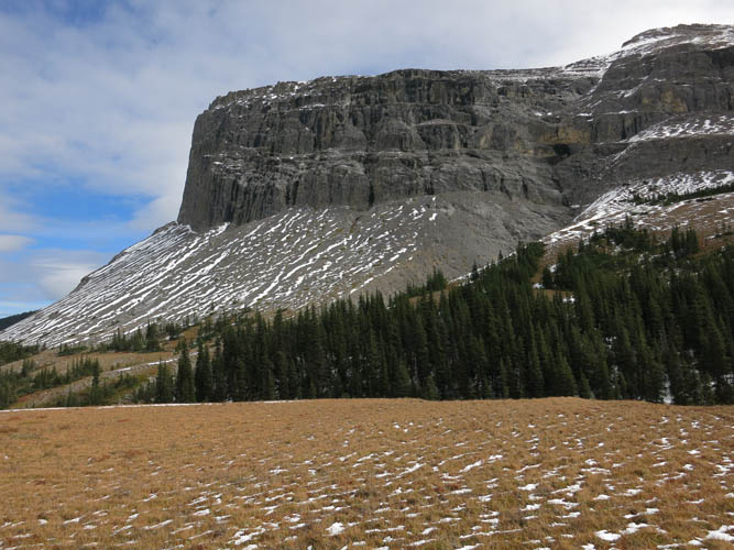
And some imposing cliffs. Most ridges and peaks in this area do not have names.
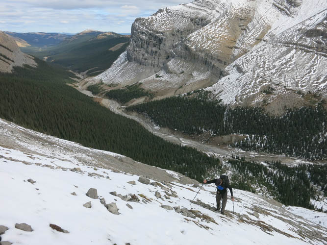
Slogging up the southern slopes of Oliver’s NE ridge.
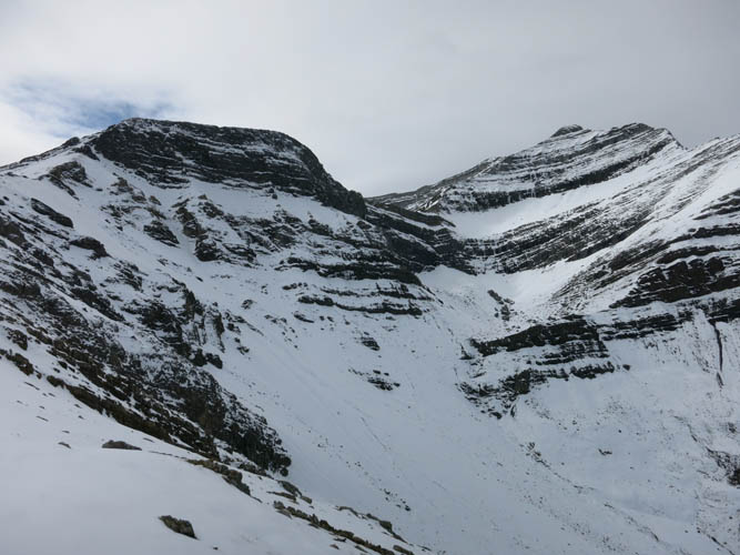
At the ridge top, the rest of the route comes into view. The flat-topped ridge on the left is our “Spicy Ridge”, with Mount Oliver’s summit tower on the right.
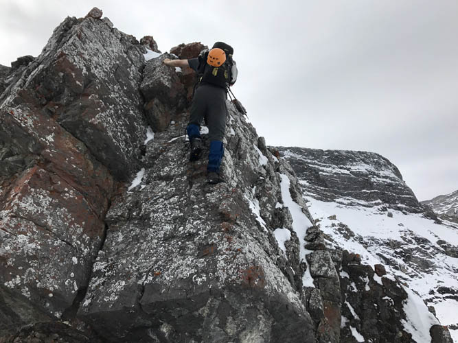
Some steep scrambling along the NE ridge. This part is entirely avoidable, though, and most of the ridge line here requires only easy to moderate scrambling. [Photo by Richard]
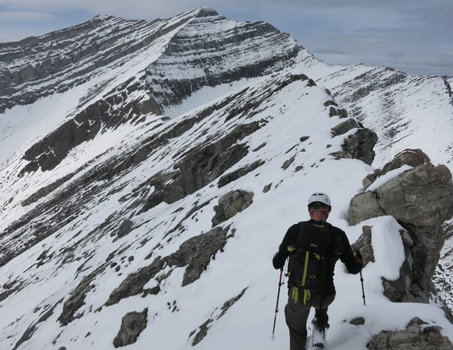
The E ridge is quite different. A difficult traverse along the narrow ridge crest with significant exposure on both sides is necessary. This ridge is spicy!
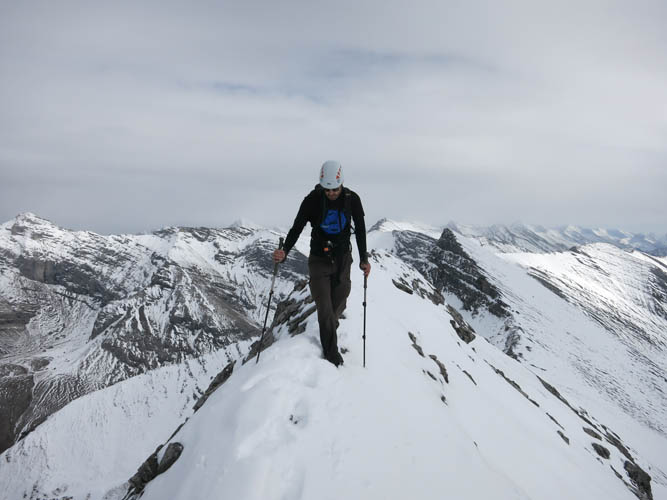
Richard carefully treads across the narrow spine. When snow free and dry, it might be possible and easier to sideslope on slabs below the crest to the right.
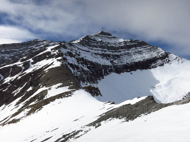
Mount Oliver’s summit tower.
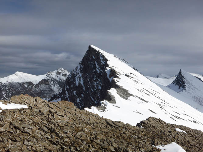
A look back at the “Spicy Ridge” shows just how steep its sides are, especially the sheer drop down the left (north) side.
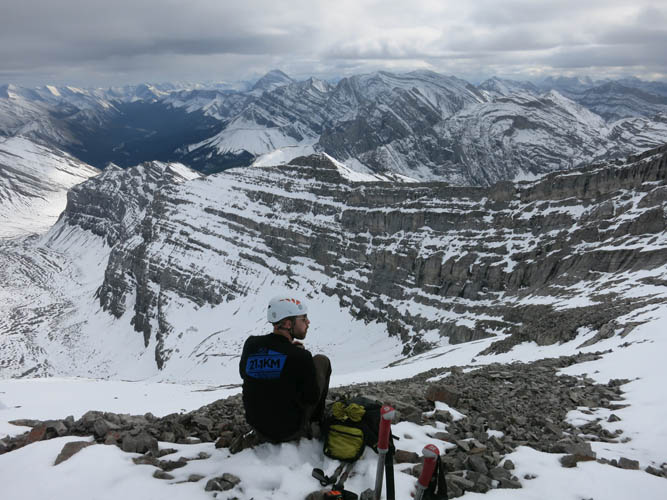
Richard enjoys a much deserved break at the summit.
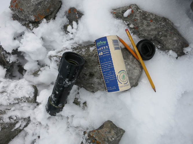
Mount Oliver summit register – an old-fashioned notepad.
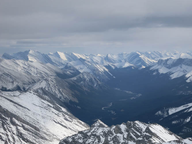
Sweeping views over the Ghost River valley to the SE. The major high point on the left side at the horizon is Saddle Peak, while Carrot Peak sticks out on the right side.
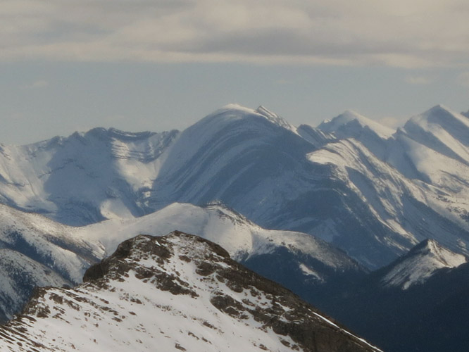
A close-up of beautifully folded strata on the north end of Carrot Peak, which lies far to the south near the shores of Lake Minnewanka at Banff.
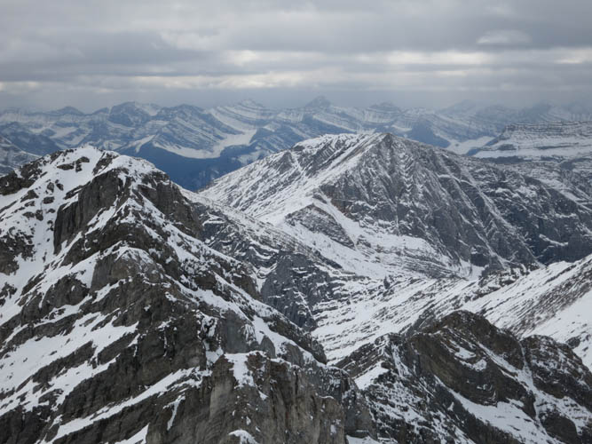
Psychic Peak is a short distance south of Mount Oliver, but the connecting ridge looks like it’s beyond scrambling.
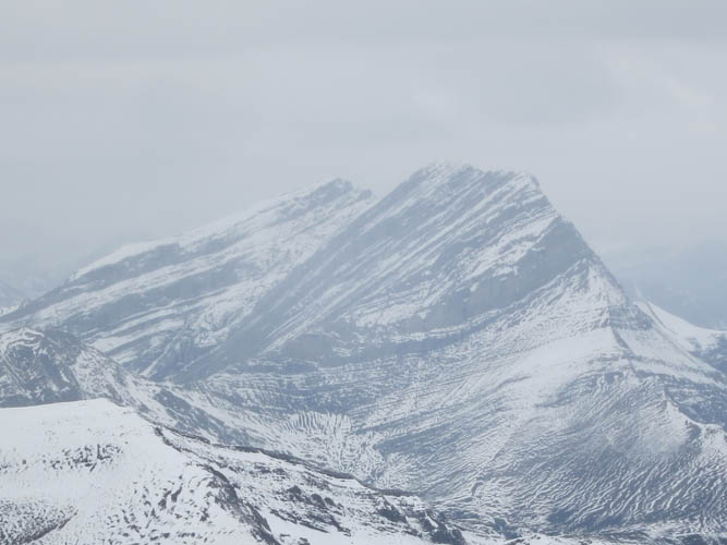
Shrouded by clouds, Puma Peak appears to the NW.
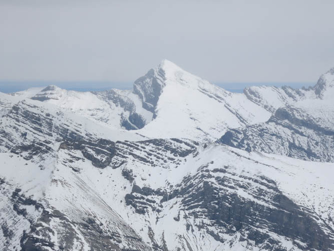
Mount Davidson to the east.
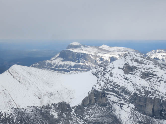
Ghost Peak, also to the east, looks quite different from this unusual perspective.
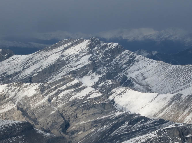
A zoomed-in shot of Zombie Peak to the north. We ascended the peak by its east ridge (right hand side) in 2016.
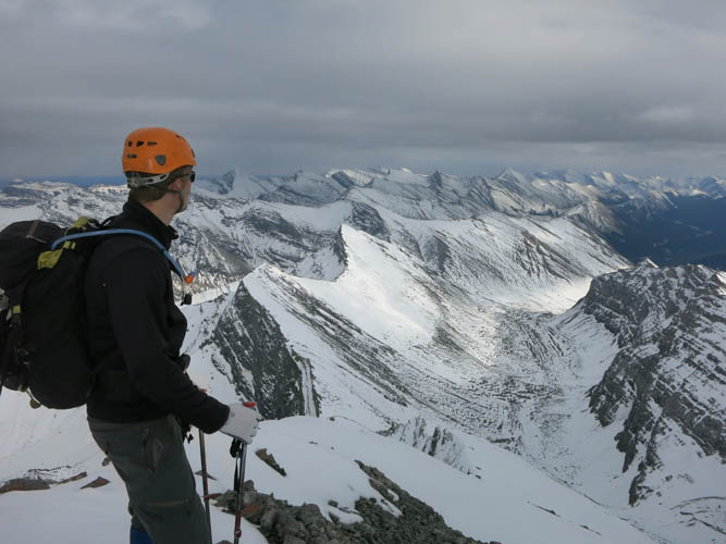
Scanning the wild and beautiful landscape one more time before we head down. [Photo by Richard]
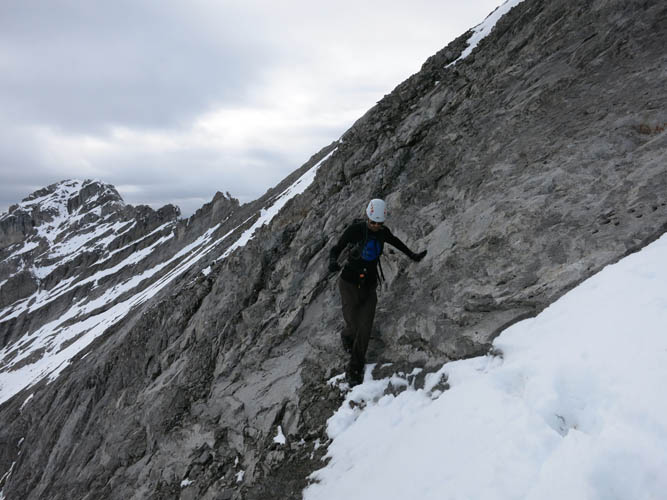
Richard negotiating the crux rock band just below the summit.

A large black spider unexpectedly appears in the middle of a snow patch. It’s about 5 cm in diameter.

View of the “Spicy Ridge” as we scramble down the summit tower.
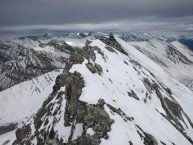
Back on the difficult ridge crest.
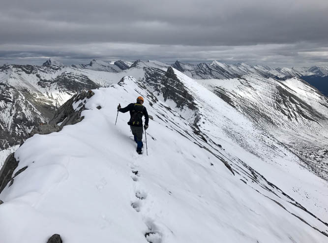
We simply follow our footsteps from the ascent, but the traverse still requires a lot of concentration because of the steep and slippery terrain. [Photo by Richard]
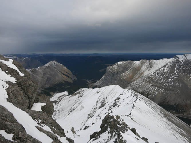
Looking down the NE ridge and the valley we used for the approach.
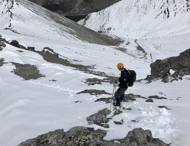
Past the “Spicy Ridge” we head straight down these slopes into the valley to the east for a faster descent. [Photo by Richard]
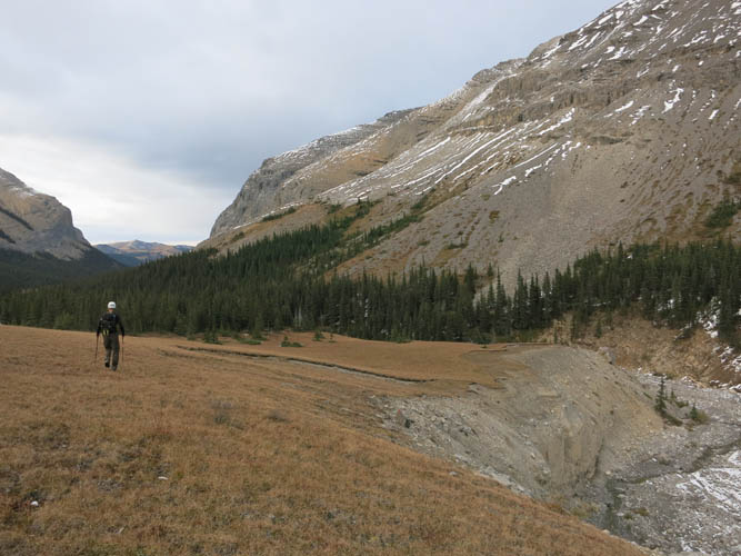
Easy hiking in the upper valley.
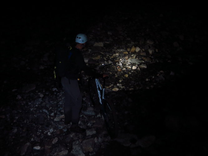
And a few more challenges before we make it back to the car at 10:30 pm.
